Burnt
Hill Stone Circle
Located in Western Massachusetts
Site Visit: November 3, 2001 by Daniel V. Boudillion
with Edward R. Cornish
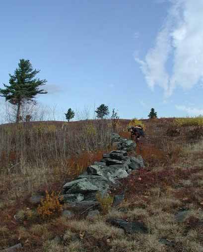
Burnt Hill is located in Heath, Massachusetts and is approximately 1,850 feet high. I climbed it from a road on the west side, following a stone wall to the extensive acreage of blueberry fields at the top. The standing stones are located in the north at the highest point on an exposed ridge of windswept bedrock.
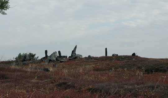
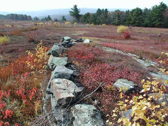
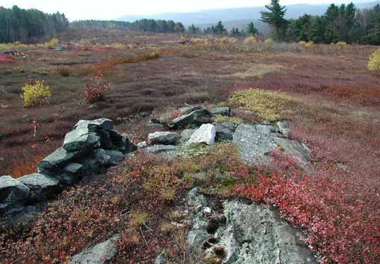
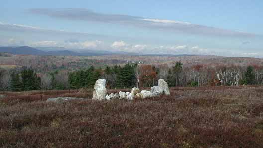
Stone Circle on Highest Point of Burnt Hill
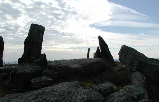
Close Up of Stone Circle
These stones do not form a circle, but are more of a strung-out line with one small cluster of three tall stones. The tallest stone, however, was no taller than I am. This cluster is formed of three standing stones in a rough triangle, with about six to seven feet between them. Recumbent within this space is a large roughly rectangular tapering slab, about a foot thick, three feet wide, and about six feet long. There are some jumbled stones around them. The best picture of this arrangement is seen on the cover of the book Manitou by Byron and Dix. There is a another shorter stone several feet to the north, but the rest of the stones string out down the ridge SSW.
There is a second formation of standing stones about 100 feet to the east on a separate, parallel but lower, north-south ridge. I did not investigate closely, but there appeared to be several standing stones strung out on the bedrock reminiscent of the main grouping, but smaller. Brush partially obscured this area.
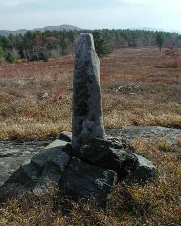
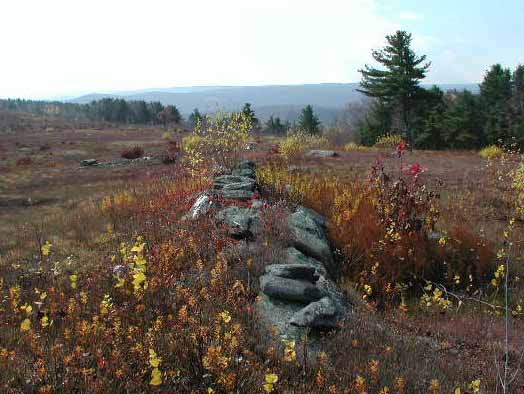
From the main cluster, I followed the ridge south. The ridge is like a dragonback that proceeds intermittently down the hill from the cluster in a SSW direction. The rest of the stones are strung out along this ridge. There are some initial standing stones of good size along the ridge (3 feet tall) just to the south of the cluster, but generally speaking, the further you are from the top, the smaller they become. As I proceeded down the ridge I noticed further stones set up on the lower ridge running parallel in the east.
Standing Stone to the South of Cluster
The main ridge descended through the blueberry bushes fairly steeply for about two tenths of a mile before it reached a slightly sloped plateau. Here it picked up one of the many stone walls and continued SSW. I noticed as I walked down the hill that whenever I looked back up the slope of the ridge, that there were enough stones spaced along it that there was always one in view against the sky. I noticed too that virtually all of the stones had been placed on bedrock outcrops of the ridge.
As I proceed into the gentle slope of the plateau, the ridge became less distinct and more intermittent, sinking into the grass. However, where it was exposed, it had been built up with stone rows. There were several such places.
The stone row I was following was almost immediately crossed by a second row. The row I was on did not cut straight through the crossing row, but rather it stopped at it and picked up on the other side about ten feet further along to the right. The rows were built up to almost twice the height in this small area. I called this juncture of rows the Nexus.
The Nexus
On the far side of the Nexus the bedrock of the ridge resurfaced, and the row ran along the eastern edge of it. The shape of the ridge, combined with the row, reminded me of a ship and I called this feature the Longship. At its end, where the bedrock re-submerged into the grass, the stone row dwindled as well, with a white quartz stone at its southern most point. There was also interesting stone construction the length of this row.
The Longship
White Quartz at Southern End of Longship
Further along the ridge resurfaced, and a low row of stones ran the length of its spine. This had the appearance of an whale surfacing, and I called it the Whaleback. I noticed as well, looking back and to the east, that there continued to be occasional stones from the second ridge paralleling this one, but on a smaller scale.
The Whaleback
Continuing, I came on a flat area where there was some exposed bits of bedrock. Looking back up the hill, I realized that both ridges came together at this place. The second lower ridge, I realized, was not exactly parallel, but angled toward the larger one, meeting here. Looking up each, I could see the spaced standing stones marching up either ridge. Because of the distances involved, this photographed poorly.
Following the line of the combined ridge, the next feature was an elongated low mound of piled stones. This ran SSW like the others, was about six feet wide, and raised barely a foot high. I was unable to determine if there was exposed bedrock underneath it. I called this the Berm. (Note: the Whaleback is visible in upper left of photo.)
The Berm
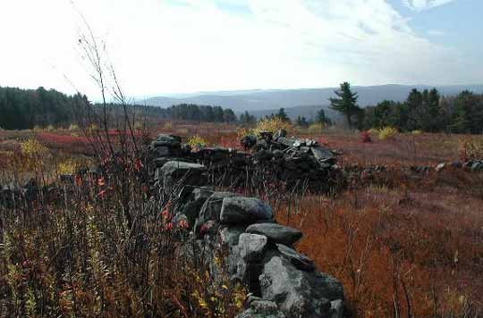
The final feature of the ridge that I investigated was another stone row. This was beyond the Berm and situated like the others on the SSW line of the ridge. This row was about seventy feet long, and had a slight but discernable bow shape, the concave side to the west. I called this the Bowed Row. The distance of the ridge from the cluster at the top of the hill to the end of the Bowed Row was about four tenths of a mile. The elevation had dropped by this point to 1,710 feet. (The view in the photo is north, looking back up the hill.)
The Bowed Row
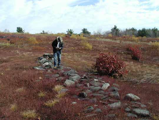
As I investigated, it soon became clear that there were dozens of standing stones on the hill, as well as odd formations of stone. Some of these formations were made entirely of white quartz. Burnt Hill has a tremendous amount of quartz: white, red, and amber in color. Some of the formations and stones markers, especial certain quartz ones, are suspect in my opinion. They are balanced to precariously to have been there long. It is important to know that everything I saw was in the middle of an extensive blueberry growing operation. Based on the vintage of the junked trucks, the farm has been in production for at least 50 years. In this business blueberries are still picked by hand, thus teams of pickers have been working in and among the stones for many years. One wonders if the crews have made it a hobby to set up stones. There were so many standing stones that it felt suspect due to the sheer volume.
White Quartz Formation
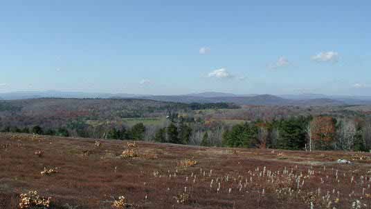
There is a considerable view to the south, west, and north, with an excellent horizon and variety of hills and notches. The east and northeast are currently obscured by trees. With the exception of about five stones at the very top, the rest of the marker stones are too short, or positioned such that they can not be viewed as horizon markers from the top. Mostly, the bulk of them are spaced along the length of the two SSW descending ridges, seemingly marking out its course. The only time some of these outlying stones could be seen against the horizon was when climbing up the ridge towards the top. From that angle they are silhouetted up against the sky.
Panoramic View
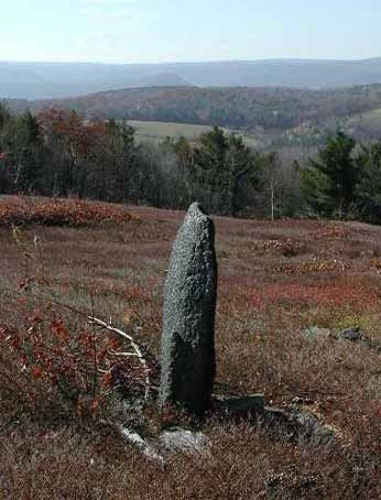
There was one three foot tall lone standing stone on the west side of the hill that was worth noting due to its size. There are no standing stones this large except at the very top. The hill, however, is so steep that it can not be seen from the top and I therefore doubt it is a sighting stone, but I include a photo of it because it is visually pleasing.
Standing Stone
I have made a map of the site especially noting the walls and berms on the lower slope. I would very much like to confirm placements as well as add in the locations of many of the individual stones. If anyone will be visiting the site, I would be pleased to correspond with them about developing a more detailed site map. My email address is dvb@boudillion.com
Copyright © November 2001 by Daniel V. Boudillion