|
|
Deed Rock & God's Ten Acres
Worcester Massachusetts
Field Investigation:
31 March 2007
by Daniel V. Boudillion
|
Note: this is the full
text of the abbreviated version published in the book Weird Massachusetts
Introduction
Once upon a time a kindly old
man created one of the strangest sights to be seen in Worcester,
Massachusetts. High in hill country he dedicated ten acres to God.
And just to make sure God got it, he carved the 215 word legal document
into a flat rock on the hillside. It is unknown if God ever took
delivery of the parcel, but Deed Rock remains as an enduring testament
to his unique faith.
Just as enduring,
modern rumors of dark curses and hangings swirl around the area. What
is the story with God’s Ten Acres? And why is it apparently the Devil’s
Playground today? Lets start at the beginning. . .
Solomon Parsons
 Solomon
Parsons Jr. was born in 1800, son a Revolutionary War veteran, in
Leicester, Massachusetts. When he was 12 years old, his father bought a
farm in Worcester, which Solomon would call his home for the long length
of his extraordinary life. Solomon
Parsons Jr. was born in 1800, son a Revolutionary War veteran, in
Leicester, Massachusetts. When he was 12 years old, his father bought a
farm in Worcester, which Solomon would call his home for the long length
of his extraordinary life.
Solomon Jr. came from a line of
religious men. His grandfather Rev. David Parsons was the first Puritan
minister in Leicester. His father Solomon was one of the original
members of the First Baptist Church in Worcester in 1812. The newly
formed Baptist movement, far from being the pillars of the community
they are today, where very much looked at askance and under considerable
negative pressure from the Puritan Church who clashed with their New
Testament teachings. This maverick religious streak was inherited by
Solomon Jr., and he was one of the founders and pioneers of the First
Methodist Episcopal Church in Worcester.
In his domestic life he was an
ardent and successful farmer and took "especial delight" in the
cultivation of the soil on the family farm in Valley Falls in
Worcester. He joined the local militia and was active from 1821 to 1831
as an officer in the Worcester Light Infantry, first as a Sergeant, and
later was commissioned as a Lieutenant in 1827. He married the
granddaughter of a Hessian soldier in 1828 and had 2 sons and 3
daughters.
Enter, William Miller
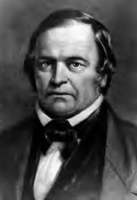 Like
so many people of that era, his life was forever changed by the Prophet
of Doom,
William
Miller. Mr. Miller was a Vermont farmer-turned-preacher who
prophesied the second appearing of Christ and the imminent end of the
world. His whirlwind tours across New England where the thundered his
end of the world message in the late 1830’s and early 1840’s fired the
imagination of the time. Whole communities were taken with the Millerite
fever, as the Second Adventists were popularly known. Like
so many people of that era, his life was forever changed by the Prophet
of Doom,
William
Miller. Mr. Miller was a Vermont farmer-turned-preacher who
prophesied the second appearing of Christ and the imminent end of the
world. His whirlwind tours across New England where the thundered his
end of the world message in the late 1830’s and early 1840’s fired the
imagination of the time. Whole communities were taken with the Millerite
fever, as the Second Adventists were popularly known.
Solomon Jr. was a man who valued
religious liberty and free-thinking above all things. In the
free-for-all of the open air Millerite meetings he found a home that
suited his free-ranging mind and maverick religious feelings.
A Man at Midlife
Solomon Jr. heard the Millerite
message at midlife, sometime prior to 1840, and many changes ensued. He
severed his connection with the Methodist Church. He became a pacifist
(a position that intensified twenty years later into a fierce hatred of
war when he lost his namesake son in the Civil War). He entered into a
strict vegetarian diet that he practiced for the rest of his life, for
more than 50 years. He regarded animals as created by God and that
killing them for any purpose was a sin. He used no leather in his
apparel or in his equipage, going so far as to harness his team with
ropes and chains instead.
In 1840 he bought a ten acre
tract high in the wilds and hills of western Worcester as a sanctuary to
God. How he came to choose this tract is unknown.
God's Ten Acres
The ten acres were high on a
small plateau on the eastern slope near the top of Tetasset Hill,
reached by a winding footpath. A magnificent slope of jumbled boulders
rises from the plateau to the hill top high above. Tetasset is a
Nipmunk Indian name, but the Colonists soon renamed the hill
Rattlesnake
Hill. It was perfect cover for rattlers with plenty of basking
sites facing the rising sun and deep hollows for winter dens. The
rattlesnakes were wiped out in Worcester by 1800, but Rattlesnake Hill,
or more specifically, Rattlesnake Ledge (as the slope itself was called)
was the last pocket of rattlers in the town.
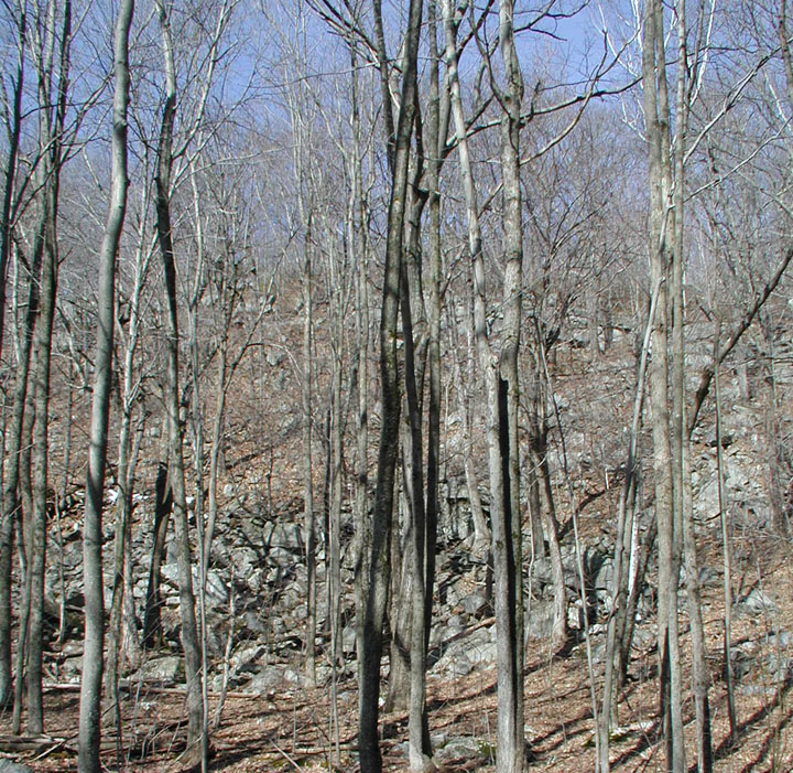
Rattlesnake Ledge
In 1840, this wild woodland
plateau was one of those beautiful sylvan glades where, according to
George Maynard in 1903, "the devout soul can fitly seek communion with
its Maker." A first-hand account in 1870 by T. W. Higgins describes it
as, "a dark, dense tract of second-growth forest, masked here and there
with grapevines, studded with rare orchids, and pierced by a brook that
vanishes suddenly where the ground sinks away and lets the blue distance
in."
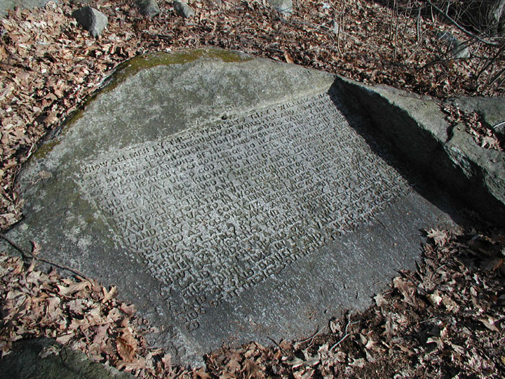
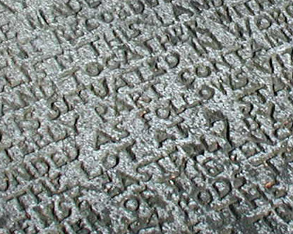
Upon
paying $125 to William G. Hall in 1840 for this beautiful tract, Solomon
had Hall deed over the parcel to God, rather then himself. And to
immortalize the intended enduring nature of the transaction to
perpetually dedicate the site to the service of God, he had Sylvester
Ellis carve the deed into a flat boulder in the shadow of Rattlesnake
Ledge. This 215 word inscription must have taken months if not years to
carve. The workmanship and depth of carving was so carefully done that
170 or so years later the inscription is still as clear and legible as
when it was first meticulously chipped into the rock.
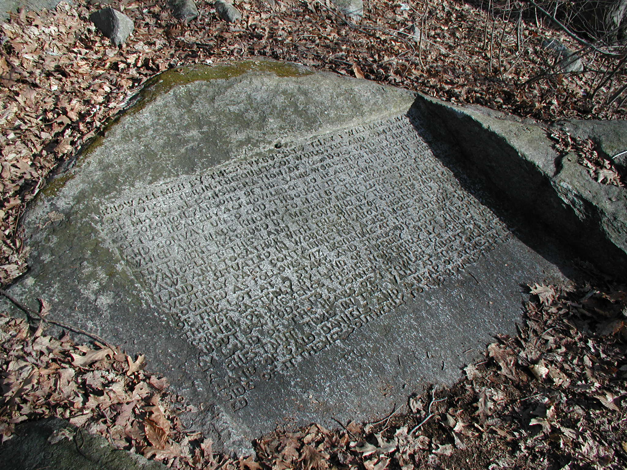
Deeded To God
The deed reads exactly as
follows, as transcribed at the location by my friend Scurv Dawg on March
31, 2007:
"Know all men by these presents
that I William G. Hall
Of Worcester in the County of
Worcester and Commonwealth
of Mass in consideration of 125
dollars paid by the hand
of Solomon Parsons of the same
Worcester the receipt where
of I do hereby acknowledge do
hereby give, grant, sell
and convey unto God through the
Laws of Jesus Christ
which are made known to man by
the record of the New
Testament recorded by Matthew
Mark Luke John the
Evangelist this land to Governed
by the above mentioned
Laws and together with the
spirit of God the said tract of
Land is situated in Worcester
above mentioned the South
Westerly part bounded as follows
viz beginning at the southwest corner
Of the lot at a stake and stones
by land of E Daniels
Thence easterly by land of S
Perry about 97 ½ rods to a
Corner of the fence thence
northerly by land of L Cates
About 54 rods to a corner of the
fence thence westerly
By land of the heirs of J Fowler
about 24 rods to
A chestnut tree in the wall at
the corner of the
Land of said Daniels and a heap
of stones by the
Side of it thence southerly to
the bound first mentioned."
• For a detailed image of the engraving
on the rock,
click here.
A Legal Document?
Was this deed carved in the rock even a legal
document? Despite its time-consuming and meticulous carvings the deed
had legal flaws. For starters, William Hall did not have his signature,
execution date or an acknowledgment chiseled into it. Even if the rock
was loaded and hauled to the Registry for recording, it would not be
transcribed into the record books because it wasn’t a
"duly
executed and acknowledge instrument,"
even though Hall apparently relinquished possession of the property.
Then there is the secondary issue of God taking delivery of the deed and
possession of the property.
It is the realm of
the theologian to determine if God took possession, but in the eyes of
the law, the only apparent possessor was Solomon. It can be argued that
Solomon, as paying consideration to Hall for God was thus God’s agent,
and that the conveyance created a
"Resulting
Trust"
on Solomon’s behalf. On the other hand, it may also be argued that
Solomon was effectively a squatter on the site. However, he made
"open
and notorious use"
of the property for more than 40 years. He would have had an adverse
possession claim to the property, especially since Hall, who held
"record
title,"
failed to bring an action to recover the land within 20 years. However,
anyone reviewing the Registry of Deeds records would conclude that
William G. Hall was the
"record
owner."
|
An Analysis of the Legitimacy of the Deed, by Scurv Dawg
The Massachusetts Bay
Colony was the first to enact a recording act so that
"Every man
may know what estate or interest other men may have in houses,
land or other hereditaments" and was initially established to
protect a grantee where a grantor remained in possession. The
Massachusetts recording statue was enacted in 1652 and the law
provided that no conveyance would be valid unless it was
"By deed
in writing under hand and seal" accompanied by livery of seisin,
or the acknowledgement and recording of the deed. In 1697 the
recording statue was amended and provided that a recorded deed was
valid to pass title without any other act or ceremony. However if
a deed was recorded without an acknowledgment it was not valid
except as to the grantor and the grantor’s heirs. In 1836 this
last part of the statue was revised to include the grantor, the
grantor’s heirs, the grantor’s devisees, and persons who have
actual notice. The purpose of the revised statute is to prevent
fraud where the grantee (having actual notice of a prior
conveyance) who takes a subsequently executed deed could defeat
the title of a prior valid deed simply by being the first to
record.
William G. Hall
did not have his name, date or an acknowledgment chiseled in Deed
Rock. Even if the rock was loaded and hauled to the Registry for
recording it would not be transcribed into the record books for
because it wasn’t a duly executed and acknowledge instrument.
Whether the Almighty was able to take "livery of seisin" would be
a theological debate. . .
To read the entire
article,
click here.
|
Forest Sanctuary
 Deeding
the land to God was only the beginning. The real purpose of the site
was to erect a Temple to God, where He could be worshiped feely and
spontaneously. This structure was called the Forest Sanctuary and was
built by hand by Solomon himself. At the height of Millerite
end-of-the-world fever in the early 1840’s, Solomon began construction
of a building intended, he said, to
"escape
the wrath to come, and should endure even amid a burning and transformed
earth." Deeding
the land to God was only the beginning. The real purpose of the site
was to erect a Temple to God, where He could be worshiped feely and
spontaneously. This structure was called the Forest Sanctuary and was
built by hand by Solomon himself. At the height of Millerite
end-of-the-world fever in the early 1840’s, Solomon began construction
of a building intended, he said, to
"escape
the wrath to come, and should endure even amid a burning and transformed
earth."
As he related to T. W. Higgins
at the time, "if the first dispensation had been strong enough to endure
there would have been no need of a second," and he therefore “resolved
to build for his part something which should posses permanence at
least.”
This Temple is no longer
standing and is described in several varying accounts. Higgins, an
eyewitness, describes it as follows:
"There are four low stone walls
three feet think, built solidly together without cement and without
trace of tools. The end walls are nine feet high (the sides being
lower) and are firmly united by a strong iron ridge-pole, perhaps
fifteen feet long which is imbedded at each end in the stone. An arch
in the terminal wall admits the visitor to the small roofless temple,
and he sees before him, imbedded in the center of the floor, a large
smooth block of white marble, where the deed of this spot of land was to
have been recorded, in hopes to preserve it
even after the globe should have been burned and renewed. But not
a stroke of this inscription was ever cut." In another account the
structure was further said to be flanked by two stone towers, four feet
square and seven feet high.
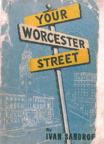
A more recent description, by
Ivan Sandrof in a 1947 issue of the Worcester Telegram & Gazette,
differs from Higgins in startling ways. He begins with the Temple being
25 feet square, but then goes on to contradict both Higgins and himself
by saying, "Six huge pillars, arranged about 12 feet apart, formed the
support of a hexagonal structure."
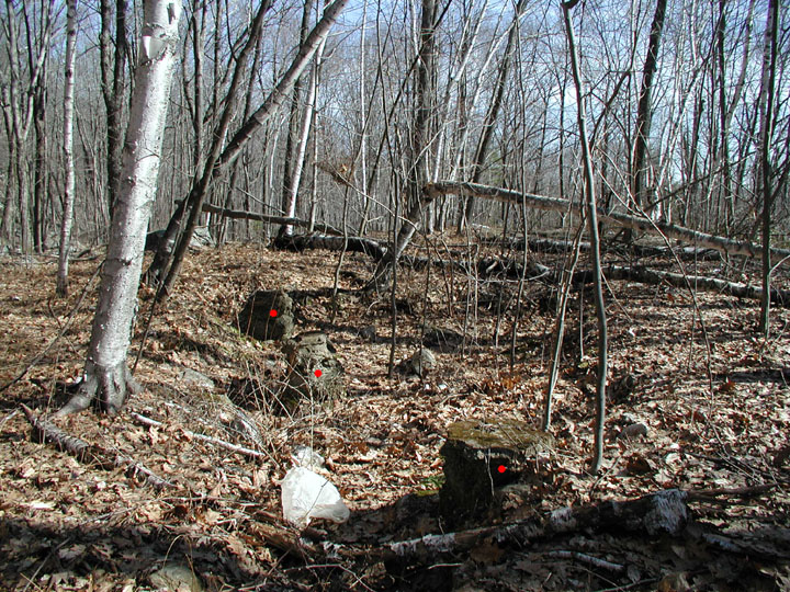
Footings for temple, marked in red
Field investigation reveals 5
pillar footings, but these are in a row, not in a hexagonal figure.
Both accounts agree that the entrance was through a stone gateway, and
that the roof was constructed of large sections of sheet iron. Solomon
had designed the Temple to be made of iron and so that it would survive
the impending cataclysm.
However, it did not survive its
own construction methods. Higgins indicates that the building was made
without cement, but Sandrof says it was, albeit a mortar lacking horse
hair binder due to Solomon’s vegetarian beliefs. This mortar lacked
durability and crumbled away easily. A local legend says that during
one particularity spirited meeting in the Temple, a sudden windstorm
"unroofed and unwalled the sacred edifice."
However that may be, Forest
Sanctuary Temple was no longer with a roof at the time of Higgins’s
writing in 1870. Higgins goes on to comment
on the mystical abandoned feel of the roofless woodland temple, "There
is a little monument [Forest Sanctuary], …which always seemed to me as
wild a memorial to forgotten superstitions as the traveler finds amid
the forests of Japan."
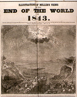
The Great Disappointment
William Miller predicted the end of the world
to happen between the vernal equinoxes of 1843 and 1844. During this
heady time of both repentance and religious exuberance, Solomon and his
fellow Millerites met for prayer and worship and awaited while wearing
white ascension robes the bodily flight to heaven and the worlds
demise.
Solomon also spent
1843 selling off property. Like many Millerites, he appears to have
been jettisoning personal belongings that he considered unnecessary
including land holdings, prior to being taken up to heaven. In that
year he sold off 4 parcels, a move reenacted many times that year by
other Second Adventist brethren.
Forest Sanctuary Today
When the world did not end on the final
predicted date of October 22, 1844, many Millerites abandoned religion
in the shock and disappointment of that emotionally catastrophic night.
However, Solomon and his friends continued to revere Forest Sanctuary as
a place of worship and continued to meet there for many years to come,
if not as Millerites. Indeed, for approximately 50 years, Solomon
continued to worship God at the Temple every Sabbath
"according
to the dictates of his conscience"
with any who wished to climb the forest path to join him there on the
log seats among the vines. According to Maynard,
"thousands
… in those long years visited that forest shrine."
The Hermitage
 Solomon Parsons
passed away in 1893 at the age of 93. God’s Ten Acres came into the
possession of a business tycoon, Abel Swan Brown. However, it was not a
linear change of hands or chain of title. Rather, it seems that Brown
simply started building on the site sometime after 1883 with no legal
claim to it. Solomon Parsons
passed away in 1893 at the age of 93. God’s Ten Acres came into the
possession of a business tycoon, Abel Swan Brown. However, it was not a
linear change of hands or chain of title. Rather, it seems that Brown
simply started building on the site sometime after 1883 with no legal
claim to it.
Brown owned more
than 300 acres surrounding God’s Ten Acres, and had a total acreage of
more then 650 acres in the Rattlesnake Hill area. He chose the little
plateau of Solomon’s Forest Sanctuary as his building site. He named
the estate Wildwood and built there a luxurious two and half story
summer home called the Hermitage, named after the little hermit shack
where Solomon’s nephew, Andrew Clark, lived like Thoreau for several
years in the late 1870’s. (Clark was recuperating from a serious
illness at the time and sustained himself by playing a cabinet organ for
a dime a listen.)
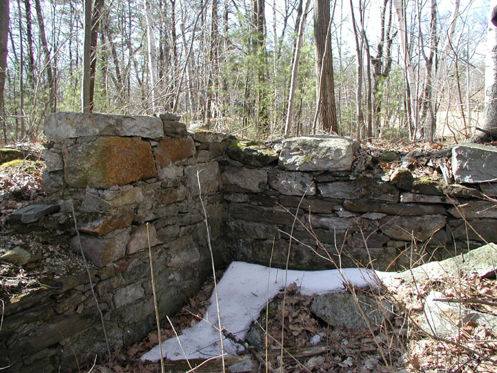
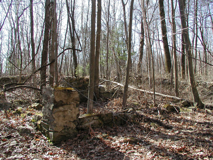
Hermitage foundation (left), and
Hermitage barn foundation (right)
As early as 1886 (seven years before Solomon’s
death), the City of Worcester Assessors Atlas shows the Hermitage and
its attendant buildings on the site. However, Brown never had title to
the land. Legal title to the property was never fully obtained until
after Brown died and his heirs were trying to sell it in 1904. To do
so, the heirs of Hall had to issue a
"quit
claim"
to the heirs of Brown. Solomon heirs deeded their interest in the
property to Brown prior to his death but this deed was not sufficient as
Hall was still the record owner. God as grantee in the Deed from Hall,
never took delivery, never recorded his deed, nor did he ever make an
attempt to clarify his chain of title through subsequent conveyances or
by court order. God may have been able to exert some authority over his
land if he had stepped forward as beneficiary of the Resulting Trust
prior to the conveyance by the heirs of Parsons but, alas, he did not.
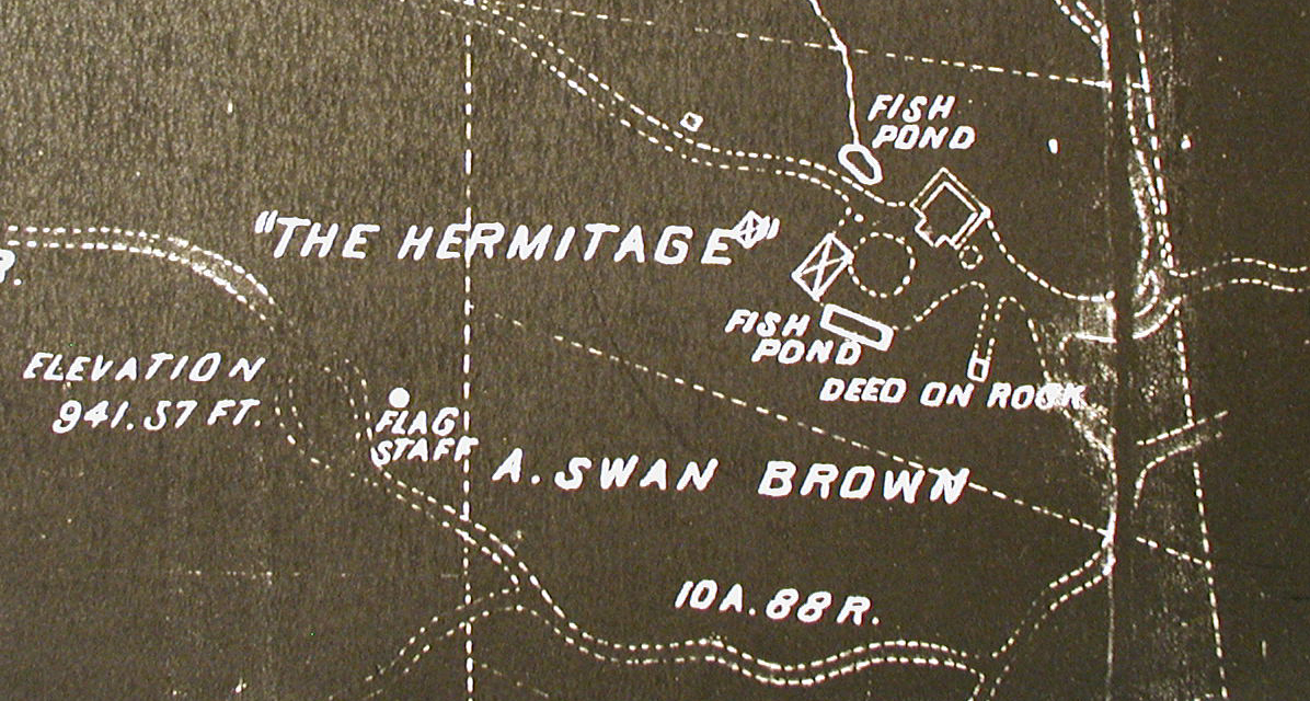
Worcester Assessors 1886 Map
It is unlikely
that Brown would have started construction while either Solomon was
worshiping at the temple or when Clark was living in the hermit shack.
Because the Assessors Atlas shows a fully constructed Hermitage complex
on God’s Ten Acres by 1886, and it is recorded that Clark had returned
to civilization by 1883, we can infer that Solomon had stopped climbing
the old trail to Forest Sanctuary by then as well. It would have been
at this point that Brown simply moved in and began building.
Brown’s
Hermitage included a stable, its own gas plant, kennels for his 50
dogs, terraced gardens, rock gardens, fountains, decorative ponds, and
waterfalls. The old
forest trail to the Sanctuary was abandoned and a road was carved along
the hillside all the way up to the Hermitage. This required building
sections of roadway into the steep hillsides that were 15 foot high,
hundred foot lengths. Brown named this dirt road Swan Avenue after the
Swan branch of the Brown family.
The Forest Sanctuary had either
fallen apart from the mortar problems or had been demolished by Brown at
the time of his construction. Brown also cleared the little plateau of
trees, using much of the timber for the Hermitage. This opened up a
spectacular view but also removed the last visual connection with
Solomon’s woodland place of worship.
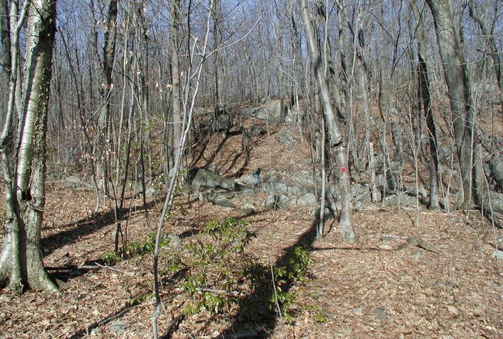
Of Hangings & Curses
On March 31, 2007,
my friend Scurv Dawg and I made the trip to Deed Rock and God’s Ten
Acres. I had heard rumors of the rock for several years, but only got a
good description of the location from
"Mac,"
a Worcester fellow who had emailed me earlier in the year about it.
Deed Rock is not
an easy place to find if you have never been there. Even with
directions, topographical maps, and aerial survey photos, Scurv Dawg and
I spent a good hour among the foundations of the Hermitage looking for
the rock.
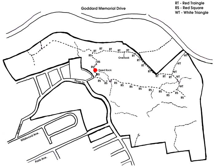
Map of God's Ten Acres, Deed Rock is
marked in red
This map will save you a lot of
trouble
(click to enlarge)
However, we did
however find the Hanging Tree. Local legend knows Deed Rock as
"Will
Rock."
In fact, all the correspondents who have written me about the rock have
called it Will Rock. It is only in researching the subject at the
Worcester Historical Museum that I learned that its historical name is
Deed Rock. Local legend has it that the
"will"
carved thereon is from a man who hung himself from a tree at a fork in
the road where the old lane enters the Hermitage, thus
"cursing"
this area. There actually is a short chain hanging from a fork high in
that tree, mute testimony to superstition.
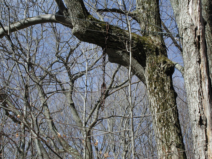
The "Hanging Tree" and close up of
metal chain
(Click to enlarge)
About 1000 feet
further down Swan Avenue on the right is Paris Avenue. Here I have been
told that in the 1960’s there were two suicides by hanging and an
attempted hanging. Both suicides happened within five years of each
other and both victims were discovered by their younger brothers. Later
a teenage girl attempted suicide there by hanging as well. This legend,
as described by a former Paris Avenue resident who knew one the suicides
as a boy, is that they were victims
"of
the woods up there – the Will Rock area - and the curse that was left
behind."
 According to a
Worcester document called
A History of Your City Streets, there have
indeed been suicides in the Wildwood area after the Hermitage burned
down in 1942:
"Police
occasionally swung up there and returned with a suicide."
This is an oddly worded sentence and I imagine it to mean that more then
one victim has been retrieved from the old Hermitage area. According to a
Worcester document called
A History of Your City Streets, there have
indeed been suicides in the Wildwood area after the Hermitage burned
down in 1942:
"Police
occasionally swung up there and returned with a suicide."
This is an oddly worded sentence and I imagine it to mean that more then
one victim has been retrieved from the old Hermitage area.
Further, Abel Swan Brown died quite suddenly
in 1899 at age 54, according to his obituary,
"at
the Hermitage, his summer home"
after a
"sickness
of less then a week’s duration."
The obituary notes that a doctor was in attendance. However, this
strikes me as the same careful wording and protective cover given
suicide victims in obituaries today. This conclusion regarding Brown’s
passing is solely mine and only a conjecture.
It appears that the modern local legends are a
mingling of Solomon’s stone-carved deed (the
"Will")
and Brown’s death (possibly a suicide). Add to this the dereliction of
the property and subsequent suicides in the area, and it is no surprise
that the reputation of the place has darkened.
If nothing else, the location went from a
Temple to God to a Temple to Mammon. Brown was one of the wealthiest
men of his era and he demolished Forest Sanctuary and turned the plateau
into a rich man’s playground. Fifty years after Solomon created a
temple to God, it still stood. Fifty years after Brown demolished it to
create a temple to himself, it had burned, the property fallen to ruin
and become the haunt of suicides.
Clearly, God’s Ten
Acres have undergone a transformation of a very dark kind. Perhaps it
would be better named the Devil’s Acres these days. I can’t say if it
is cursed, but the old Hermitage area and the Paris Avenue area are as
uncomfortable as described by the residents. It honestly wouldn’t
surprise me if the restless spirits of suicides, or darker things,
roamed the area.
Rocks & Ruins
 In our search for
Solomon’s deed to God, we eventually wandered back to Swan Road, and
there we noticed the small sign and arrow pointing to the Deed Rock
trail. A scant minute later we were standing at Deed Rock. It was well
worth the journey and search. Unlike the Hermitage area, Deed Rock
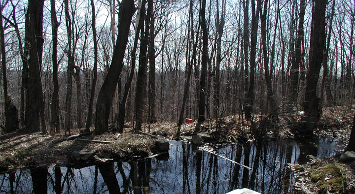
is a serene and contemplative place. A spring-fed brook softy
burbles as it passes beneath Deed Rock
itself. The view though the trees is amazing and Rattlesnake Ledge is
both imposing and impressive. In our search for
Solomon’s deed to God, we eventually wandered back to Swan Road, and
there we noticed the small sign and arrow pointing to the Deed Rock
trail. A scant minute later we were standing at Deed Rock. It was well
worth the journey and search. Unlike the Hermitage area, Deed Rock
is a serene and contemplative place. A spring-fed brook softy
burbles as it passes beneath Deed Rock
itself. The view though the trees is amazing and Rattlesnake Ledge is
both imposing and impressive.
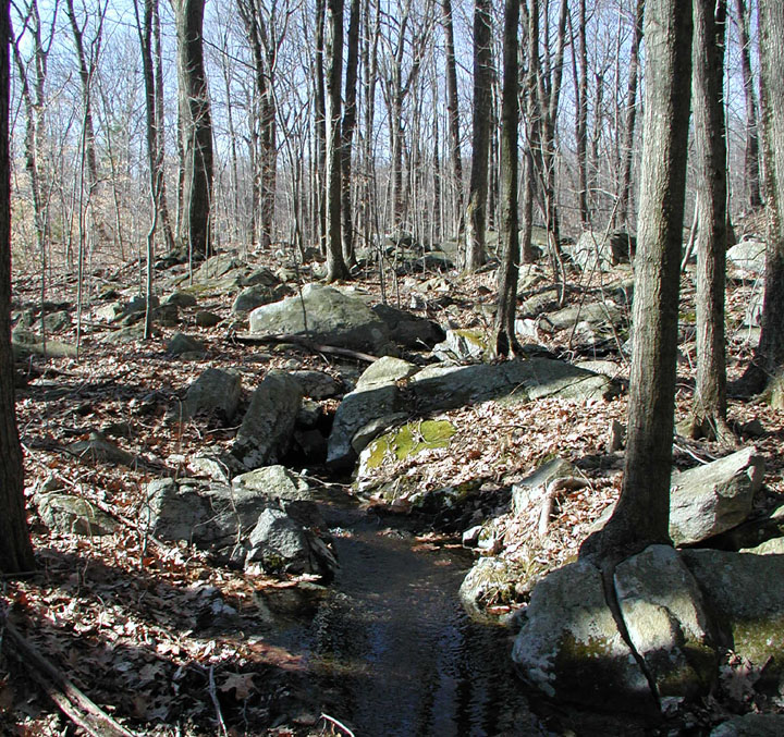
Spring Fed Brook
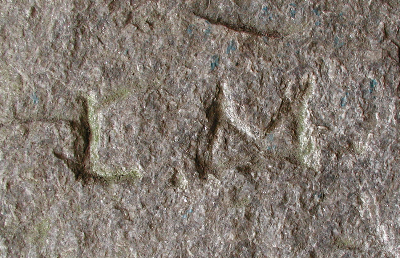
High up near the top of Rattlesnake Ledge,
overlooking God’s Ten Acres, is a cave made of jumbled boulders. The
foreyard of the cave at its opening appears to have been built up with
earth to make a flat platform in the steep hillside. Sitting within the
mouth of the cave the view above the trees easterly across Worcester is
spectacular. This certainly would have been a place known to Solomon as
its mouth is clearly visible from the Temple location below. Within the
cave the initials L. M. are carved. (click
here for picture of initials.)
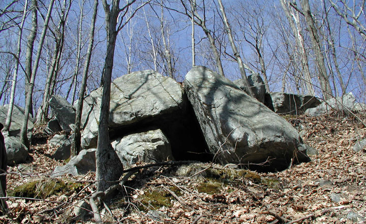
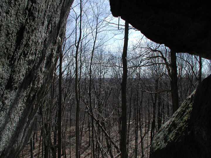
Cave & View from Rattlesnake
Ledge
The local Nipmunk
Indians who named the hill Tetasset would have known this cave as well,
although that was rattlesnake territory at the time. There is legend
that a Sachem lived on this hill near the spring in a tribe of about 100
people.
Below on the plateau, all that is left of
Brown’s Hermitage are the stone foundations and a small pond. There is
nothing serene or contemplative about this location these days. It is a
stuffy claustrophobic place,
dumped with trash and junk, and I felt
uneasy the entire time I was there. It is the kind of place you expect
to find trouble, even at 10 o’clock in the morning. I was relived when
we left.
Hermitage Pond
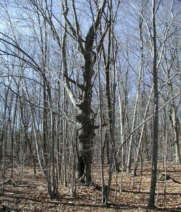 The
site of Solomon’s Temple is marked by a few pillar footings, and unless
you know what you are looking at, they are unremarkable. Gone is the
Temple built with human hands, but the spiritual essence of Nature’s
Temple still remains, even amid the wider negative field of the
Hermitage, if you are sensitive to such things. Indeed, an old Beech
tree standing nearby, which knew in its youth the days of worship here,
still has within its aura the whisper of Solomon’s Forest Temple and its
cleaner, purer, vibrations. The
site of Solomon’s Temple is marked by a few pillar footings, and unless
you know what you are looking at, they are unremarkable. Gone is the
Temple built with human hands, but the spiritual essence of Nature’s
Temple still remains, even amid the wider negative field of the
Hermitage, if you are sensitive to such things. Indeed, an old Beech
tree standing nearby, which knew in its youth the days of worship here,
still has within its aura the whisper of Solomon’s Forest Temple and its
cleaner, purer, vibrations.
Gone are the
"Thou
shalt not kill"
commandment at the Temple door and the entrance slabs that proclaimed,
"Peace
on earth,"
and
"Good
will to men."
Though the reminders are gone, we know that such messages should first
and foremost be written in our hearts anyway.
"Uncle Solomon" was a "quiet,
thoughtful farmer, long-bearded, low voiced, and with that aspect of
wild refinement which and ideal life brings forth even in quiet
uninstructed men." He deeded this land to
God, and had that deed carved in stone, in the hopes to preserve this
place "even after the globe should have
been burned and renewed." Today, the
Worcester Airport Commission owns it, and has placed it under a
conservation restriction, prohibiting its development in perpetuity.
Solomon Parsons would be pleased with that.
Deed Rock is located at
approximately these GPS coordinates: 42.2560N, -71.8620W.
If you are visiting you will notice a lot of trash in the Hermitage
area. Please bring a garbage bag or two and do a quick clean up. Uncle
Solomon would thank you.
Email Daniel V.
Boudillion
Back to Field
Journal
Copyright © 2007, 2009 by Daniel V. Boudillion
| 


