|
|
Pots Point The Way?
An Enigma in the Dog Town Woods
Article & Pictures
Site Visit: 18 February 2002, by Daniel V. Boudillion
|
Introduction:
This is a follow-up report in response to several
pieces of correspondence I have received in regards to the
Father John & the Rock Pile
field report. [A recent "Donation" of an antique medicine bottle on a
stone platform in the Boxborough woods.] Several people have suggested
that the direction the mouth of the medicine bottle is pointing might be
significant. Not so much as a marker of a celestial event such as a
solstice sunrise, but as a subtle signpost (like a directional arrow) pointing
to other lithic and/or sacred sites. The suggestions were that "trash"
might actually be signposts to sites. The dominant culture would see
only "trash", but to others it might actually be subtle arrows pointing to the
locations of significance. What hidden culture this might be - if it
even exists - I don't know, but it has been suggested that there might be a
Native American connection.
Field Investigation:
In any event, this correspondence brought to mind an
enigmatic tableau I came across in Dog Town in Cape Ann in February of 2002.
This was a snow-less winter, and good for field work. I was up in the
woods between the old foundations and the railroad tracks - an area of
interesting lithic structures, glacial erratics, and talus caves. On a
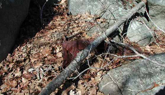
large flat boulder were three old pots.
[Figure 1] It was odd to see them in the woods to begin
with, and odder still was their seemingly deliberate arrangement. The
handles seemed to point. Feeling somewhat foolish, I took out my
Suunto, and sighted the handles. I was astonished and perplexed to find
the handles were aligned exactly 300, 600,
and 900 magnetic. I sighted the horizon
along the degrees marked by the handles, but nothing obvious jumped out at me.
[Figure 2] I
took several photos, made a mental shrug, and continued with my field work.
As for the lithics in the immediate area, there were
plenty of interest, which may or may not be of significance in relation to the
pots. I include these items as they may simply be of interest in and of
themselves. First, there is a small dolman on the bedrock of the hill
top. [Figure
3] Judging from the tree growth, this entire area
was open not all that long ago. There are also two other small boulders
the same size as the dolmen on the same bedrock within several yards of each
other.
[Figure 4]
Another same-size boulder very close by had one rock beneath it and I wondered
if it were also intended to become a dolmen as well - perhaps they all were.
[Figure 5] Although
I am no expert, a casual examination of the dolmen did not convince me it has
been there all that long. However, I can vouch that it has been there
since at least the mid 1980's. The pots are located on a plateau just
below the hilltop to the east.
There is a jumble of boulders on the plateau that I
call "the fort." Whatever it may have been used for, it shows certain
use as a camping place.
[Figure 6]
Although it is not readily apparent in the photo, there is a central open area
in the center of the rocks that is hidden from view from those below. It
is this hidden central place that shows signs of camping. (I use the
term "fort" in this instance in the way young boys would describe a fun place
to play in.) On top of one of the boulders comprising the "fort" is a
large perched stone.
[Figure 7]
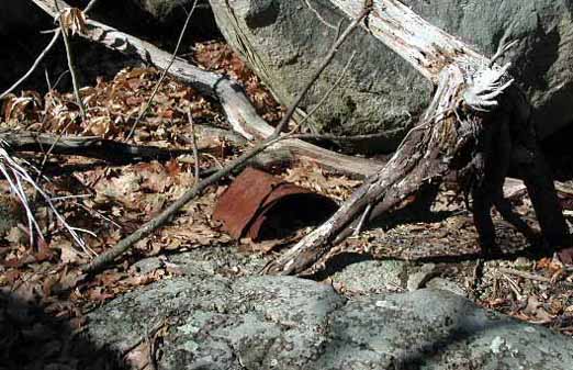
There are also two rusty pails among this jumble of rocks.
[Figures 8 & 9] This is interesting in the light of the
above proposed idea that some "trash" may be of a subtle significance
undetected to dominant culture. Indeed, see my report
Father John & the Rock Pile
for a theory by James Mavor and Byron Dix on the possible significance of
rusty pails in particular marking sacred places. There is also an
"effigy".
[Figure 10]
The "fort" overlooks a steep skree-strewn slope
through which railroad tracks cut at the bottom. There is a path leading
up to it from the tracks. Nearby on the same plateau is a cave/tunnel
formed by a large erratic on top of two other boulders.
[Figure 11] The interior widens out inside to the right
and is larger than it appears.
[Figure 12]
The other end is partially blocked by stones, and if it were further closed
with wood or bark, it would make a nice dry shelter indeed.
Heading past the boulder with the pots there is a
giant erratic tilted-up on several much smaller rocks.
[Figure 13] The giant erratic is on bedrock, and appears
to be supported in its tilted-up position by but one small rock.
However, a row of small boulders run along the edge of the tilted up area.
There appear to have been placed there.
[Figures 14, 15, & 16]
They are flattish boulders stood on their sides and have a
tooth-like look to them.
The boulder with the pots happens to be the center
of this ring of interesting lithincs: dolmen, cave, giant tilted-up erratic,
perched boulder, and "fort."
[Figure 17]
The pots have not been exposed to the weather for long - certainly not for
more than a year or two when I saw them. Whoever put them there for
whatever reason has done so in the recent past.
Historical Data:
Dog Town has a long and unusual history.
It is overgrown heath land on top the Cape Ann plateau. During pirating
times the villagers moved from the shore up to the plateau for protection.
Years later when this was no longer a threat, they moved back down again -
leaving their dogs behind them, or so it is said. Some of the old and
poor continued to live out their lives there.
Even today with the jam-packed development of Cape
Ann, most of the Cape - the plateau - has not been developed and remains a
wild and uninhabited area. It is a surprising large area, and not
without dangers. There have been attacks and murder there over the
years. It is literally a massive jumble of boulders and rocks - in some
of the "fields" you can walk for hundreds of feet by stepping from rock to
rock.
It is also an area associated with odd doings.
Some of the last inhabitants of Dog Town, penniless and bitter old women, were
considered witches. Strange happenings were recorded in and around 1690:
a troop of "Indians" moved in that were impervious to bullets, and repeatedly
taunted the Colonials for an entire year. Recluses and hermits have
lived there as well over the years. One man spend most of his life
carving moralistic slogans into the large boulders. It is one of those
places that tend to attract odd people and odd practices.
Conclusions:
I really have no idea what to make of the pots.
It is my opinion that they were deliberately placed as they were, with the
handles deliberately aligned as such. At the time of my readings, the
alignments were exact. I tend to doubt this was all accident. I
have not yet returned to see if following the directions leads to anything
interesting or significant. It will have to await for the leaves to be
down to do so.
The area does seem to have significant lithics - the
dolman on the hilltop being a case in point. The boulder cave would
make a fine shelter, and the "fort" is the kind of place that draws people to
it. The rusty pails may or may not have anything to do with things.
Again, much like with the Father John & the Rock Pile report, I am
at a loss as to what is going on. But it certainly appears that there is
some kind of unusual and subtle - and recent - activity here. I would
urge others who find such things to leave them untouched.
If anyone has comments or a better understanding of
what I have reported, please feel free to email me at
dvb@boudillion.com.
Pictures:
Click Pictures to Enlarge
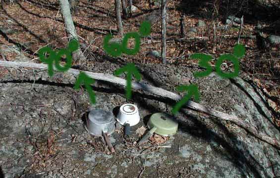
Figure 1: Pots On Rock
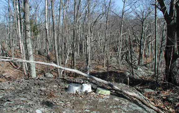
Figure 2: Horizon Viewed From Pots
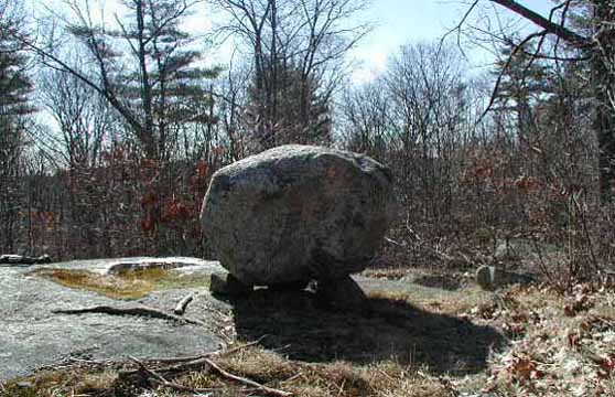
Figure 3: Dolman on Hill Top
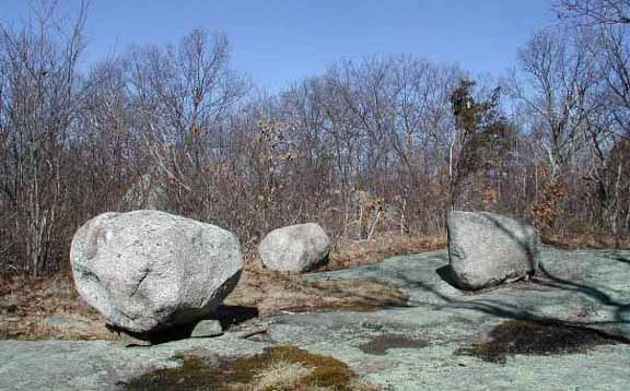
Figure 4: Same Size Boulders Next to Dolman
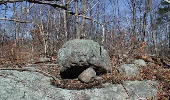
Figure 5: Partially Constructed Dolman?
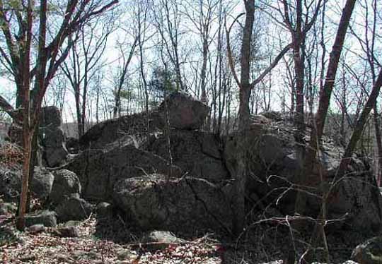
Figure 6: The "Fort"
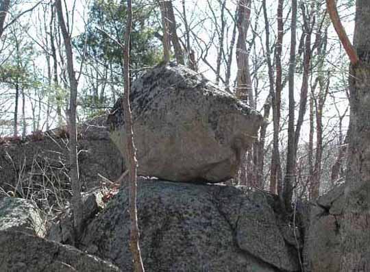
Figure 7: Perched Stone
Figures 8 & 9: Rusty Pails
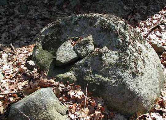
Figure 10: Effigy
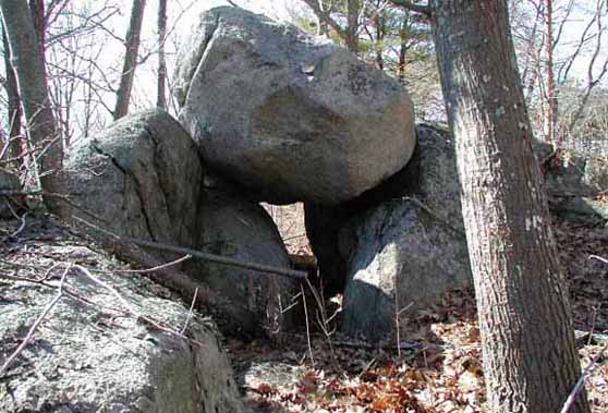
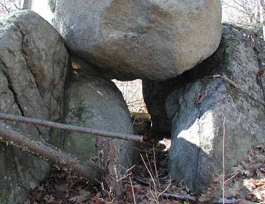
Figure 11 & 12: Boulder Cave & Close-up of
Boulder Cave
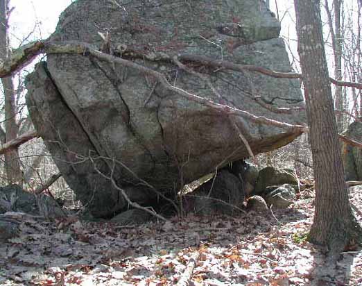
Figure 13: Giant Tilted-up Erratic
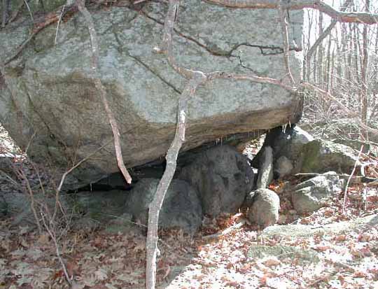
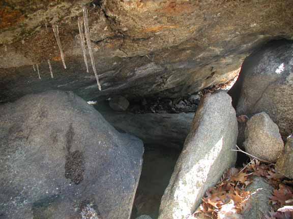
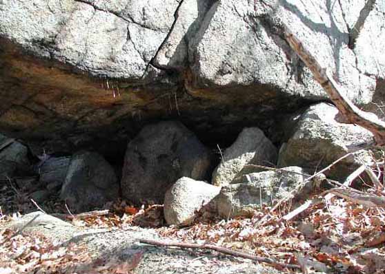
Figure 14, 15, 16: Close-ups of Small Boulders
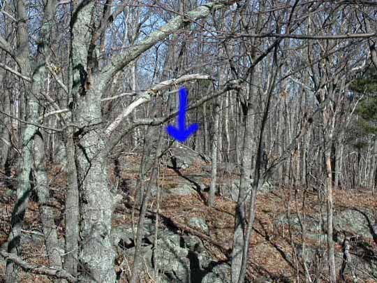
Figure 17: Pots on Rock
As seen from standing on the "Fort"
To boudillion.com Home Page
Field
Journal
Copyright © June 2003 by Daniel V. Boudillion
|


