Fort Pond in Littleton is named after
the Indian Fort of the Nashoba Praying Indian Village era of 1651
to 1714. This was a small palisaded enclosure, similar
to other Indian forts recorded by the Puritans in the 1675/76 King
Philip's War. It is recorded that the Nashobas would abandon
the fort and leave the area the minute the Mohawks (their
ancestral enemies) would appear in the area, so it likely that the
either the fort was poorly constructed or there were not enough
men to defend it, or both. However this may be, its exact
location has been lost, but there are several possible places it
could have been.
 Typical
Indian forts of the era were situated in the low islands in
swamps, a practice called "enswamping" by the Puritans.
There are several such low islands in the swamp around Fort Pond,
and it is recorded that as late as the 1920s Indians would pass
through to honor their ancestors buried on the islands. This
lends weight to the idea that the Fort was also on one of the
"islands."
Typical
Indian forts of the era were situated in the low islands in
swamps, a practice called "enswamping" by the Puritans.
There are several such low islands in the swamp around Fort Pond,
and it is recorded that as late as the 1920s Indians would pass
through to honor their ancestors buried on the islands. This
lends weight to the idea that the Fort was also on one of the
"islands."
Another location put forth is Speen's
Point, a peninsula on Fort Pond named after a prominent Nashoba
Plantation Praying Indian. This site has appears quite
defensible from a European perspective, but there is no historical
evidence to connect it with the fort.
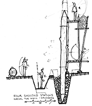
1615 Indian Fort at Castle
Hill
A third location is an earthwork on the
side of Speen's Field, high on a western slope of Fort Pond Hill
in the Sarah Doublet Forest. There is a 1910 photograph in
possession of the Littleton Historical Society which is labeled as
follows: "This shallow well (now filled with rocks) is believed to
be the site of the Nashoba Indian fort in Speen's Field on the
Northerly* slope of the hill near Fort Pond."
*Note:
the location is actually westerly on the hill.
Using a copy of the photograph and a
knowledge of the general area, I was able to match a distinctive
shaped stone in the stonewall in the picture with the actual stone
in a wall - and thus locate where the picture was taken and the
remains of the well/earthwork. Incidentally, this particular
site is adjacent to one of the three springs in the Sarah Doublet
Forest. However, locating where the picture was taken does
not conclusively locate the Indian Fort, all it really means is
that this is where people believed it to be in 1910.
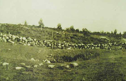
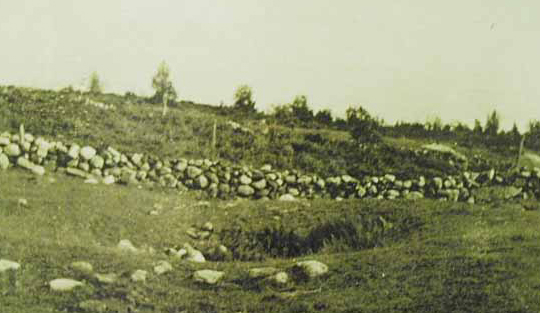
Site of Indian Fort
at Speen's Hill
.
Note: the picture to the left is the
1910 Speen's Field Indian
Fort site.
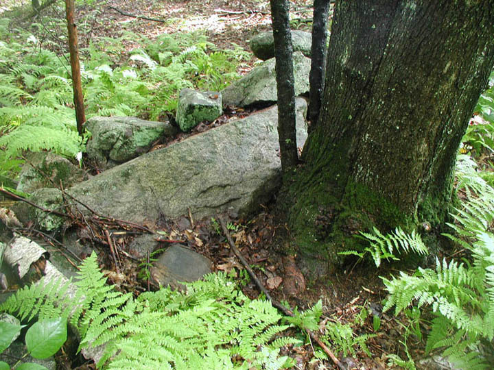
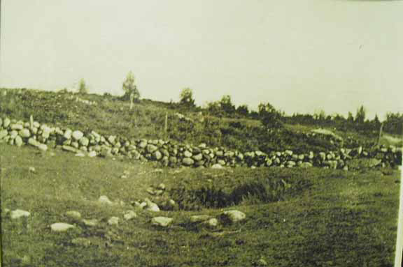
In the picture, in the part of the stonewall to the far right, note the
long stone with the hooked tip. I was able to locate this
distinctive stone, now recumbent in the wall, and conclusively
locate the site of the picture (and the earthwork). The picture to
the right is of the distinctive now-recumbent stone.
Unfortunately, this site is on private property.

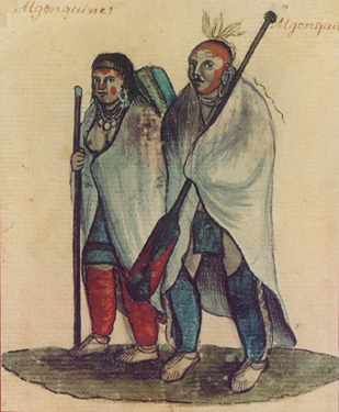
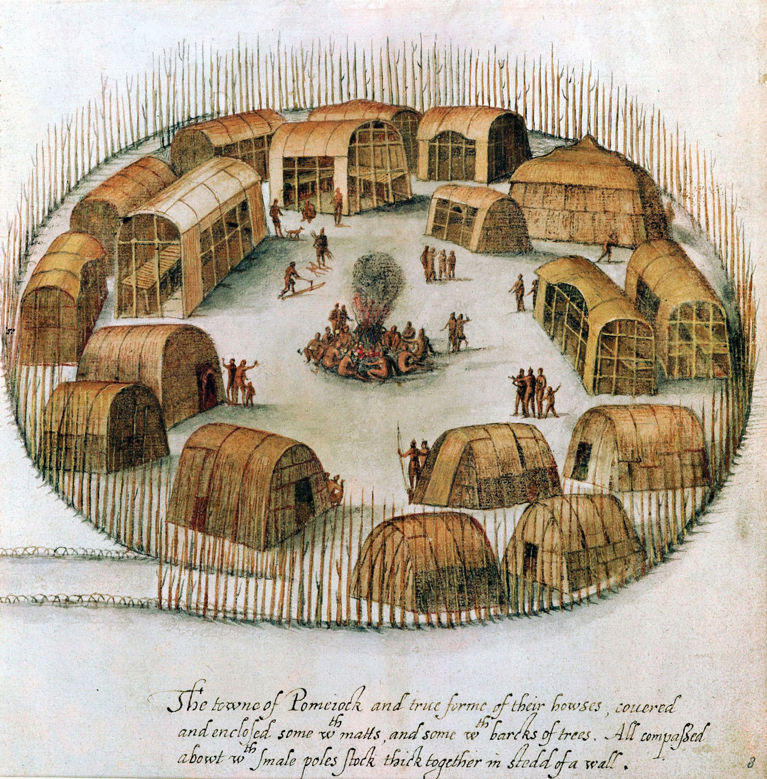
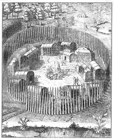
Algonquin
village of Pomeiock & an Algonquin couple
.
Note: The palisade around the village
is typical of Algonquin Indian Forts and fortified Indian
villages.
.
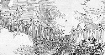
Note:
In regards to Contact Period palisaded Algonquin Indian
Forts, is this excerpt from the
Molly Ockett webpage: "A
major focal point of Molly Ockett's world was Pigwacket, the ancient
Indian enclave at present-day Fryeburg, Maine. This late 16th century
representation of an East Coast Algonquian village conveys something of Pigwacket's appearance in the decades before Molly Ockett's birth.
[See
picture of palisaded village.]
.
A
description of the semi-abandoned Pigwacket village made in 1703 by an
English scouting party led by Major Winthrop Hilton states: "When we
came to the fort, we found about an acre of ground, taken in with timber
[palisaded], set in the ground in a circular form with ports [gates],
and about one hundred wigwams therein; but had been deserted about six
weekes, as we judged by the opening of their barnes [storage pits] where
their corn was lodged." The bark-covered wigwams or longhouses in this
view (excepting "A") are typical of Abenaki dwellings used in this
region. By tradition, "Pigwacket" is said to mean "at the cleared
place."


