|
|
Nashoba Hill: The Hill that Roars
Vision Quest and Nashoba Praying Indian
Village
Field Investigation © by Daniel V. Boudillion
|
Note: this is the full
text of the abbreviated version published in the book Weird Massachusetts
Expanded & Revised
12-2009
Introduction
There is a very
special hill in Littleton, a hill that roars. The Indians thought
the winds were pent inside; the Colonials said it sounded like cannons;
some folks climbed it to await the rapture; and others erected a stone
altar on its top. It’s a well-known hill, famed these days for its ski
slopes. But its history is far more strange, and ongoing, than anything
that has ever swooshed down its slopes or taken the chair-lift. Gather
around the ski lodge fire, friends, and hear the strange tale of Nashoba
Hill: of a dark king under the mountain and an island village of vision
quests and shamans.
.Section 1: History & Legend
Nashoba Praying Indian Village
 Littleton,
Massachusetts was originally a Praying Indian Village. Back in 1646,
Rev. John Eliot, known as the Apostle to the Indians, began an effort to
organize the Massachusetts Indians into Christian Villages. With the
backing of Cromwell’s England and 12,000 pounds sterling, he began a
long-term mission to the Massachusetts and translated the Bible into
Algonquin in 1663. Littleton,
Massachusetts was originally a Praying Indian Village. Back in 1646,
Rev. John Eliot, known as the Apostle to the Indians, began an effort to
organize the Massachusetts Indians into Christian Villages. With the
backing of Cromwell’s England and 12,000 pounds sterling, he began a
long-term mission to the Massachusetts and translated the Bible into
Algonquin in 1663.
Although he was a
Puritan, Eliot was also a humanitarian and he felt that the best way to
assure their survival in the midst of heavy English land-pressure was to
organize the Indians into English towns and lifestyles. They were to
convert to Christianity, have deeded towns, live in English houses, wear
English clothes, and worship Puritan style in Meeting houses.
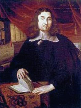
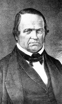
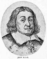
John
Eliot
.
Between 1651 and
1658, Eliot and his assistant Daniel Gookin organized seven Praying
Indian Villages in Massachusetts Bay Colony, and Nashoba was the sixth.
All told there were at least 14 such villages in Massachusetts with
between 45 to 60 inhabitants each.
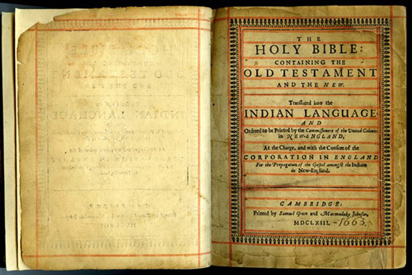
The
UP-BIBLUM GOD,
the Bible translated into Algonquin
1663 edition
In an interesting
twist, Eliot allowed the Indians to choose the sites of their new
Villages. The local Concord Indians led by an early convert, their
Sachem Tahattawan, requested the
"nashope"
lands close by. With such latitude to location, it would not be
unexpected for the Indians to choose places that were special or
important to them. It is also known from Eliot that
"nashope"
was Tahattawan’s main residence, again marking these lands as desirable.
 The Indian
Plantation of Nashoba [also spelled Nashobah] was formally granted by
General Court in 1651 and was laid out in a lozenge-shape carved from a
gore of unsettled lands situated between Groton, Chelmsford, Concord,
and Lancaster. Its sides were approximately 3 x 4 x 4 x 4 miles in
length and the area encompassed most of current day Littleton and a
portion of Boxborough (which was formerly Littleton). The Indian
Plantation of Nashoba [also spelled Nashobah] was formally granted by
General Court in 1651 and was laid out in a lozenge-shape carved from a
gore of unsettled lands situated between Groton, Chelmsford, Concord,
and Lancaster. Its sides were approximately 3 x 4 x 4 x 4 miles in
length and the area encompassed most of current day Littleton and a
portion of Boxborough (which was formerly Littleton).
The Village
thrived until King Phillip’s Indian War in 1675-76, when the Nashobas
were rounded up and dumped on Deer Island in Boston Harbor to freeze and
starve. Only a handful survived to return. The Plantation was rapidly
sold to English settlers seeking land and by 1714, it was completely in
English hands as the Town of Nashoba, and re-incorporated as the Town of
Littleton in 1715. The surviving Indians were given the Indian New
Town, a 500 acre tract of rocky hill between and including portions of
Nagog Pond and Fort Pond (which was named after the Indian fort there).
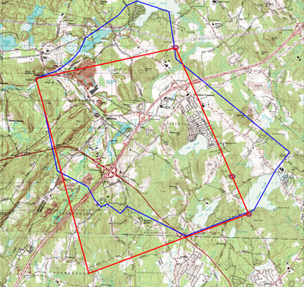
Nashoba Indian
Plantation 1654 and Town of Littleton 1988
click to
enlarge
.
Note: Nashoba Plantation is in
red, and Littleton is marked in
blue. The red square of Nashoba Indian Plantation was
incorporated as the Town of Nashoba in 1714. The next year the
name was changed to Littleton. Note how the shape of the town has
changed over the years. For instance, the lower left corner became
part of Boxborough, and Concord Village (Powers Farm) was added to the
right side of town.
What does "Nashoba" Mean?
Nashoba is a word
of many meanings. When applied to the Nashoba Praying Indian Village,
it means the Place Between the Waters. (These titular waters were Nagog
Pond and Fort Pond, and less significantly, Long Pond.) When applied
to Nashoba Hill, it means the Hill that Shakes. It is from Nashoba Hill
that the early English settlers said the booming and rumblings
emanated. Sachem Tahattawan certainly did choose a place of special and
unusual qualities, intentional or not.
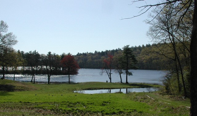
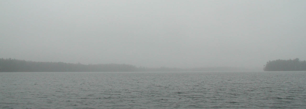
Nagog Pond & Fort
Pond
.
Note: The "Place Between
the Waters" is located between Nagog & Fort Ponds.
Where the Winds are Pent
 Daniel Gookin in
his Historical Collections of the Indians in New England,
(written in 1674, and published in 1692), identifies an Indian belief
that unusual noises were associated with a pond in Nashoba: Daniel Gookin in
his Historical Collections of the Indians in New England,
(written in 1674, and published in 1692), identifies an Indian belief
that unusual noises were associated with a pond in Nashoba:
"Near
unto this town [Nashoba] is a pond, wherein, at some seasons, there is a
strange rumbling noise, as the Indians affirm; the reason thereof is not
yet known. Some have considered the hill adjacent as hollow, wherein
the wind, being pent, is the cause of this rumbling."
Commenting on this
passage by Gookin, Rev. Edmund Foster of Littleton said in his 1815
Century Sermon that,
"The
above pond above mentioned must be Nagog . . . it lies on the eastern
extremity of this town."
Nagog Pond at
Winter Solstice
.
Creative Commons:
Courtesy of Muffet
The
"adjacent
hill"
is not specifically identified by Gookin, but John Mitchell in
Trespassing (1998) indicates that it is a low hill to the
"Northwest"
of Nagog Pond, and paints this florid picture,
"[the
hill] was hollow and the four winds were pent up inside. Periodically
they would attempt to escape, and at these times … terrible roaring and
growls and rumbles were issue forth from within the hill. The very
earth would shudder, massive rocks would shift from their beds, trees
would sway and creak, and were it not for the intercession of the
shamans, the earth might have cracked open and revealed the dark,
boiling innards."
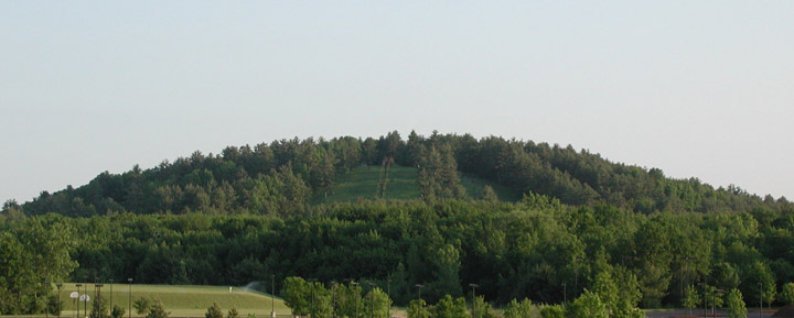
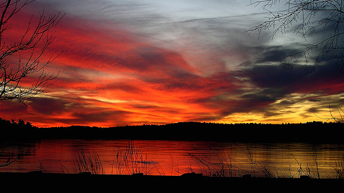
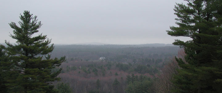
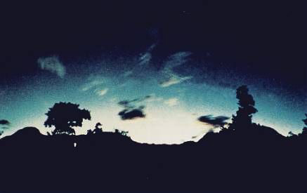
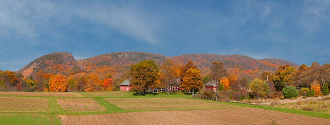
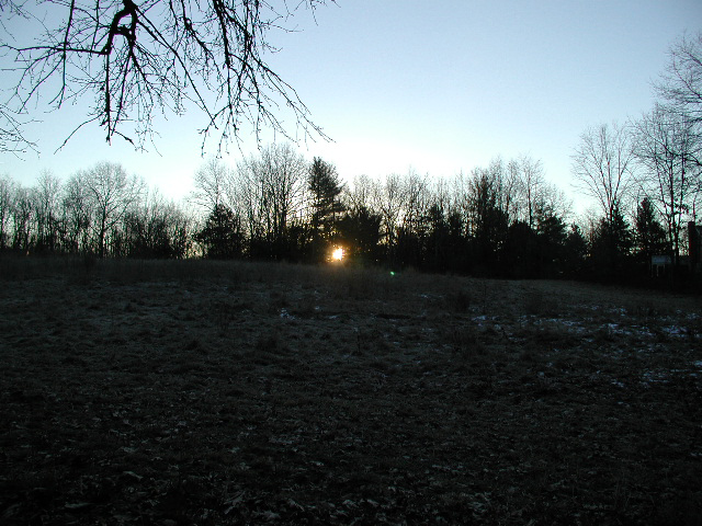
Nashoba Hill
.
Note: View from the Packard Farm on Great
Road.
Eyewitnesses of
the rumblings in earlier centuries clearly identify the spot as Nashoba
Hill. John Warner Barber in his 1841 Historical Collections
relates,
"The
report of the strange noise, heard occasionally in this pond, was not
without foundation. But the noise was not within the water, as they
[the Indians] imagined, but from a hill. Lying in a north-west
direction, and about half a mile distant form the pond, partly in
Littleton and partly in Westford, known by the name of Nashoba Hill."
Other odd
earth-noises heard in Nashoba at that time were loud humming sounds that
emerged from the beneath the Praying Indian Village. This was recorded
in the writings of John Eliot, who knew the village well and lived there
off and on while preaching. A Littleton Town Clerk’s report from 1896
references Eliot in this regard,
"He
came to this place to visit his wards, and in his writings are found
allusions to it, among others to the noises in Nashoba Hill."
|
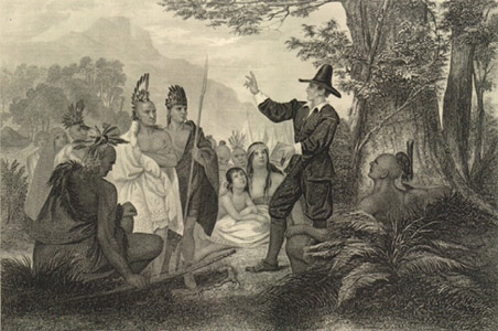
"Elliot, The First
Missionary Among The Indians"
John Chester Buttre,
1856
|
"Eliot's Pulpit",
Boxborough
Near Swanson
Road, since destroyed |
|
.
.
Note: Elliot preferred to preach from the
top of large boulders to the extent that these locations became known as
"Eliot's Pulpits." There are a number of such Eliot's Pulpits in
Massachusetts. The one in Boxborough, pictured above, was adjacent
to what would become the Nashoba Praying Indian Village, and is where he
often preached to the Nashoba Indians. See the
Picture
Glossary of New England Lithic Constructions for further information
on Eliot's Pulpits. A more representative picture of Eliot's
preferred mode of address, if otherwise inaccurate, is
here.
He was also known to preach beneath large trees, the
Eliot Oak
in the Praying Indian Village of Natick being one such example.
|
Interestingly, for
about a week in the early 1980s a humming sound was heard to emanate
from the ground in Littleton. It sounded like it was coming from the
North and proceeded Southwards, and was most audible near the
Congregational Church on King Street.
Humming sounds
from the earth are not without precedent, the
"Taos
Hum"
of Taos, New Mexico being the best known of such phenomena.
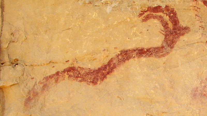
Water Monsters
An Indian belief
related by John Mitchell in Trespassing is that Nagog Pond was
supposedly home to a water monster in the time of the Nashoba Praying
Indian Village. According to Mitchell, Ap’cinic was a water beast that
lived deep in the pond. It had horns and a
"gnashing
beak,"
and would
"reach
up out of the waters of Nagog at certain times and draw the entrails of
passing villagers down into its depths."
Its tentacled arms were said to feel along the shore for victims.
Nagog Pond
Currently Nagog
Pond is the town of Concord’s water supply and prior to that it was a
resort lake with boating, the Nashoba Inn, and cottages nearby. I have
never heard of anyone being pulled in by Ap’cinic, but plenty of people
have been pulled out by the Acton Police for illegal fishing.
|
Indian Water
Monsters
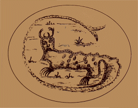
Piasa sketch & Uktena-like
petroglyph
Note the horns and long tail
The Piasa picture is from a sketch made
by Jean-Bapiste Framquelin in 1678 of an Indian painting on the
limestone bluffs on the Mississippi River in Alton, Illinois.
Although modern drawings show the Piasa with wings, the Framquelin
sketch and the 1673 Marquette description depict the Piasa as
water monsters, as follows:
"They are as large As a calf; they
have Horns on their heads Like those of a deer, a horrible look,
red eyes, a beard Like a tiger's, a face somewhat like a man's, a
body Covered with scales, and so Long A tail that it winds all
around the Body, passing above the head and going back between the
legs, ending in a Fish's tail."
It was not until 1836 that it
erroneously became a "bird" and was depicted with
wings.
More Easterly, and more in Algonquin
territory, there are similar traditions of horned serpentine water
monsters, such as the Maine Abenaki Pita-Skog, meaning "Great
Snake," and the eastern Uktena, meaning "Horned Serpent."
Further, there is also an Underwater Panther in Eastern Native
tradition.
For more on the Piasa and links to
winged anomalous beings, see:
Mothman &
the Thunderbird: A Striking Resemblance Between Two Creatures of
Legend.
|
A Haunting Landscape: Sarah Doublet Forest
Some people feel
that Nashoba is haunted, specifically, the area known as the Sarah
Doublet Forest on the rocky hill squeezed between Nagog Pond and Fort
Pond. This is the 500 acre area set aside in 1714 for the remaining
Indians after they sold off the Village. It remained in Indian hands
until 1736 when the last surviving member, Sarah Doublet, passed away.
It is considered to be central to the old Village, and if Tahattawan did
chose
"nashope"
for its special qualities, the 500 acres would particularly display
those unique qualities.
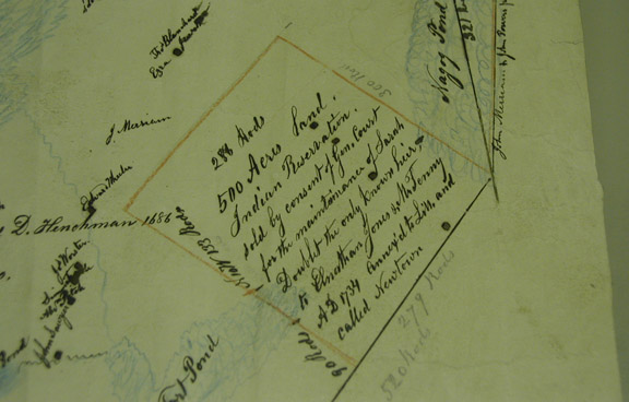
"500 Acres Land.
Indian Reservation."
1714 Littleton
Proprietor's Map
Courtesy Littleton
Historical Society
This rocky hill is
a strange and inspiring landscape indeed. The bare bones of the earth
are exposed in bleak gray ledge, cliff, and strange long humps of
granite bedrock that look like beached whales. Narrow trails wind
between them, and stone walls of inexplicable origin proliferate.
Traces of the old village remain: acres of corn planting mounds, three
worked-stone springs, a hollowed and smoothed rock surface, and
artifacts unearthed on the western
slopes*. I’ve been told by a retired
Professor that the fire-blackened rock faces are the marks of Indian
fires. Also in evidence are veins of white quartz, a crystal structure
prized by the shaman of old.
.
*Note: An elderly man who owned a summer
camp on Fort Pond related this story: when he was a boy he used to fire
his .22 rifle from the back steps of the cottage into the slope of the
hill across the lane. For safety's sake, he dug out a shooting
butt in the hillside, and in doing so unearthed a considerable number of
stone Indian artifacts. The location and type of artifacts have
led some to believe that this hillside was a burial area.
Corn Planting
Mounds
.
Note: There are very few surviving Indian
corn planting mounds in existence. If these are real mounds, as we
suspect, then they are of considerable historical significance.
About 15 years ago we were able to interest the State Archeologist in
these mounds to the extent that he set up a date to meet us here and
look at them. Unfortunately, due to an illness, this was cancelled
and never rescheduled.
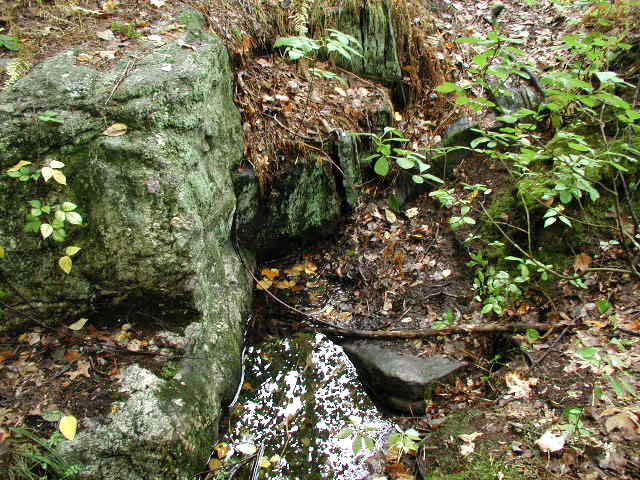
Freshwater Springs
in the Sarah Doublet Forest
.
Note: There are three worked-stone springs
in the Sarah Doublet Forest. The one to the left has a capstone
and a cleared channel. In the 30 years I have visited this
locations I have never seen this spring dry - with the one exception of
the occasion I took the photograph. The spring to the right
emerges from under ledge-rock. A channel has been cleared for the
water to flow. The third spring is now the water supply for a
summer cabin on the shore of Fort Pond. The springs are
significant - any Indian settlement would require fresh water (lake
water is not a good idea to drink) and would have provided a year-round
supply.
|

The Indian Fort
at Fort Pond
By
Daniel V. Boudillion
14
December 2009
Fort Pond in Littleton was named after
the Indian Fort of the Nashoba Praying Indian Village era of 1651
to 1714. This was a small palisaded enclosure, similar
to other Indian forts recorded by the Puritans in the 1675/76 King
Philip's War. It is recorded that the Nashobas would abandon
the fort and leave the area the minute the Mohawks (their
ancestral enemies) would appear in the area, so it likely that the
either the fort was poorly constructed or there were not enough
men to defend it, or both. However this may be, its exact
location has been lost, but there are several possible places it
could have been.
For the rest of the article click
here.
|
Worked Stone and
White Quartz at Sarah Doublet Forest
.
Note 1: The stone to the left is in a small
Colonial quarry. A large oval bowl of unknown purpose and origin
has been worked into the stone. It does not appear to be a lye
leaching stone, nor does it look like a typical corn-grinding stone.
In any event, the stone was left intact and carefully quarried around,
suggesting it was of significance. It may also indicate an Indian
origin as Native Americans were often employed as stone cutters in
Colonial times, and may have preserved the stone.
.
Note 2: The stone to the right bears
white-quartz, a stone significant to Native Shaman at the time.
There is also a second vein of white-quartz in the western slopes of the
hill. This would have been part of the of significance of Nashoba as a "special place."
There are three
turtle effigies to be seen here, as the turtle was sacred to the
Algonquin-speaking peoples of Massachusetts. The largest is a
collection of boulders on the lower eastern slopes that appears like a
giant turtle crawling up from Nagog Pond towards the hilltop. A
carapace stone is further up the hill and a small but elegant stone-pile
turtle effigy is in the woods near the eastern shore of Nagog.
Turtle Rock at
Sarah Doublet Forest & Nagog Pond Turtle Effigy
Turtle Carapace at
Sarah Doublet Forest
.
Photo enhancement
courtesy of Tim
MacSweeney
Colonial Cannons: The Shooting of Nashoba Hill
The early English
settlers were also aware of the strange boomings and rumblings in the
area, especially from within Nashoba Hill. It was so loud that they
likened the sound to cannon shot, and said it was as though an army was
trapped inside the hill.
According to
Barber in 1841,
"A
rumbling noise, from time to time has been heard from this hill ever
since the settlement of this town, it has been repeated within two years
past [1839-1841], and is called
'the
shooting of Nashoba Hill.'"
The first English
settlement in the area began with Ralph Shepard and his son-in-law
Walter Powers in 1666. They lived in an area between Nagog Pond and
Nashoba Hill called Concord Village that shared a common border with the
Praying Indian Village. The settlement was nearer to the Hill than the
Pond and Powers actually lived on the lower slopes of Nashoba Hill as
early as 1675 in the old Garrison House. Both families would have heard
these
"cannon
shots"
and are no doubt the people referred to as hearing the noises
"ever
since the settlement of this town."
Walter Powers'
Garrison House Well
.
Note: The Garrison House
was situated on the lower slopes of Nashoba Hill to the right of the
well. There is a local tradition that there was a tunnel leading
from the Garrison house into the side of the hill. The Garrison
house is long gone, but the rumors of the tunnel persist. It is
possible this is a folk memory of a chamber that was said to have been
in the vicinity.
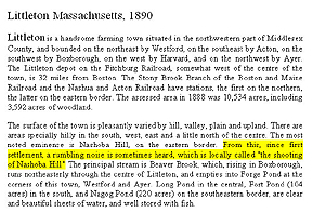
The rumblings
became part of the fabric of Littleton life, so much so that a one-page
write up on Littleton in Nason and Varney’s popular a popular 1890
almanac, the Massachusetts Gazetteer, includes a mention of it:
"The
most noted eminence is Nashoba Hill, on the eastern border. From
this, since first settlement, a rumbling noise is sometime heard, which
is locally called
'the
shooting of Nashoba Hill.'"
 The same year,
Herbert J. Harwood published his Historical Sketch of Littleton, in
which he refers to Daniel Gookin’s 1674 observation of the rumblings as
follows:
"Traditions
are plenty of rumbling noises, sometimes said to be like the discharge
of cannon in the vicinity of Nashoba Hill." The same year,
Herbert J. Harwood published his Historical Sketch of Littleton, in
which he refers to Daniel Gookin’s 1674 observation of the rumblings as
follows:
"Traditions
are plenty of rumbling noises, sometimes said to be like the discharge
of cannon in the vicinity of Nashoba Hill."
These traditions
of noises associated with Nashoba Hill have survived up to the modern
era. On April 4, 1957, Carolyn Webster notes in her Littleton
Legends newspaper column that Nashoba Hill is
"a
curiosity because of the rumblings which have been known to emanate from
it in the past and in recent years."
Massachusetts Gazetteer, Nason & Varney, 1890
1821: An Altar on Nashoba Hill
Not long after
Rev. Edmund Foster had delivered his Century Sermon at the
Puritan (now Unitarian) Church in Littleton, a new denomination was
quietly filtering into town via Nashoba Hill. Although standing as a
pillar of the community today, the Baptists started out facing much
hostility. It is described on the Littleton Baptist website as
"the
great hatred and contempt which they met in certain quarters"
over their differences in doctrine and practice - which was essentially
a clash between Old Testament and New Testament beliefs. Prior to 1821,
there were only several Baptists in Littleton and they had to meet
secretly, and had no pastor.
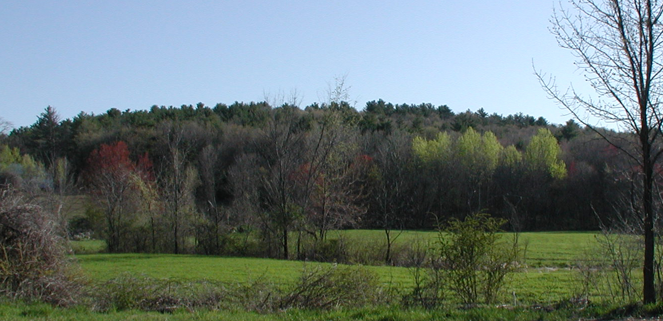
View towards
Westford from the top of Nashoba Hill
One of these few
Baptists began weekly meetings with a believer from Westford and they
chose to do so secretly on the top of Nashoba Hill, which is the
boundary line between the two towns. On the spot between the two
parishes on the hilltop
"they
erected an altar of stone"
and began praying for a revival of religion in their towns. These
hilltop meetings took place from the early spring to late fall of 1819.
The first Baptist meeting hall in Littleton was dedicated in 1823.
1844: Signs & Wonders in Nashoba
 The years between
1838 and 1844 were years of religious revival and wonder in Nashoba. In
1835 William Miller, a Vermont farmer turned preacher, began prophesying
that the end of the world would occur sometime between 1843 and 1844.
He gained a considerable following in Massachusetts particularly in the
Nashoba Valley area where he often preached the approaching Day of Doom
in the small brick Baptist Church in Littleton.
"Graves
will open up! Christ will reappear! There will be signs in the
heavens!,"
he thundered from the modest pulpit. The years between
1838 and 1844 were years of religious revival and wonder in Nashoba. In
1835 William Miller, a Vermont farmer turned preacher, began prophesying
that the end of the world would occur sometime between 1843 and 1844.
He gained a considerable following in Massachusetts particularly in the
Nashoba Valley area where he often preached the approaching Day of Doom
in the small brick Baptist Church in Littleton.
"Graves
will open up! Christ will reappear! There will be signs in the
heavens!,"
he thundered from the modest pulpit.
These Second
Adventists, or Millerites as they were more commonly called, set up
large encampments in Groton, and in Littleton (now Boxborough) in J. H.
S. Whitcomb’s pastures on the southeast side of Oak Hill Road. All
summer long the nightly singing, shouting, and occasional shrieking of
hundreds of fervent Millerites could be heard clear across Littleton.
It was
"the
craziest spot in Massachusetts,"
the locals averred. (Clara Endicott Sears, Days of Delusion,
1924)
William Miller 1848
.
Signs and wonders
did indeed follow the path of Miller’s teaching. Nashoba Hill was heard
to rumble and roar, as was noted at that time by Barber in Historical
Collections. And just as impressively, in April of 1843, a massive
comet appeared in the sky over the encampments. In January of 1844 the
encampments saw rings around the sun and blazing crosses in the sky.
The end was undoubtedly at hand. Possessions were given away and
good-byes said to non-believer friends and family. White robes were
donned, and after an aborted run on March 21, 1844, the Millerites
gathered on the night of October 22, 1844, to await being carried up to
heaven.
Robed Millerites
climbed
Gallows Hill in Salem, others gathered at graveyards, and still
more assembled naked on county hillsides. In Littleton the leading
Millerites, including the Richardsons of Westford, gathered at Benjamin
Hartwell’s house on the Common to await ascension and the end of the
world. The rank and file gathered at the Whitcomb farm encampment; or
the Old Burying Ground in Littleton Center to ascend with their dear
departed.
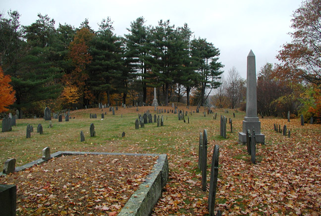
Littleton's Old
Burying Ground
.
Note 1: These were unsophisticated times
and the majority of the Millerites had trouble imagining how they would
actually ascend to heaven. Thus, many of them procured large
baskets and sat in them, supposing they would rise to heaven in the
basket. They also gathered at the cemeteries under the assumption
that their dearly departed would rise bodily from the grave and
accompany them to heaven in the basket. This resulted in the
event becoming quite the spectator sport wherein large crowds of
non-believers gathered at the cemeteries - including Littleton's Old
Burying Ground - to watch the Millerites and their dead rise to
God. The more sophisticated Littleton Millerites gathered at
Benjamin Hartwell's house across the street.
.
Note 2: This belief in the dead rising
corporally resulted in the end of at least one marriage. In an
account related by
Clara Endicott Sears, one fellow spent
the night sitting on the grave of his dead wife so he would be able to
ascend with her. His current wife, however, did not appreciate
this gesture, and upon the morning's light soundly rebuked her husband
and proceeded to terminate the marriage.
According to Clara
Endicott Sears in Days of Delusion, (1924),
"All
through the eventful summer of 1843 and 1844 long processions of
Millerites could be seen wending their way up the green slopes of some
hill back of their town or village, there to await or watch out for the
coming of the Lord."
Not unsurprising, there is a local legend that some Millerites so
impressed with the rumbles and roars of Nashoba Hill, considered to be
heralding the end of the world, that they were often seen on the hill
and spent the night on its peak awaiting the promised flight to heaven.
(Oral tradition.)
The prophesied end
did not come that night but panic did come to a congregation of
well-to-do Millerites at the Bancroft mansion in Westford. A local
joker named Amos Jackson, armed with his bugle, gave a mighty blast
outside the
building
at midnight. At the apparent summons of Gabriel’s
Horn, the white robed Adventists stumbled outside falling to their knees
while others cried and screamed hysterically. Amos supposedly greeted
them with a laconic,
"How
do,"
and walked home.
Sadly for many
Millerites, there was no home for them to walk back to come daylight.
They had given away all their possessions including their houses and the
new owners were not much obliged to return them.
|
William
Miller and the End of the World

"1843
was to be the year of the world's end. In that year, Christ
personally would return to the earth to establish his kingdom,
glorify the saints, and take vengeance on the wicked. This
was the conclusion arrived at by William Miller in 1822 and the
message that he proclaimed for the next 21 years."
To the left is "Miller's
Prophetic Chart of 1843, published as a lithograph by B. W. Thayer
and Company. The large numbers indicate two different
methods of calculation that Miller used, both arriving at 1843 as
the year for fulfillment of the prophecy. The chart was
published in 1842."
1843 Prophetic Chart
As much as
William Miller wanted it to, the world never ended.
He even prophesied it three times with no luck. Sadly, he
seemed to have believed his own prophecy, and died a sad and
broken man.
William Miller and the Millerites seem
to weave their way through the fabric of the times I write about.
For other articles that have Millerites in the background
proclaiming doom , please see:
•
Deed Rock and Gods Ten Acres
•
How the
Shakers Invented Spiritualism
|
.Section 2: seismology
Modern Rumblings: An Epicenter
Nashoba hill still
booms. On January 23, 1990, I was living on Robinson Road at Littleton
Common, about one mile northwest of the peak of Nashoba Hill. There was
an extraordinary, explosive, all-pervading boom, and the house staggered
as though it had been struck by a car. Actually, it and the entire
Nashoba area had been struck by an earthquake centered in Littleton
registering 3.6 on the Richter scale. This was the strongest earthquake
recorded in Nashoba since the approximated 3.5 in December of 1668. And
I can tell you that Nashoba Hill does indeed boom.
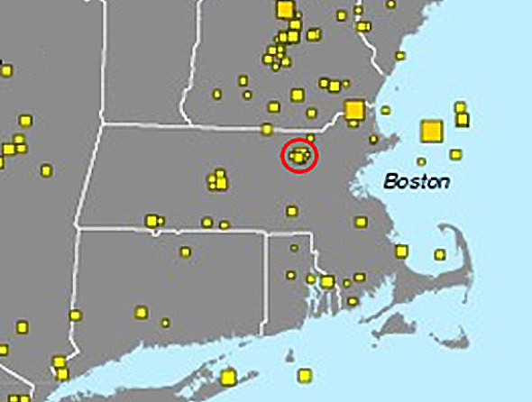
Littleton-Nashoba:
A Seismic Epicenter
.
Note: Littleton is circled in
red. The yellow squares are
earthquakes, and the size of the square represents the relative size of
the earthquake. Note how Littleton is an island epicenter for a
cluster of midsized earthquake activity.
But at least
today, its booms are in conjunction with seismic activity. Nashoba has
always been an area of concentrated seismic events. The old
Newbury-Clinton Fault runs practically under Nashoba Hill as it passes
southwest between Littleton Common and Nagog Pond. For some reason, the
Littleton section of the fault is very active as an epicenter. In the
last 70 years alone, there have been at least twenty recorded
earthquakes centered in Littleton (Nashoba), averaging 2.2 on the
Richter scale.
The most recent, a
2.5 magnitude earthquake on October 19, 2007, was just over a mile
Southwest of Littleton Center. This was not without its sonic
component. Boston’s WCVB TV5 reported that concurrent with the
earthquake residents of Littleton
"heard
what sounded like a loud boom or explosion"
and that they also
"heard
rumblings"
later in the morning during an aftershock. The epicenter was only two
miles from Nashoba Hill, and exactly at the geographic center of the old
Praying Indian Village.
Plutons & Earthquakes
 The October 2007
earthquake was reported on the news as a product of the Newbury-Clinton
fault. However, earthquakes in Eastern Massachusetts are of a more
complex origin. For starters, when I discussed the seismology of the
area with a geologist,
he informed me that the Newbury-Clinton fault is an artifact of a
previous age and has not been active in over a million years. The October 2007
earthquake was reported on the news as a product of the Newbury-Clinton
fault. However, earthquakes in Eastern Massachusetts are of a more
complex origin. For starters, when I discussed the seismology of the
area with a geologist,
he informed me that the Newbury-Clinton fault is an artifact of a
previous age and has not been active in over a million years.
Rather,
earthquakes in the vicinity are the product of geologic features called
Plutons. The pluton/earthquake connection was discovered in 1975 when
the Nuclear Regulatory Commission required Pilgrim Unit II in Plymouth,
Massachusetts to address the validity of seismic guidelines used in the
design of the plant.
Plutons – named after Pluto, god of the underworld – are 100 million
year old cylindrical shafts of cooled magma with depths of 30 miles or
more. It was found that all the major earthquakes in Eastern
Massachusetts and Southern New Hampshire centered on these plutons
(called the White Mountain magma intrusive series, and which are much
younger than most New England rocks).
Further, the
seismically active plutons were discovered to have magnetic and
gravitational anomalies. An aeromagnetic survey in 1975 confirmed that
these magnetic anomalies are circular and do indeed correspond exactly
with the circular tops of the pluton shafts.
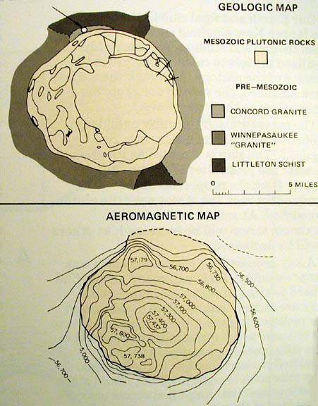
Plutons &
Aeromagnetics: Ossipee Pluton
Note how the
circular plutonic rock shaft (top illustration) has a matching
circular magnetic anomaly (bottom illustration).
At its simplest,
the study found that where there are circular magnetic anomalies there
are plutons, and where these plutons also exhibit gravitational
anomalies is where (and only where) earthquakes occur in New England.
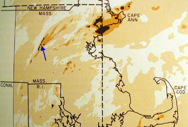
Magnetic Anomaly
Map: Magnetic Anomalies Correspond to Plutons
.
Note: Blue arrow
indicates the magnetic anomaly (Pluton) under Nashoba Praying Indian
Village. Also, the section of the Newbury-Clinton fault running
through Littleton is plutonic as well.
The earthquakes
themselves are caused by linear stresses pressing against the less
compressible rock (Gabbro) of the cylindrical plutons. This causes a
slight twitch in the pluton, which results in earth tremors.
Interestingly, in
Our New England Earthquakes (Weston Geophysical Corporation,
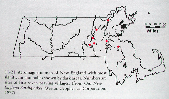
1977) an aeromagnetic map of New England reveals that the Nashoba
plutons follow the line of the old Newbury-Clinton fault. So although
the fault is not active, the plutons on it are.
Earthquakes in Nashoba
Certainly,
earthquakes have been recorded here in Nashoba since the earliest
Colonial times, and they have been recorded in conjunction with noise
activity, a significant piece of the puzzle.
The Littleton Town
Clerk’s report of 1896 referencing John Eliot, the man who organized the
Nashoba Praying Indian Village, had this to say,
"He
came to this place to visit his wards, and in his writings are found
allusions to it, among others to the noises in Nashoba Hill, and to a
great crack in the earth made here by an earthquake previous to 1670."
(Emphasis added.)
Eliot described
this crack as a vast
"hiatus"
in the earth that created immense
"cavities"
under the rocks. The location of this crack is unrecorded but it is
assumed it was somewhere on Nashoba Hill.
"A
great crack in the earth made here by an earthquake"
.
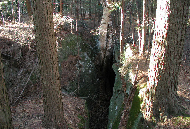
Note:
The above crack in the bedrock is several feet wide, up to 10 feet deep,
and over 150 feet long. When I first encountered it up by Black
Pond in Littleton I was sure I had found the vast earthquake-created
"hiatus" and "great crack" Eliot reported seeing in
Nashoba. Unfortunately, I have since learned that this is a very
early Colonial lime quarry, and the "crack" is where the lime seam ran before the lime
was picked out. Frankly, I was very skeptical of such a crack
being a lime quarry, or any type of a quarry, until I found pictures of
the old lime quarry in the Estabrook Woods over in Carlisle
that looks
exactly the same. So sad. In any event, here are some
links to early Colonial lime quarries in
Carlisle and
Chelmsford for comparison.
Nashoba Hill,
remember, means the Hill that Shakes. Gookin also equates the rumblings
of the hill with earthquakes,
"Some
have considered the hill adjacent as hollow, wherein the wind, being
pent, is the cause of this rumbling, as in earthquakes."
(Emphasis added.)
In 1890 Herbert
Harwood follows suit and equates the rumbling noises and sounds to the
"discharge
of cannon"
with seismic activity, referring to the noises as
"probably
earthquakes."
This is the
popular explanation for the noises and Littleton Legends
columnist Carolyn Webster concurs. In writing about the Nashoba noises
in 1957, she informs us that
"a
few years ago there were earth tremors felt at Cobb’s Chicken farm not
far from Nashoba Hill. Present day geologists advance their theories on
the booming of Nashoba, but so far none have been proven."
Cobb’s Chicken farm was located on Pickard Lane (at the present
Montessori School), which is about halfway between Nashoba Hill and
Nagog Pond.
Strange Lights
In conjunction
with the seismic activity, there have been reports of strange aerial
lights. This is not as odd as it may seem, as the theory of
"earthquake
lights"
has received considerable attention in the past few years.
 In short, it is
thought that the pre-and post-seismic stresses, particularly in which
the
"explosive
process of rock fracture causes electrons emitted from fresh broken
surfaces to bombard the surrounding air and excite it to produce light.
This theory explains satisfactorily how both large and small earthquakes
which break the earth’s surface can produce light. Such phenomena as
bright white lights floating among treetops, luminous dust clouds moving
along near the ground, sequential flashes from different points on a
hillside, and fireballs on the horizon can be explained by earthquakes"
and are seen to appear at fault zones. In short, it is
thought that the pre-and post-seismic stresses, particularly in which
the
"explosive
process of rock fracture causes electrons emitted from fresh broken
surfaces to bombard the surrounding air and excite it to produce light.
This theory explains satisfactorily how both large and small earthquakes
which break the earth’s surface can produce light. Such phenomena as
bright white lights floating among treetops, luminous dust clouds moving
along near the ground, sequential flashes from different points on a
hillside, and fireballs on the horizon can be explained by earthquakes"
and are seen to appear at fault zones.
Earthquake lights: Turkey, 25 July 1999
Following the 3.1
magnitude earthquake in Nashoba on October 15, 1985 (described as
"the
rumblings of a freight train")
there appeared yellow-orange, brightly glowing pockets of air in the
Woodchuck Hill and Oak Ridge area on the Harvard-Boxborough border.
This part of the Oak Hill ridge is just a mile and a half southwest of
the old Nashoba Indian Praying Village and is high enough to have been
seen from the village.

Earthquake lights,
12 May 2008, Sichuan China
.
Note:
This video was taken 30 minutes
before the earthquake. (Click here for the
YouTube video)
Note the similarity of colors to the Woodchuck Hill lights of 1985 which
were reported as being "yellow-orange."
Further, at the
time of the November 23, 1980, Nashoba earthquake of 2.5 intensity, I
observed at night from the vantage point of Nagog Pond a bright
welling-up of intense white light out of the top of Fort Pond Hill (in
what is now called the Sarah Doublet Forest), in the heart of the old
500 acre reservation. This welled up like a dome of light, about 350
yards wide, and about 200 yards tall at its peak. After about three
seconds the light then collapsed back into the earth. This was observed
with a friend.
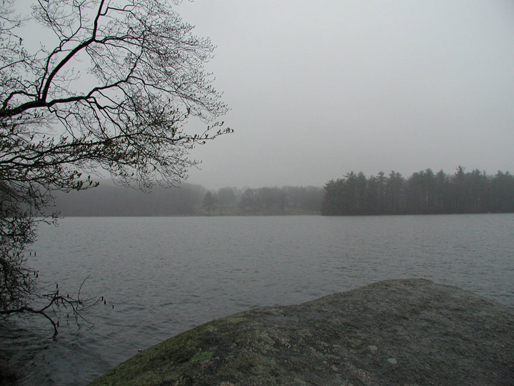
Nagog Pond: view of
Sarah Doublet Forest from across the water
.
Note:
The light-dome anomaly was
seen over the trees on the far left shore.
Since I have been
presenting this topic as a slide show in Littleton and surrounding towns
a number of people have come forward to share with me their own
experiences with light phenomena in Nashoba. For example, an elderly
man on Star Hill in Littleton had light balls roll through his house one
night, and an employee at Nashoba Hill Ski Area in Westford describes
seeing a recent dome of light at Nagog Pond similar to the one I saw.
Earthquake lights,
26 September 1966, Mount Kimyo, by T. Kuriayashi
.
Note:
Compare this image to the descriptions of
glowing domes of light seen at Nagog.
Going back to the
fact that Eliot allowed the Indians to make their own choice of location
for their praying villages, they certainly chose a place in
"nashope"
where many strange and wondrous characteristics are concentrated and
occur regularly:
•
Rumblings and
hummings from the earth.
•
Seismic
activities.
•
Strange light
phenomena.
It seems unlikely
that this is coincidence.
.Section 3: The Moodus Noises
There is a Bad Noise
The lights,
rumblings, and earthquakes at Nashoba are hardly without precedent.
Indeed, this has been going on in a place known as Moodus, in East
Haddam, Connecticut for as long, and with much more attention.
Moodus is an
abbreviation of Machemoodus which in the local Wangunk dialect means
"there
is a bad noise,"
a reference to the strange sounds heard there. These noises were
recorded by Colonials as early as 1668, and centered on Mount Tom,
located on a neck of land between East Haddam and the Village of Moodus,
all of which was purchased form the Indians in 1662.
|
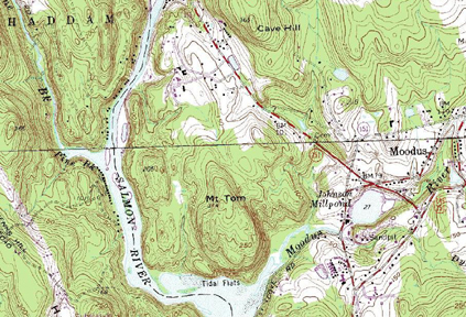
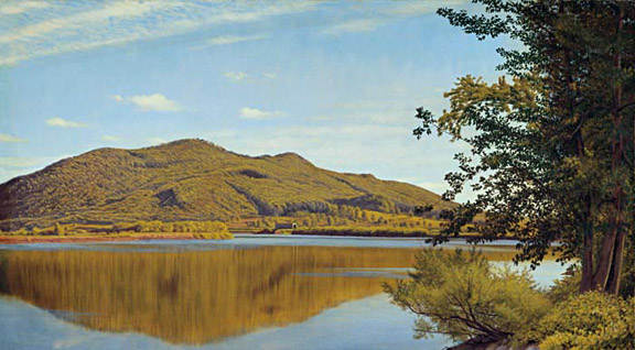
Mount Tom, Haddam
Connecticut
.
Note:
Mt. Tom and Nashoba
Hill are quite similar in size. Mt. Tom at 314 feet in
height rises 214 feet above the Connecticut countryside, while Nashoba Hill at 426
in height rises 226 feet above the Massachusetts countryside.
Also, both hills are composed of the same geologic materials:
Schist and Gneiss.
.
The Counties both Nashoba Hill and
Mount Tom are located in are called Middlesex County. I do not
attribute any particular significance to this, but it is an odd
connection worth mentioning.
|
These noises were
described at the time as crackings and rumblings that were compared to
fusillades, to thunder, a roaring in the air, to the breaking of rocks,
to reports of cannon, and to rocks falling into immense caverns and
bouncing
off underground
cliffs as they fell. Sometimes the sounds and tremors would roll
out of the north and pass underneath, and break like a severe
thunderclap,
"shaking
the houses and all in them."
These were so numerous that the Reverend Hosmer, the first minister in
Haddam, wrote in 1729 that he had heard several hundred such noises both
"fearful
and dreadful"
within twenty years, sometimes daily.
Earthquakes & Lights
The region of
Moodus is one of the three most seismically active places in New
England, the others being Ossipee, New Hampshire, and northeastern
Massachusetts including the Nashoba Hill area. John Eliot records in
his diary a series of earthquakes including the now familiar attendant
noises and aerial lights.
"On
November 4, 1667, there were strange noises in the air, like guns and
drums, and on March 16, 1668, and earthquake shock was felt after there
had been prodigies [extraordinary objects, probably light phenomena] in
the heavens the night before."
These noises and vibrations were intense enough to agitate the waters of
the river.
|
The Moodus Noises Cave
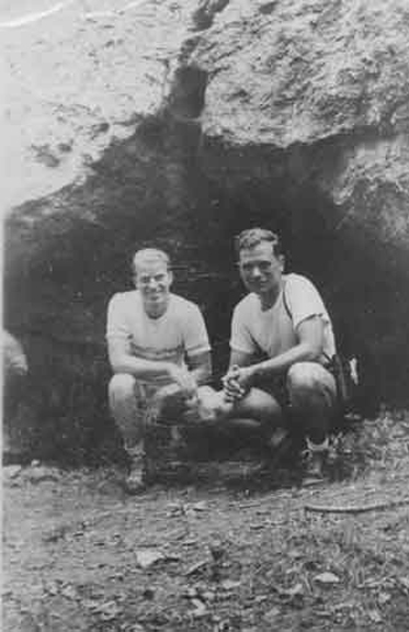 According
to local legend, the Moodus Noises can be heard most clearly issuing
from the cave on Cave Hill, which is adjacent to Mt. Tom. The site
is owned by the
Cave Hill Resort in Moodus, Connecticut. For more on the
Moodus Noises,
see
here. According
to local legend, the Moodus Noises can be heard most clearly issuing
from the cave on Cave Hill, which is adjacent to Mt. Tom. The site
is owned by the
Cave Hill Resort in Moodus, Connecticut. For more on the
Moodus Noises,
see
here.
Entrance to "Moodus Noises" cave on
Cave Hill, 1940s
|
Concerning a 1663
earthquake felt all the way in Montréal, the French relate that
"Ten
days after the initial shock, a loud rumbling noise was heard. Forest
trees were set in violent motion, thrown from side to side. There were
flashes of lightening and rocks cracked and rolled over each other."
A 1797 earthquake
in Moodus resulted in
"stones
of several hundred tons found removed from their places and fissures
were found in immovable rocks."
A Prodigious Trade at Worshiping the Devil
Indian Pawahs
(powwows) were seen as priests with certain powers. According to James
Mavor and Byron Dix in Manitou (1989),
"They
could make
'rocks
move'
and
'trees
dance.'"
This sounds uncannily like the above-quoted descriptions of seismic
activity upon rocks and trees in the 1663 and 1797 earthquakes, and in
significant earthquakes in general. Surely there is a link between
Indian shaman and earthquakes.
According to Mavor
and Dix, the Indians local to Moodus were
"known
for their religious activity and served as priests or shamans to other
tribes. Pequot, Mohegan, and even Narragansett Indians, with whom the
other groups were constantly in conflict, went to Moodus and the
Machemoodus powwows because they believed that the thunderings and
quaking, called Moodus noises, could only mean that this was the home of
Hobomock, the spirit most sought after by the powwows of New England.
The English colonists, as early as 1670, reported both the noises and
extraordinary Indian ritual activity on the mountain [Mount Tom]."
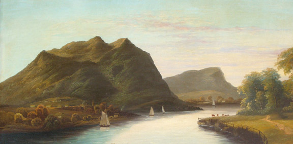
Mt. Tom by E. A. Coates
Revered Hosmer
describes Moodus in 1729 as
"a
place of extraordinary Indian pawaws, or, in short, that it was a
place where the Indians drove a prodigious trade at worshiping the
devil."
In other words, Moodus was a significant and important questing ground
for native shamanic activity.
Hobomock
 Hobomock was one
of two principle deities of the Algonquin-speaking peoples of New
England, the other being Kichtan. Kichtan was not seen or prayed to but
was understood to be good. Hobomock was seen and prayed to and was of a
more earthy and ambivalent quality. He was not a devil as such (the
Indians had no devil figure) but was rather a dark and powerful side of
nature. Hobomock was one
of two principle deities of the Algonquin-speaking peoples of New
England, the other being Kichtan. Kichtan was not seen or prayed to but
was understood to be good. Hobomock was seen and prayed to and was of a
more earthy and ambivalent quality. He was not a devil as such (the
Indians had no devil figure) but was rather a dark and powerful side of
nature.
The Indians prayed
to him to heal wounds and cure diseases, and when a disease was curable,
Hobomock was considered responsible for both the condition and the
cure. If it was not curable, it was considered the will the Kichtan.
As the most
day-to-day operative spirit, Hobomock was the most sought after deity in
vision quests by the powwow shaman. He was invoked musically, and with
rhythmical practices, and was said by the successful spirit quester to
protect and empower those who obtained visions of him. However, to
Puritan eyes, those who sought visions of Hobomock were perceived as
seeking the devil.
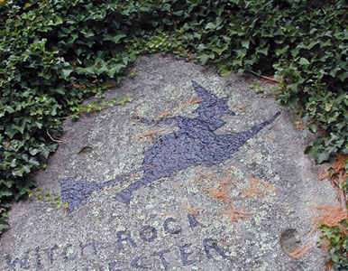
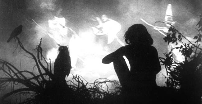
Of Witches and the King Under the Mountain
 Legends of Puritan
times relate that witchcraft was at the root of the Moodus noises. It
was said that the Haddam Witches, who practiced black magic, met the
Moodus witches, who used white magic, in a cave beneath Mount Tom, and
fought them in the light of a great carbuncle [gem] that was fastened to
the roof. If the-witch fights were continued too long the King of
Machimoddi [Machemoodus], who sat on a throne of solid sapphire in the
cave whence the noises came, raised his wand: then the light of the
carbuncle went out, peals of thunder rolled though the rocky chambers,
and the witches rushed into the air. Legends of Puritan
times relate that witchcraft was at the root of the Moodus noises. It
was said that the Haddam Witches, who practiced black magic, met the
Moodus witches, who used white magic, in a cave beneath Mount Tom, and
fought them in the light of a great carbuncle [gem] that was fastened to
the roof. If the-witch fights were continued too long the King of
Machimoddi [Machemoodus], who sat on a throne of solid sapphire in the
cave whence the noises came, raised his wand: then the light of the
carbuncle went out, peals of thunder rolled though the rocky chambers,
and the witches rushed into the air.
Note:
Hobomock
apparently had several such dwellings. Twenty-two miles to the west of
Mount Moodus is
"the
sleeping giant,"
Mount Carmel – a series of hills that resemble a human form in repose
(not unlike Ute Mountain in Colorado where the
"great
warrior god"
sleeps). The local Quinnipiac Indians were said to believe that
Hobomock was sealed within Mt. Carmel for diverting a river by
stamping his feet – an act that sounds suspiciously like an
anthropomorphicized
description of a powerful earthquake.
Mount Carmel: "The
Sleeping Giant"
.
Note: The series of hills
gives the impression of a large figure in profile sleeping on its back.
The Moodus account
is interesting in two respects. First, it pits the witches of
Haddam, a town, against the witches of Moodus, the woods.
Uniformly, English dwelled in towns, and Indians dwelled in the woods.
In an odd, almost Freudian, reversal of Puritan thought the black magic
witches were the English and the white magic witches were the Indians.
Second, and more
germane to our topic, the King
"of
the bad noises"
resides enthroned within the Mountain itself, wherefrom emanates the
rumblings and explosive thunderclaps. To quote Mavor and Dix, who
also came to the same conclusion that Hobomock resides within the
rumbling hill, the shaman sought Hobomock
"especially
in locations such as the summit of Mount Moodus [Mt. Tom], where the
depths of the mountain are considered the home of Hobomock, who makes
the bad noises."
The Voice of Hobomock
Hobomock was
certainly sought after, especially in places like Mount Moodus, which
was considered his abode. He could speak in subterranean thunderings,
as well as through the quiet subtleties of rocks and stones. There are
a number of perched stones in the Moodus area. Given even the slightest
tremor, these will gently rock, which was an indication of the spirit of
his presence to the discerning shaman.
Mt. Tom by Charles Farrer 1865
Certainly the
rumblings and rockings were the manifestations and voice of Hobomock and
shaman came from all over New England to seek him in such places with
the qualities of Moodus.
However much he
was sought, the shaman sought to appease his more powerful eruptions by
carving symbols of the Wakon-bird (spirit-dove) with special quartz
crystal* spirit-stones (according to Mavor and Dix in Manitou).
.
*Note:
White quartz is certainly found on Mt. Tom, as evidenced by
this picture.
 The power of
Hobomock to move the rocks and trees became associated with the
Hobomock-seeking shaman of seismically active areas. Thus it is no
exaggeration, spiritually, that their powers were specifically said to
be the power to make
"rocks
move"
and
"trees
dance."
It is an identification with the powers of their deity, and places like
Moodus were these shaman’s sacred sites. The power of
Hobomock to move the rocks and trees became associated with the
Hobomock-seeking shaman of seismically active areas. Thus it is no
exaggeration, spiritually, that their powers were specifically said to
be the power to make
"rocks
move"
and
"trees
dance."
It is an identification with the powers of their deity, and places like
Moodus were these shaman’s sacred sites.
Mavor and Dix
concur in Manitou,
"The
history of the Moodus area attests to participation of the native
shamans with a geophysically active landscape that moved and produced
[noises] and light. This follows a pattern among cultures all over the
world that have attributed religious significance to glowing forms that
appear at areas of recurring earthquakes."
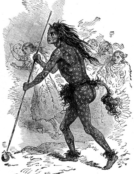
Algonquin Shaman
.
Charles M.
Skinner, in Tales of Puritan Land (1896) links Moodus back to
Nashoba, as follows,
"Such
cases are not singular. A phenomena similar to the Moodus noises, and
locally known as
"the
Shooting of Nashoba Hill,"
occurs at times in the eminence of that name near east Littleton,
Massachusetts. The strange deep rumbling was attributed by the Indians
to whirlwinds trying to escape from caves."
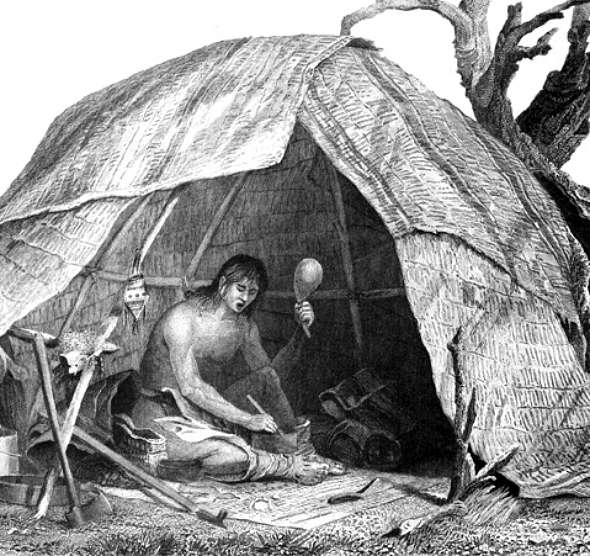
.Section 4: A Sacred Place of Vision Quest
Nashoba: Saving it from the English
Skinner is correct
to cite Nashoba Hill. Nashoba Praying Indian Village bears all the same
qualities as Moodus, except on a smaller scale. It is an epicenter of
seismic activity from the earliest recorded times up to the present;
there is a hill that rumbles and thunders; light phenomena are seen here
in conjunction with earthquakes; and it is a site specifically chosen by
the Indians themselves.
 Recall that Eliot
allowed the Indians of 1651 to chose the locations of their new
villages. These sixteen square mile plantations were granted by deed to
Indian ownership, thus protecting them from the usual encroachment and
overrunning typical of the land-hungry English. When Sachem Tahattawan
chose
"nashope,"
its close proximity to Concord was questioned. Eliot thought they would
have preferred a location that was further away, with more game, and
with less encroachment from the English. Eliot questioned Tahattawan on
this but Tahattawan was adamant.
"Nashope"
it would be. Recall that Eliot
allowed the Indians of 1651 to chose the locations of their new
villages. These sixteen square mile plantations were granted by deed to
Indian ownership, thus protecting them from the usual encroachment and
overrunning typical of the land-hungry English. When Sachem Tahattawan
chose
"nashope,"
its close proximity to Concord was questioned. Eliot thought they would
have preferred a location that was further away, with more game, and
with less encroachment from the English. Eliot questioned Tahattawan on
this but Tahattawan was adamant.
"Nashope"
it would be.
John Eliot
It seems likely,
considering the circumstances involved, that Tahattawan was using the
opportunity to reserve away a site sacred to Hobomock from being overrun
by the English. However sincere he may have been as a convert, he would
also have been savvy enough to take advantage of the opportunity
presented him. After all,
"nashope"
was his principle residence, and he would have been more aware then
anyone of its significance.
Also, as a
permanent village site, which a Praying Indian Village would be, it was
lacking the game required to support a community. Traditional Indian
ways were to move their villages several times a year to follow the
seasons of harvest and game. Clearly, there were other factors involved
with the selection of Nashoba Indian Plantation.
Mavor & Dix Indian
Village / Seismic Activity Map from Manitou
.
Note 1: The red dots show the locations of
the first 7 Praying Indian Villages. Mavor & Dix have drawn-in
both magnetic anomalies and rivers. (For the purposes of this map
ignore the rivers.) The map shows that the 7 Villages fall on or
adjacent to magnetic anomalies (and therefore plutons and are thus on
seismically active locations).
.
Note 2: Mavor & Dix in Manitou call
the above seismically active magnetic anomaly locations "linear faults."
Rather, these should be termed plutons per the discussion on this
webpage. The magnetic anomalies marked on the above map were
however coped from the Our New England Earthquakes map, and
therefore do mark plutons and not faults. Only the plutons, and
not faults, are seismically active in Massachusetts at this time, so although the
terminology is incorrect, the Mavor & Dix argument is still sound.
Another
interesting fact about the locations of the Praying Indian Villages is
that the early ones at least may all have been situated at sites chosen
by the Indians for special qualities. When Mavor and Dix laid out the
original seven Indian Plantation on a map of seismic activity, they
noticed that four of the villages (including Nashoba) fell on linear
faults, while another two were adjacent to anomalies.
"This
impressive correlation of seismic activity with the locations of the
praying Indian villages supports our theory that these places were
selected in part because of their seismic activities, which indicated
that they were abodes of the spirit Hobomock."
(Mavor and Dix, Manitou.)
Nashoba: A Ritual Landscape
It is my opinion
that the Praying Indian Villages - especially Nashoba - were located at
sacred places chosen by the Indians at areas that they knew and that
they and their ancestors had ritualized.
Is there any
indication of such ritualization at Nashoba? The answer is yes.
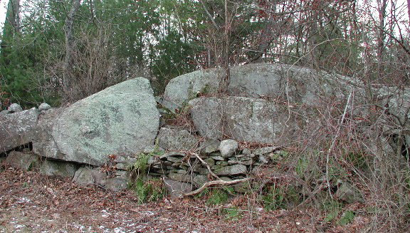
For starters,
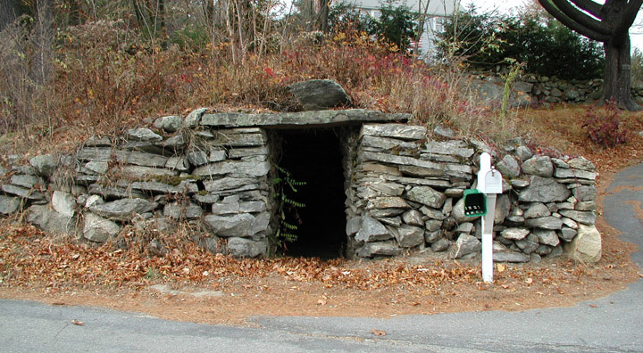
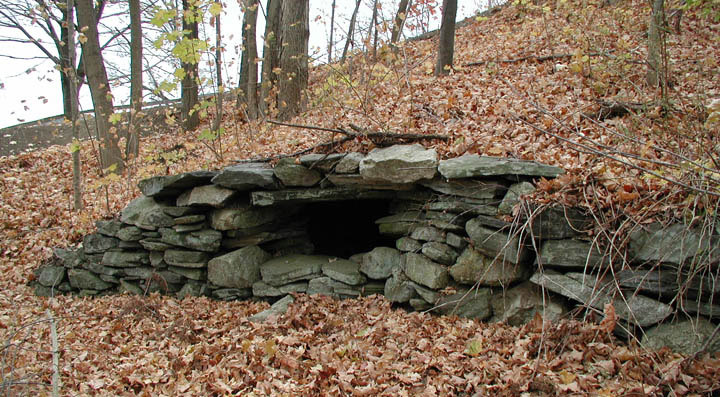
there were eight underground stone chambers local to the old Indian
Plantation: six in Littleton, one in Harvard, and one in Acton. Of the
six that fell within the exact bounds of Nashoba Plantation,
two of the
ones in Littleton have since been destroyed, and another Littleton
chamber since lost (said to have been at the Northwestern foot of
Nashoba Hill).* There are chambers in Moodus and Mavor and Dix consider
these and other chambers to be
kiva-like vision quest sites. One of the
Littleton chambers is in the Sarah Doublet Forest, the heart of the old
sacred landscape of Nashoba.
.
*Note: The eight chambers of the Nashoba
area are: Whitcomb Ave Chamber 1, Whitcomb Ave Chamber 2, Partridge Lane
Chamber, Sarah Doublet Chamber, Nashoba Brook Chamber, the destroyed
King Street/495 dogleg Chamber, the Tahattawan Road/Foster Street
Chamber, and the lost Nashoba Hill Chamber.
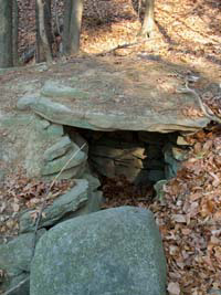
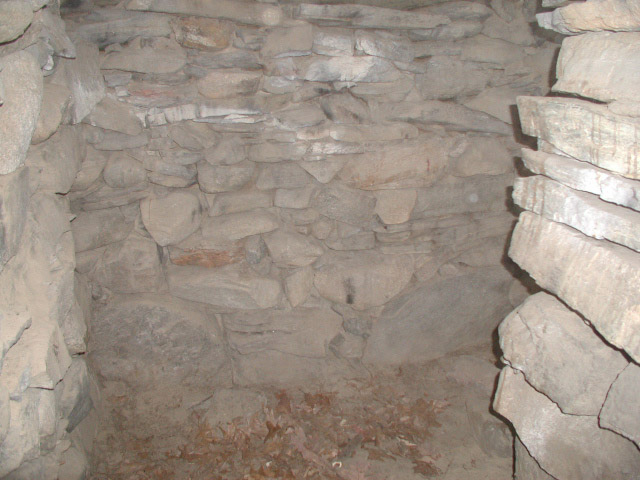
Whitcomb Avenue
Chambers 1 & 2 in Littleton
.
Note 1:
The Whitcomb Avenue Chamber 1, to the left, is on a
hillside and overlooks the Boxborough Esker site. Unfortunately,
due to the sighting lines being
blocked by a
large red barn, it is unknown if it is oriented to view a
significant sunrise over the esker. However, with the advent of
GoogleEarth, calculations can be run to recreate the sightlines and
determine significance if any.
.
Note 2:
The Whitcomb Avenue Chamber 2, to the right, is adjacent
to the Whitcomb house. The Whitcomb house was built in 1705 and
is the earliest Colonial structure in the vicinity. The chamber has
had many uses over the years. It
was briefly used as a tomb by the Whitcomb
family until around 1925 when some collage boys broke in and stole a
bone. It was also used by a Mr. Whitcomb of years gone by to play the
trumpet in. The chamber originally had a walk-in entrance, as
evidenced in this
31 May 1932
photo by
Harriet Merrifield Forbes. The chamber is next to a brook,
and at the time of the walk-in entrance, the floor of the chamber
would have been roughly level with the brook, and thus prone to flooding
- a fact that would have made it a very poor "Colonial root cellar." Interestingly, and perhaps significantly, there is a 40
foot stone
tunnel in the immediate vicinity of the chamber. The tunnel is
partially filled and is collapsed in the middle, but as recently as the
1970s boys were able to crawl a good 12 to 15 feet into it. Local
folklore is that it was
constructed as an escape route to the chamber in the event of an Indian
attack.
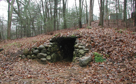
Dogleg Chamber in
Harvard
.
Note:
A length of the entryway of this chamber has long since
collapsed. Originally, in the above right photo, the crawlway came
in from the left and crossed to the current opening, and made a left
hand turn into the current opening. Here is a
sketch
from Manitou of the current tunnel and chamber configuration.
There is legend of a second chamber adjacent to this one that was
destroyed by Partridge Road. Also, there is reason to believe that
this chamber was used in Underground Railway times as a way station.
For a picture of the crawlway, see
here.
(Did you see the big hairy spider?) The chamber itself is large enough to stand up in. As a matter of
fact, when Partridge Lane was being surveyed for house parcels, the
surveyors had lunch one day in the chamber.

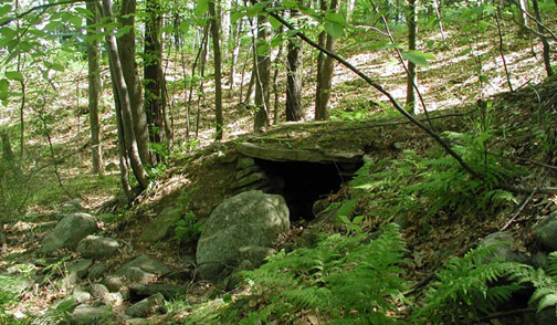
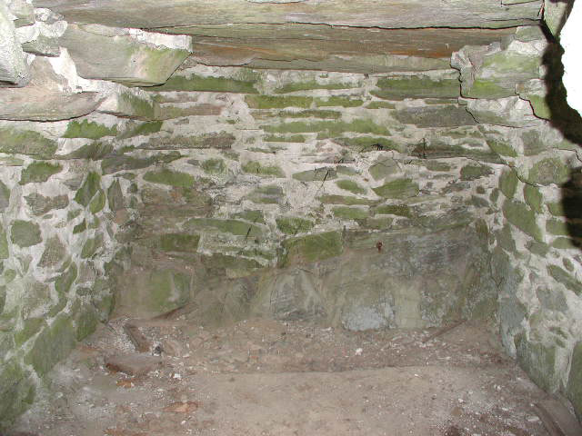
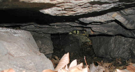
Nashoba Brook
Chamber in Acton: Collapsed & Reconstructed
.
Note:
The Nashoba Brook chamber, which had a
partially collapsed entryway, was
reconstructed in
2006 by the Acton Historical Chamber with assistance from
NEARA. Professional
archeologists and historians associated with the project erroneously
maintained that the chamber was within the bounds of the Nashoba Praying
Indian Plantation, and made this part of their reports. Clearly,
they never looked at the historical record, the Littleton Proprietor's
map, or bothered to even review the deeds involved. The chamber,
though in the Nashoba area, is more then a mile and a half from the easternmost
corner of Indian Plantation. Sadly, several chowderheads in NEARA
continue to chant this error as religious dogma.
Interior of
Whitcomb Avenue Chamber 1 & the Nashoba Brook Chamber
.
Note: For a picture
that captures the surprising size of the roof slabs of the
Whitcomb Ave Chamber 1, click
here.
For an interior shot of the Whitcomb Ave Chamber 2, see
here.
Interior shots of the Nashoba Brook Chamber are
here and
here.
|
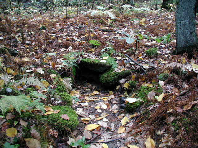
 Sarah Doublet's
Cave Sarah Doublet's
Cave
By
Daniel V. Boudillion
14
December 2009
There is an oral tradition in Littleton
that Sarah Doublet (the last Indian to hold title to the 500 Acre
Indian Reservation) lived in a cave somewhere in what is now the
Sarah Doublet Forest. The problem with this is there was
known cave in the area - indeed, I myself had walked the land
hundreds of times since the late 1970s and did not believe for an
instant there was even the possibility of a cave up there.
Other people I knew wove convoluted theories that her "cave" was
actually a lean-to of branches up against a large boulder, for
example.
This all changed one Spring morning in
the early 1990s when I was out for a walk in the Sarah Doublet
Forest.
For the rest of the article click
here.
|
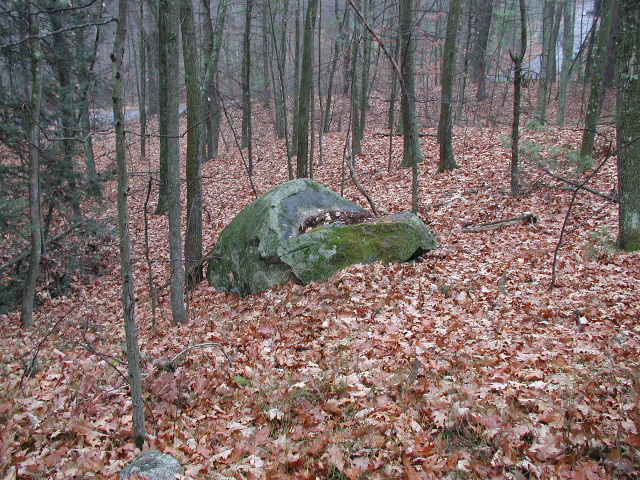
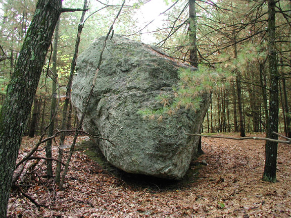
Also in the Sarah Doublet Forest is a
mammoth boulder resting on bedrock. This appears similar to the perched
rocking stones in Moodus, the kind of stones that would respond with
rocking, however slightly, to even the most otherwise undetectable earth
tremor and
"Voice
of Hobomock."
There is another smaller perched boulder near the southern shore of
Nagog Pond.
Harvard Rocking
Stone & Nagog Perched Boulder
.
Note: The Harvard
rocking stone, located in South Shaker Village, is approximately 1 ton
and can be set in motion with the finger of one hand. The Nagog
perched boulder appears to be a rocking stone. Forest detritus has
built up on the platform at it has very little movement at the moment.
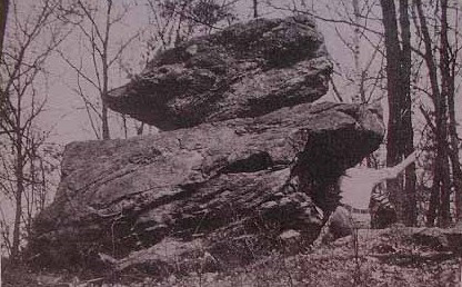
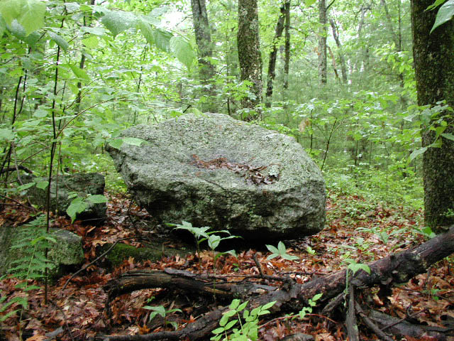
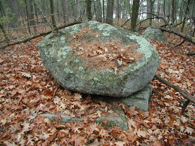
Sarah Doublet
Forest Perched Boulder
.
Note: This huge
boulder appears to have slipped off its platform, perhaps in an
earthquake? It is my theory, based on the similarities with
Moodus, that this was at one time a rocking stone as well. It is
located on top of the hill over looking the area.
Another ritual
site is in Boxborough (originally part of Littleton), a little more than
a mile away from the Sarah Doublet Forest, but still within the bounds
of the old Indian Plantation. This site is a solstice sunrise site.
From a stone slab viewing platform (if you care to venture out on the
morning of the winter solstice) you will observe the sun rising across a
field from a notch in the halves of a large outcrop of bedrock. There
is also a midsummer solstice sunrise that can be viewed from the
platform, but it is less spectacular and less convincing.
Half Moon Meadow Brook Winter Solstice
Sunrise Site
.
Note: Sunrise Rock,
left, is a large boulder/bedrock formation. The sun is
observed to rise in the notch in the rock as evidenced in the picture to
the right. Click pictures to enlarge.
|
 Half
Moon Meadow Brook: Half
Moon Meadow Brook:
A
Sunrise Solstice Site
Field Report by Daniel V.
Boudillion
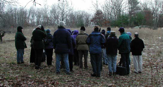
On December 22, 2001 at 7:30 a.m.,
approximately thirty people gathered in a field in Boxborough to
watch the winter solstice sun rise majestically through an
alignment of stone structures. The outing was sponsored by the
Sudbury Valley Trustees and led by George Krusen.
Half Moon Meadow Brook is a lithic site
located in Boxborough, Massachusetts, and may well be one of the
most significant early sites in Middlesex County. Its most
outstanding feature is its spectacular winter solstice sunrise
alignment. There is also a summer solstice sunrise alignment and
a variety of interesting and enigmatic stonework.
For the rest of the article click
here.
|
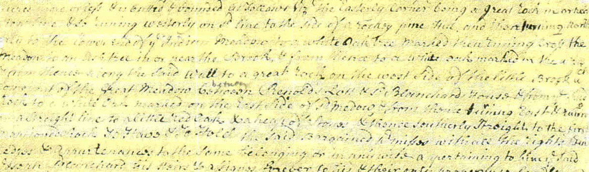
Interestingly, the
1725 deed from Isaac Powers Junior into Samuel Dudley shows that at that
time there was an Indian trail running between the Indian New Town at
the Sarah Doublet Forest and the solstice sunrise site, or Half Moon
Meadow Brook as it is called today. It is recorded as
"…the
Path that runs from Benjamin Hoar to Joseph Blanchard."
This
"path"
is now Newton Road and Boxborough Road.
Isaac Powers junior
to Samuel Dudley, February 24, 1724
.
Note: The
deed goes on to run as follows: "...the
Path that runs from Benjamin Hoar to Joseph Blanchard then running
Northerly by said Path till it comes to a stake and heap of stones then
bounding on Benjamin Hoar across Rattlesnake Meadow..."
Rattlesnake Meadow is the marsh at Fort Pond at the corner of Newtown
Road and Boxborough Road, which can be seen
here.
It was so-called because of the rattlesnake problem in the area in those
days. However, by 1850, the rattlesnake had been systematically
exterminated in Massachusetts. For more on Rattlesnake named
places in Littleton, see:
Looking For
and Finding Littleton's Rattlesnake Hill.
Blanchards & Witchcraft: Location, Location,
Location
 The Blanchard name
is well-known and respected in Boxborough, but perhaps less well known
is the fact that Joseph’s three daughters Elizabeth (11), Joanna (9),
and Mary (7) were involved in the last recorded instance of Witchcraft
accusations in Massachusetts. This happened in 1720, when the Blanchard
girls accused Abigail Dudley, the wife of Littleton’s Town Clerk and
Selectman, Samuel Dudley, of bewitching them. It created more than a
local stir and the girl’s drew an avid audience that relished the
spectacle of them falling into fits and allowing themselves to be found
in odd places such as ponds and rooftops, supposedly transported there
by Mrs. Dudley’s witchcraft. The Blanchard name
is well-known and respected in Boxborough, but perhaps less well known
is the fact that Joseph’s three daughters Elizabeth (11), Joanna (9),
and Mary (7) were involved in the last recorded instance of Witchcraft
accusations in Massachusetts. This happened in 1720, when the Blanchard
girls accused Abigail Dudley, the wife of Littleton’s Town Clerk and
Selectman, Samuel Dudley, of bewitching them. It created more than a
local stir and the girl’s drew an avid audience that relished the
spectacle of them falling into fits and allowing themselves to be found
in odd places such as ponds and rooftops, supposedly transported there
by Mrs. Dudley’s witchcraft.
As the summer wore
on a formal complaint of Witchcraft loomed against Mrs. Dudley.
However, Mrs. Dudley died in childbirth on August 9, 1720 before any
such formal accusations were lodged. In 1728 Elizabeth Blanchard
confessed to false accusations on her part to the Reverend Ebenezer
Turell in Malden, where the Blanchard family had moved for several years
following the events.
The girl’s fits
and accusations played out at their home on Depot Road in
Boxborough, which was part of Littleton at the time. The Blanchard
homestead was situated in what is now the front yard of George Krusen’s
colonial, itself a Blanchard house.
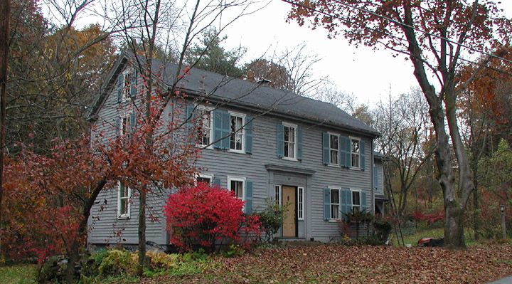
Blanchard
House, Depot Road, Boxborough
.
Note:
The original Joseph Blanchard house of 1718 stood between the current
structure and road. It is known that John Blanchard built the
current house in 1844/45 using beams and planks from the original
home. A recent dry spell revealed the footprint of
the original foundation between the house and road.
In a strange
twist, the Half Moon Meadow Brook Winter Solstice site is on the site of
the old Joseph Blanchard farm and only a hundred yards from where the
original house was located and the witchcraft fits and accusations
played out.
Winter Solstice Sunrise at Half Moon
Meadow Brook
.
Note: In
these photos of the Winter Solstice sunrise, an anomalous green orb is seen to move across the meadow.
|
1720 Littleton: the Dudley Witchcraft
Affair
By
Daniel V. Boudillion
31
October 2009
The Town of
Littleton was barely 6 years old when it was rocked in 1720 by
accusations of Witchcraft. The young daughter of Joseph
Blanchard, followed by her two younger sisters, exhibited
outrageous afflictions and behaviors that they attributed to the
machinations of a witch. Ultimately they accused Mrs. Abigail
Dudley, the wife of Littleton’s first Town Clerk and Selectman,
Samuel Dudley, as their diabolical tormentor.
In the
process, the Blanchard home became a sideshow of
"afflicted"
behavior: fortune telling, trances, fits, levitation, invisible
attacks, retaliations, and rocks flung down the chimney (and into
the soup!). People came from miles around for the cheap
entertainment and the majority opinion was Witchcraft, and a
formal lodging of accusations loomed against Mrs. Dudley. She, in
turn, had the audacity to die in peculiar circumstances before any
such charges could be lodged against her and a trial executed –
but yet strange deaths and suicides have dogged the descendents of
Joseph Blanchard ever since.
Forthcoming article by Daniel V.
Boudillion, currently being presented locally as a slide show.
For an introduction to the Dudley
Witchcraft Accusations see
Ceremonial
Time: Fact or Fiction? An Inquiry into John Hanson Mitchell.
|
Boxborough Esker
Blanchards and
Witchcraft aside, there is another special site within the bounds of the
old Indian Plantation. This is located in Boxborough but was
originally part of Littleton. The site is a series of three large
earthen circles, each surrounded by a ditch, that Mavor and Dix believe
to have Indian ritual significance. It is located next to Muddy
Pond on the eastern side of the Boxborough esker on Beaver Brook.
It is significant that this esker runs its length dead-center along the
Newbury-Clinton fault. In fact, some geologists think certain
fault-line eskers are the result of
soil
liquefactions in high magnitude earthquakes rather then glacier
related soil deposits.
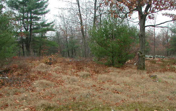
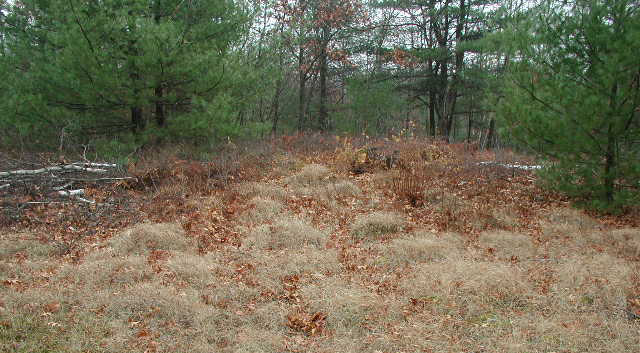
Top of Boxborough
Esker & Earthen Circle at base of Esker
.
Note:
The the earthen ditch-and-circles are very subtle and difficult to see
in person, let alone capture in a photograph. Your best bet is to
visit the location in the late fall or early spring at dawn. The
early morning shadows will help define the shapes so you can see them
better.
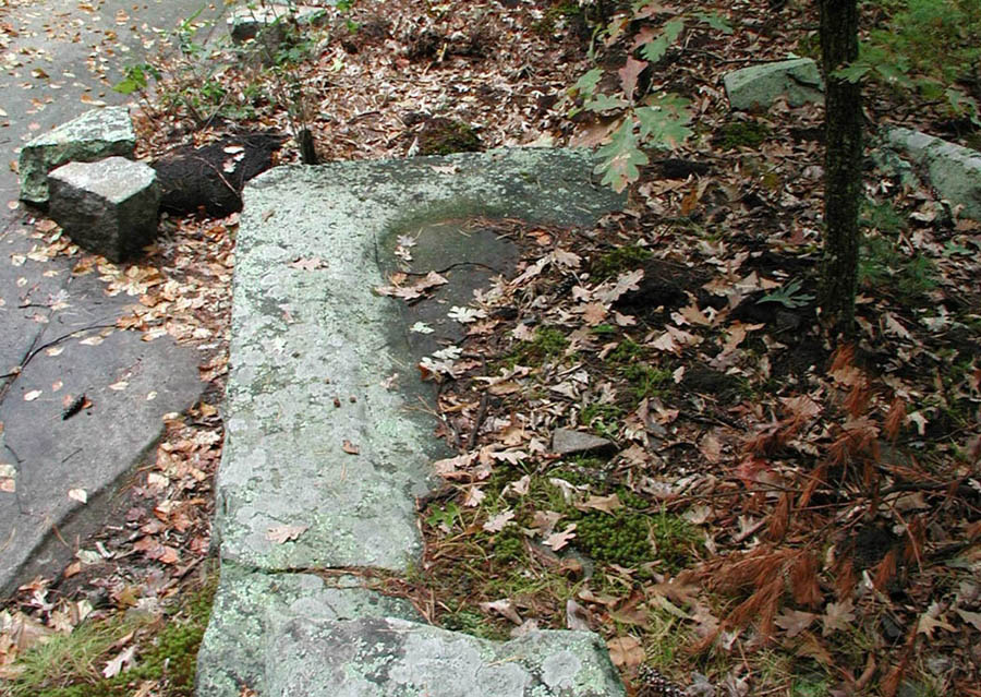
Prayer Seat at
Boxborough Esker on left & example of a Prayer Seat in good condition on
right
.
Note: The prayer seat on the left is at the
base of the Esker. The one on the right is shown as an example of
a Prayer Seat in good condition. See the
Picture
Glossary of New England Lithic Constructions for further information
on Prayer Seats.
Whatever the
cause, there are several stone prayer seats here, much like at Moodus,
and a summer solstice sunset alignment as well. The following statement
from Mavor and Dix in Manitou sums up well their views and
interest in the lands of the Nashoba Indian Village:
"We
believe that the shaman-preachers of Nashoba used the praying villages
to maintain the Indian communication links, the sacred landscape and the
stone and earthen structures in the midst of encroaching white
colonists. We believe that central to their world was the Boxborough
esker."
I disagree on the
"centrality"
of the Boxborough esker. Certainly it was important, perhaps
ritualistically, but I feel the Nagog area was more central to the
natural intrinsic uniqueness of Nashoba.
|
 The
Boxborough Esker: A Featured Site in Manitou The
Boxborough Esker: A Featured Site in Manitou
Field Report by Daniel V. Boudillion
The Boxborough Esker is
prominently featured in the book Manitou by James Mavor and
Byron Dix. They consider it a significant Native American site in
the Hopewellian tradition. To quote the authors:
"We
believe that the shaman-preachers of Nashoba used the praying
villages to maintain the Indian communication links, the sacred
landscape and the stone and earthen structures in the midst of
encroaching white colonists. We believe that central to their
world was the Boxborough esker."
I thought it would be interesting to
visit the esker and report how it appeared to me. It is not my
intent to prove or disprove anything with this article, but simply
to report what I saw and provide some photos for those who have
not yet visited the site.
For the rest of the article click
here.
|
An Island of Granite in a Sea of Schist
The entire region is an
area of sedimentary schist and gneiss that extends 21 miles from Lowell
to Bolton on a Northeasterly axis, and is about 5½ miles wide. In
geologic terms this area is called the Nashoba Zone, and its composition
of sedimentary schist and gneiss dates from the Ordovician/Proterozoic-Z
(Ozn) eras.
There are seven small
"islands"
of intrusive rock rising out of this ancient seabed of the Nashoba
Zone. These islands are composed of Andover and Acton Granite of the
Silurian/Ordovician era (SOagr), a light-gray to pinkish gray stone.
The largest of the seven islands - in the very middle of the Nashoba
Zone - is the rocky hill sandwiched between Nagog Pond and Fort Pond.
This is the Sarah Doublet Forest, the heart of the Nashoba Indian
Plantation. It is literally an island of granite in a sea of
sedimentary schist and gneiss. This granite island is a small elongated
oval running Northeasterly, about three miles long and three-quarter
miles wide. Its three-quarter mile width runs exactly between Nagog
Pond and Fort Pond. The granite meets the schist and gneiss at the
edges of both ponds, extending slightly beneath them both.
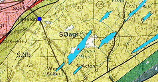
Granite Islands in
a Sea of Schist
.
Note: The
Andover granite
"islands" are filled in with light blue,
and the location of the Sarah Doublet
Forest is marked with a
red dot.
For reference, Littleton Common is marked with a
dark blue dot.
click map to
enlarge
Significantly, the
hills of the Moodus region are domes of schist and gneiss, same as the
sea of rock that composes the rest of the Nashoba Zone, and Nashoba Hill
itself. Nashoba and Moodus are areas of the exact same geologic
composition, as are the noise-making domes of Nashoba Hill and Mount
Tom.
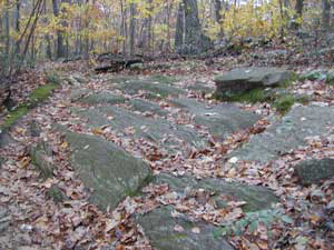
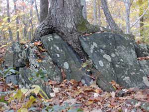
Geology of Mount Tom: Schist & Gneiss
.
Note:
Mount Tom is of the same geologic composition as Nashoba Hill: Picture 1
of of Mt. Tom is of schist in the foreground with gneiss further back, and picture 2 is
of gneiss. Courtesy of
The Geology of Mount Tom State Park website.
Also
significantly, the heart of the Nashoba Praying Indian Village, the
Sarah Doublet Forest on Fort Pond Hill, is situated dead center on this
the largest island of granite in the schist/gneiss zone. The final area
of Indian activity in Nashoba, the 500 acre Indian New Town, is almost
entirely within the granite zone. Also, there is more of the
Andover/Acton granite intrusions within the bounds of the old Praying
Indian village than in the rest of the entire Nashoba Zone.
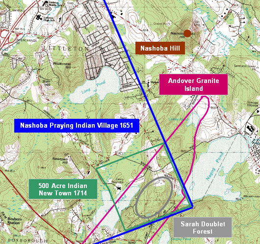
Sarah Doublet
Forest in relation to Andover Granite Island
.
Note 1:
This map shows the location of the Sarah Doublet Forest in relation to
the "island" of Andover granite. The Sarah Doublet Forest is the
gray oval between Fort Pond and Nagog Pond.
The Andover Granite Island is outlined in
red-purple. The 500 Acre Indian New Town (Indian Reservation) is
the green square. The overall Praying
Indian Plantation is marked in blue.
Note how the Andover granite island encompasses most the Indian New Town
in general, and all of the Sarah Doublet Forest (and hill) between the
two ponds. The Sarah Doublet Forest is the "sacred center" of the
old Indian Plantation, and it seems unlikely that its being on the
"island" in its entirety - as well as the reservations being mostly on
it as well - is coincidence. Rather, it seems the site was chosen
for this geological peculiarity.
.
.
Note 2:
This map is also a good illustration of the location of Nashoba as "The
Place Between the Waters." The three "waters" in question are Long
Pond at mid-map, and Fort Pond and Nagog Pond at the bottom of the map.
It would seem that
this is significant to the selection of
"nashope"
by Tahattawan and his shamanic advisors, and no doubt one of the factors
that contributed to its unique character. The heart of the village was
centered on the granite island. Thus the heart of the vision questing
and shamanic activity was also centered on the granite as well.
Hobomock’s voice may have come from the schist hill, but he was invoked
from the granite.
Perhaps the
granite islands reacted in some unusual or pronounced way to the
tremblings of this seismically active area. Or perhaps they remained
calm in a storm of jiggling schist and gneiss. Certainly, these islands
are from a deeper strata of rock and their roots penetrate the shallow
sea of schist and gneiss deep into the seismically active bowels of the
earth.
Powwows Under the Mountain
The voice of
Hobomock was a powerful call to the shaman of old in
"nashope."
In fact, according to legend, Tahattawan didn’t simply die, but
apparently followed the Voice of Hobomock into the hill itself, where he
now lives his ghostly life in Hobomock’s domain.
In an essay
written around 1910, Littleton schoolboy Jonathan Harwood recalled a
local legend that
"Tahattawan
and King Philip, – Indian Sachems – as the legends run, still hold their
ghostly pow-wows in a cave on Nashoba. Hence the roar of dissenting
voices occasionally issue…"
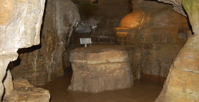
Ohio Olentangy Indian Caverns: Council
Rock
.
Note:
Although there are no known caves in Nashoba Hill, Indians did use
caverns for council rooms and shelters. For instance, concerning
the Olentangy Indian Caverns in Delaware Ohio: "There is evidence that
the Wyandotte Indians used these caverns as a haven from the weather and
from their enemies, the Delaware Indians.
One of the large rooms contains
"Council Rock", used by the Wyandotte's for tribal ceremonies."
Courtesy of the
Olentangy Indian Caverns
website.
According to this legend, Sachem Tahattawan is therein accompanied by
King Philip (otherwise known as Metacom), the most powerful and fearsome
Indian of Massachusetts history. King Philip developed such a frightful
reputation in the King Philip’s War against the English settlers in
1675-76 that dozens of place names still bear the remembrance of this
Wampanoag sachem.
Mary Shepard Kidnapped
There is reason to
attach King Philip’s name to the area. A King Philip’s War
incident occurred 350 yards from Nashoba Hill on a hill between it and
Nagog Pond. On February 12, 1676, Mary Shepard (or Mary Powers,
there is some debate over the name) was keeping watch on Quagana Hill
while her brothers
Isaac and Jacob Shepard threshed corn in a nearby barn. The
Indians took them all by surprise,
killed the brothers,
and abducted Mary to their Wenimisset camp in New Braintree,
Massachusetts. Mary stole a horse and escaped to Chelmsford three
days later.
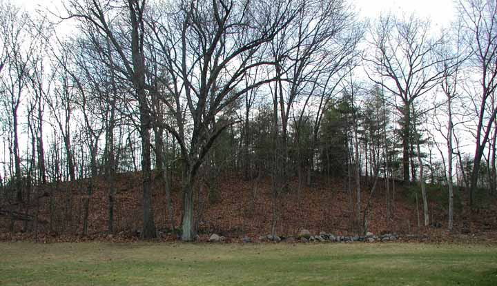
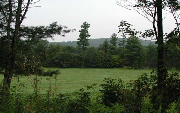
Quagana Hill &
Wenimisset Lower Camp
.
Note: There is a Powers' family oral
tradition that Mary came back pregnant.
|
Who Was Mary?
This section under construction: 16 December 2009.
There is some debate
between the Shepard and Power's families over who "Mary Shepard"
actually was. Both Harwood in Littleton (1890) and Hudson in
Concord (1904) record the event as happening to Mary Shepard.
However, "Mary Shepard" does not show up in the historical record
of the time the events took place: 1676. Unlike all the
other children of Ralph and Thanklord Shepard, there is no birth,
death, or marriage records for her name. Charlestown,
Malden, and Concord do not list her.
However, there was a
Mary Powers on the spot and of the right age in 1675. Walter
Powers had married Ralph Shepard's daughter Trial, and his
Garrison house - built for protection against the Indians of King
Philip's war (1675/1676) - was only about 300 yards from Quagana
Hill. Ralph Shepard lived about 50 yards from the hill.
Ralph Shepard and his son's families, and Walter Powers and his
family, were the only English people who lived there, in what was
a part of Concord Plantation called Concord Village.
It is recorded that
"Mary Shepard's" two brothers, Isaac and Jacob, were killed by the
Indians and she taken prisoner. However, if Mary were
|
King Philip is the
arch-enemy Indian of the Puritan Colonials and all things
"English,"
personifying to them all that was heathen, wild, and savage in the New
World. That he is in the hill conducting heathen powwows is an
indication of the non-Christian practices associated in Puritan times
with the sounds emanating from the hill. Just as significantly, Sachem
Tahattawan, supposedly a convert, is also in the caverns beneath the
hill conducting ghostly powwows – veritable rituals to Hobomock – with
the most feared Indian in Massachusetts history.
King Philip's War
Club: Fruitlands Museum
.
.
Note 1:
War clubs like this were the hand-weapon
of choice among the Algonquin speaking warriors of King Philip's war
parties. Most Puritan settlers who were killed died of a result of
having their heads bashed in by clubs like this. Indeed, my
direct ancestor and his family were "Cutt of" (killed) in a raid on
their secluded farm in Warwick in 1675, with the exception of the
youngest son who was ransomed back for a wagon load of pumpkins.
This story was simply a family tradition until 2004 when I found a copy
of a letter that Warwick's Captain Edmund Calverly wrote the Governor
begging for reinforcements, and citing the death of Francis and his
family as proof of the pressing need:
"As
Also that they has Cutt of Francis his wife & fower smale children, And
burned his house, And All his provision & goods was, for ought we know
ther destroyed together, for wee then could find none of them."
Note 2:
There is a modern story about King
Philip's War Club worth recounting as well. Back in the 1970s some
young men visited the Indian Museum at Fruitlands and asked to look at
the club - which was on open view and not display-cased at the time.
An excuse was made to get the curator to leave the building for a few
minutes. When he returned both the young men and the club were
gone. The club remained missing for many years. However,
about 15 years ago it surfaced at a local yard sale, and better yet, was
seen by a person who knew what he was looking at. To make a long
story short, the club was purchased for a few dollars and returned to
the Museum.
The sounds from
the hill are the roaring of their rebellious voices. Tahattawan,
associated with the place of Hobomock’s voice as Sachem of
"nashope"
and thence Nashoba Praying Indian Village, has in the end become one of
the heathen voices of the hill, if not the King under the Mountain
himself.
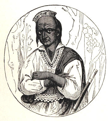
King Philip &
Sachem Tahattawan
.
Note :
These are artists conceptions - there are no known likenesses of either
King Philip or Sachem Tahattawan. The earliest depiction of King
Philip was an engraving by Paul Revere,
seen here,
created 96 years after Philip's death.
Note: It is also
interesting how the legends around Nashoba Hill migrated across the two
competing cultures. It went from the Indians believing that the winds
were pent in the hill, to Colonials believing that the Indians
themselves were pent in the hill.
Nashoba: Shaman & Sacred Ground
Like Mavor and
Dix, I also think that history and evidence indicate that the Nashoba
Praying Indian Village was a uniquely special place, and chosen for
religious reasons of the Indians. Hobomock lived like a king in the
depths of the rumbling hill and shaman sought him here in vision quest
in the underground chambers, living among Tahattawan’s folk in the
village on the granite island, an island with its roots deep in the
earth.
The earthquakes
signaled Hobomock’s might and agitated the waters of Nagog Pond. The
glowing lights added to the mystery of the place. The boomings were his
voice, and his slightest whisper could be read in the movements of the
perched boulders. Quartz was found here for carving the Wakon-bird in
appeasement if necessary. Stone turtles climbed from sacred water to
sacred hill. Strange powers lived in the pond and moved its waters, and
would drag you into the deeps if approached to close. Perhaps the
Ap’cinic story was a metaphor or warning to the uninitiated – here be
dragons.
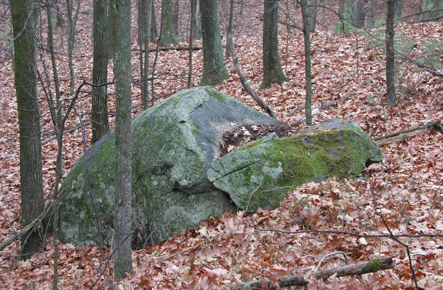
Stone turtle
ascends the hill of vision quest
Indians certainly
lived in the heart of Nashoba, the Sarah Doublet Forest, on the hill
between Nagog Pond and Fort Pond from its inception as a Plantation in
1651, to when the last surviving member died in 1736. The longevity of
this tract as Indian-held land happened in a round-about way, not in the
linear manner erroneously depicted by John Mitchell in Trespassing*.
However, the outcome was the same – the heart of the area was lived on
and tended by Indians until the very end. Even then they didn’t really
die, they simply entered the ghostly cavernous realms of Hobomock deep
beneath Nashoba Hill and became the voice of the hill itself.
.
*Note:
The unofficial settlement of Littleton
began in 1686 with the sale from the Indians of half the Plantation to
the Hon. Peter Bulkeley of Concord and Maj. Thomas Henchman of
Chelmsford for the consideration of ₤70.
This sale included what is now known as the Sarah Doublet Forest.
By 1701 the entire Nashoba Praying Indian Plantation had been sold into
English hands, and a series of competing petitions were generated over
the fate of the area – that it be incorporated into other towns, or be
incorporated into its own town. It was finally decided by Massachusetts
Bay General Court in favor of it being its own town, and incorporated as
Nashoba in 1714, and renamed Littleton in 1715. Even though the
Indians had sold all their lands, they still continued to live where
they always had, which was an inconvenience and affront to the new
English landholders. Thus, when the town was incorporated in 1714,
a 500 acre tract was was aside as an Indian Reservation in an attempt to
corral the Indians off English lands. The 500 acre tract, which
encompasses the Sarah Doublet Forest, was chosen for two reasons.
First, it was poor farming land, and thus of little value to the
English. Second, it was a location where most of the Indians were
living anyway - an observation that lends weight to it being of special
spiritual significance to the Nashoba Indians.
Nashoba Today
As I look up from
my computer and out my dining room window across what was once Walter
Powers fields back in 1670, I can see Nashoba Hill, one half mile away.
Is the dark king still under the mountain? It has been 2 years since I
last heard his voice, but the occasional tremor reminds me of his
presence.
New life has been
given these old sacred lands. In the Sarah Doublet Forest, the heart of
Nashoba
"between
the waters,"
are several stone circles. A white witch coven met there in the early
1980s not far from the chamber, calling the blessings of the Old Gods
upon that place, or more likely, calling up the Old Gods from
that place.
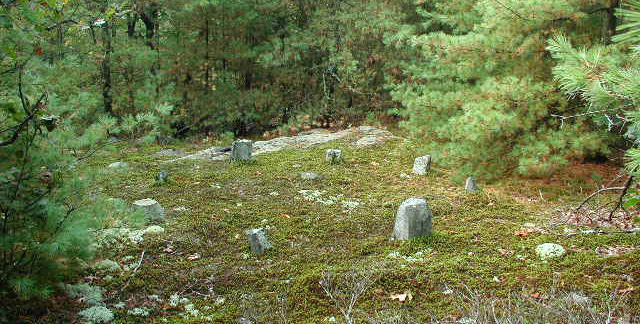
Stone Circle in the
Sarah Doublet Forest
.
Note:
In the book Trespassing,
John Mitchell
has this to say about the Sarah Doublet Forest: "Once I
even found a small stone circle in the the area, a sort of miniature
Stonehenge ... neo-pagans have set up a celestial tracking stage here,
in the form of a circle of stones, wherein they worship the rising or
setting of the sun, moon, and stars."
It is not uncommon
to stumble upon a contemplative soul in quiet mediation in the woods of
the Sarah Doublet Forest. As you walk the trails you will also notice
that modern rock-stackers have been at work here balancing columns of
stones, in a modern version of
"duff,"
the old Indian rock-stacking game. At night, the coyotes yip in the
woods and the moonlight eerily shadows the undulating rocky mounds and
the rough-stone sacred turtle effigies.
The Six Altars of Nashoba
Within the
original bounds of the old Nashoba Praying Indian Village, I have found
6 stone altars tucked away in the woods. Based on field-use and tree
growth (they are concealed by trees in what once were open fields
cleared of stone), these would not appear to be more then 80 years old,
and were probably made sometime after the 1960’s. It seems neo-pagans
have felt attracted to this place as well, same as the Indian shamans of
old were. Indeed, some feel that the Indians have not abandoned
Nashoba, and that certain stone and brush formations are their
continuing offerings to Manitou, the spirit of place. As late as 1920,
it was still recorded that Indians would pass through for a day or two
to visit the graves of their ancestors on the
low islands in the swamps
of Fort Pond.
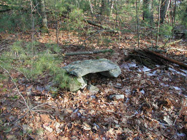
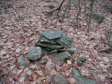
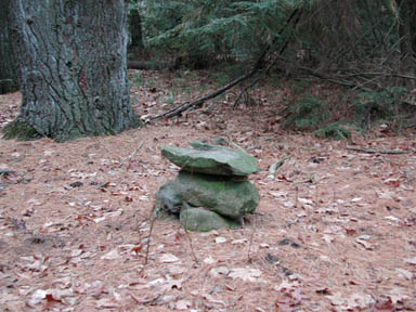
stone Altars: Nagog Woods, Half
Moon Meadow Brook, Oak Hill
|
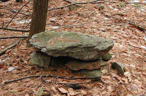 The
Six Altars of Nashoba: The
Six Altars of Nashoba:
A
Question of Purpose and Origin
Field Report by Daniel V. Boudillion
Over the past twenty-four years I
have noticed a variety of unusual lithic constructions in Nashoba,
Massachusetts. A particular structure that keeps turning up is a
flat-topped table-like structure, either round or rectangular. I
call these structures "altars", although it is unclear what
exactly they were intended for. So far I have recorded and
investigated six. There are two varieties: round and
rectangular. These are found as follows: 2 on Oak Hill, 1 at Nagog
Pond, 1 at Nagog Hill, 1 at Black Pond, and 1 at Half Moon Meadow
Brook.
The following is a review of the
structures and their environment, a discussion on possible uses
and builders of these constructions, and my conclusions to date.
For the rest of the article click
here.
|
The Shooting of Nashoba Hill - New Year's Eve Style
For those who do
not live here, or do not have the patience to wait for the unpredictable
Voice of Hobomock, the tradition of
"the
shooting of Nashoba hill"
continues to this day, and quite spectacularly I might add - light
phenomena and all. Every New Year’s Eve, Nashoba Hill Ski Area puts on
a magnificent twenty minute midnight fireworks display, and the booming
of the explosions roll across the town like cannon shot. How strange
and wonderful is it that the 350 years tradition of a booming hill still
continues at the exact same spot, albeit with a modern twist.
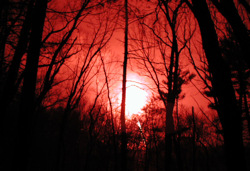
Fireworks at
Nashoba Hill as seen from Indian Council Esker
There is a
tradition here among the locals too. Every New Years Eve at midnight,
my friends (Ed, Gib, and Don) and I stand out at the
old Indian council
spot on the
high esker behind my house and watch, beers in hand, as the
fireworks drape and scintillate the night sky above us. Even the old
shaman never had it so good.
GPS Locations & Accessibility
The poet J. G.
Brainard (1796-1828) wrote of Moodus, but could well have been
describing Nashoba with these same words:
Oh, this is the
very wizard place,
And now is the
wizard hour,
By the light that
was conjured up to trace,
Ere the star that
falls can run its race,
The seat of the
earthquake’s power.
•
Nashoba Hill is
private land, but the Westford side is owned and operated as Nashoba
Valley Ski Area. So come winter, you can explore it there, if you like
to do your exploring on skies, that is.
Nashoba Hill
Peak: 42.5400N, -71.4480W
•
Nagog Pond is the
Town of Concord water supply, and posted as
"no
trespassing."
But there are trails off of Nagog Hill Road in Acton on conservation
land that wind down near the pond.
Acton Nagog
Parking Lot: 42.5000N, -71.4390W
•
The Indian New
Town (Sarah Doublet Forest), the heart of the old village on Fort Pond
Hill, is now conservation land owned by the Town of Littleton, with
access on Nashoba Road.
Sarah Doublet
Forest Parking Lot: 42.5120N, -71.4540W
•
The Solstice
Sunrise site was recently purchased by Sudbury Valley Trustees, with
access on Littlefield Road in Boxborough.
Half Moon
Meadow Brook: 42.5030N, -71.4870W
•
The Boxborough
Esker site is owned by The Nature Conservancy, and may be accessed by a
trail at the end of Swanson Road.
Boxborough Esker:
42.5050N, -71.5280W
References Cited
Barber, John Warner. 1841 (edition).
Historical Collections.
Worcester, MA: Dorr, Howland &
Co.
.
Goodrich, S.G. 1844. A Pictorial
History of America.
Hartford, CT: E. Strong.
.
Gookin, Daniel. 1792.
Historical Collections of the Indians in New England.
Boston: Apollo Press by Belknap
and Hall.
.
Hurd, D. Hamiliton. 1890.
History of Middlesex County MA
(A chapter entitled "Historical Sketch of
Littleton," contributed by Herbert Harwood).
Philadelphia: J.W. Lewis & Co.
.
Hosmer, Rev. Stephen. 1895.
Collections of the Connecticut Historical Society, Vol. 3.
Hartford CT: Case, Lockwood &
Brainard Co.
.
Mavor, James W. and Byron E. Dix. 1989.
Manitou.
Rochester, VT: Inner Traditions
International.
.
Mitchell, John. 1998.
Trespassing.
Reading, MA: Addison-Wesley.
.
Sears, Clara Endicott. 1924.
Days of Delusion.
Cambridge, MA: Riverside Press.
.
Simmons, Gene. 1977. Our New
England Earthquakes.
Boston: Boston Edison Company.
.
Skinner, Charles M. 1896. Tales
of Puritan Land.
Philadelphia and London: J.B.
Lippincott Co.
.
Webster, Carolyn. 1957. "The
Town's Topography." Littleton Independent,
April 4, 1957. Littleton
MA.
.
Walcott, Charles Hosmer. 1884.
"Concord in the colonial period: being a history of the town of Concord"
(Rev. Edmund Foster of Littleton, 1815 Century
Sermon).
Cambridge, MA: John Wilson and
Son.
Email Daniel V.
Boudillion
Back to Field
Journal
Copyright © 2007, 2009 by Daniel V. Boudillion
| 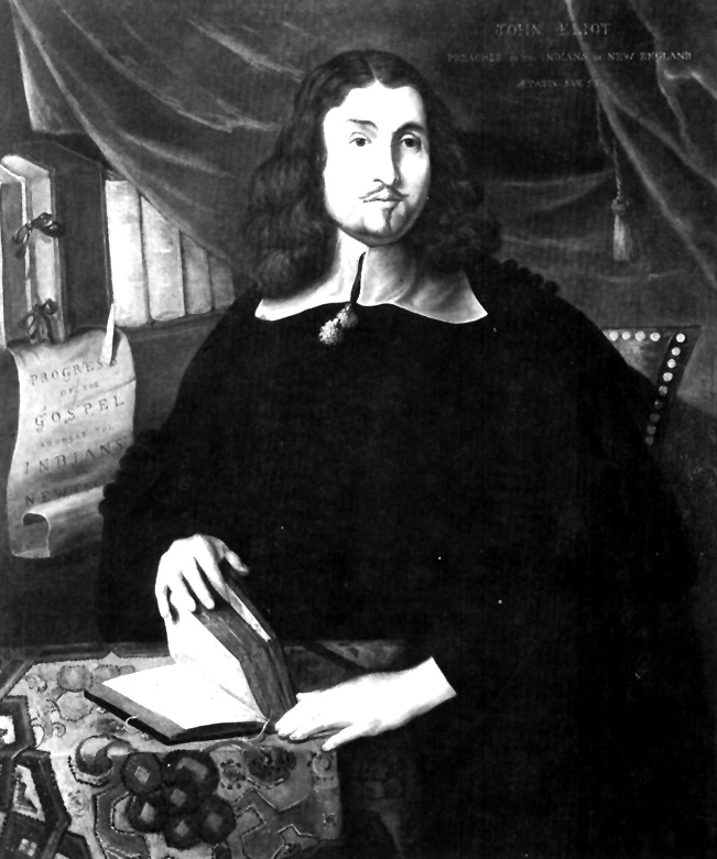
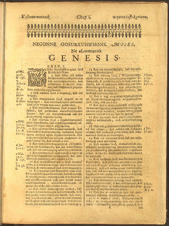
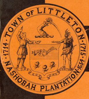
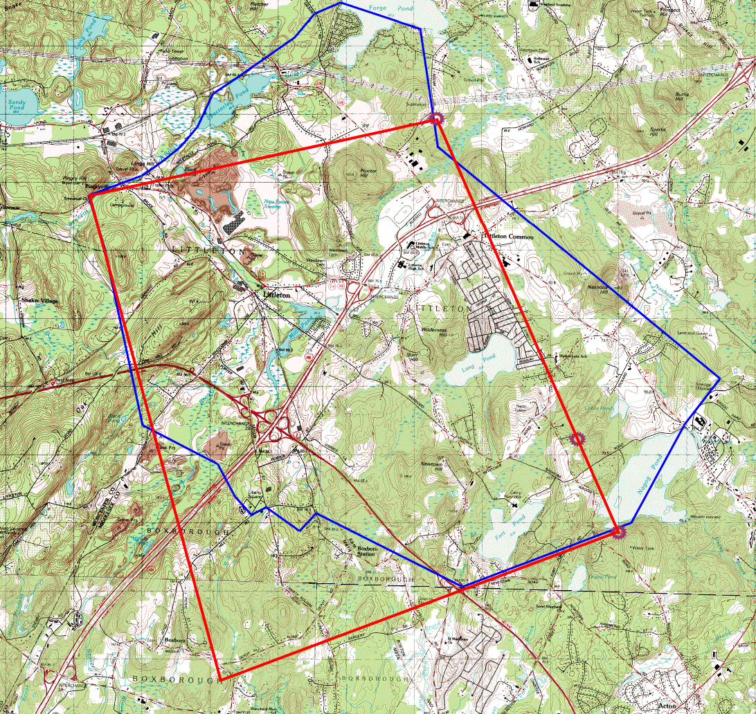


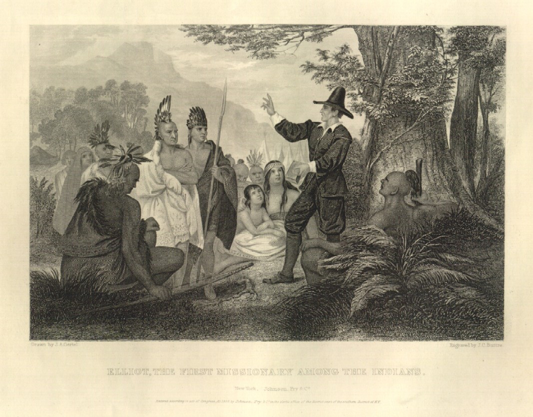


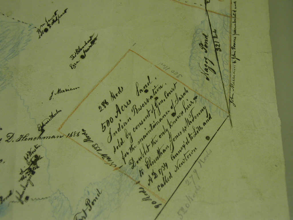


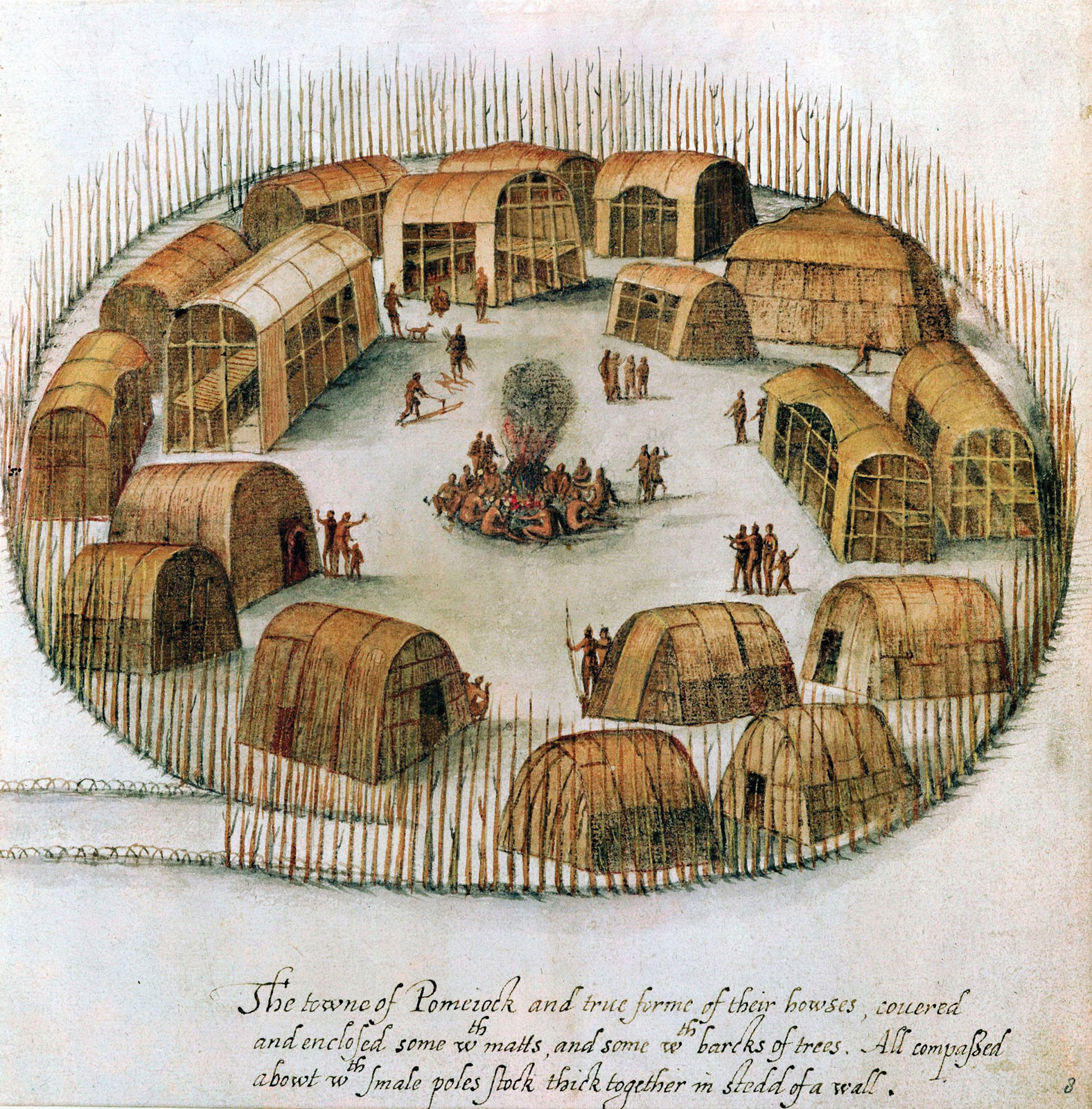


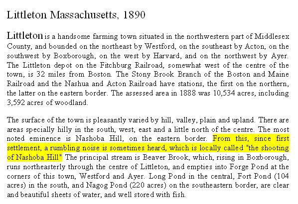


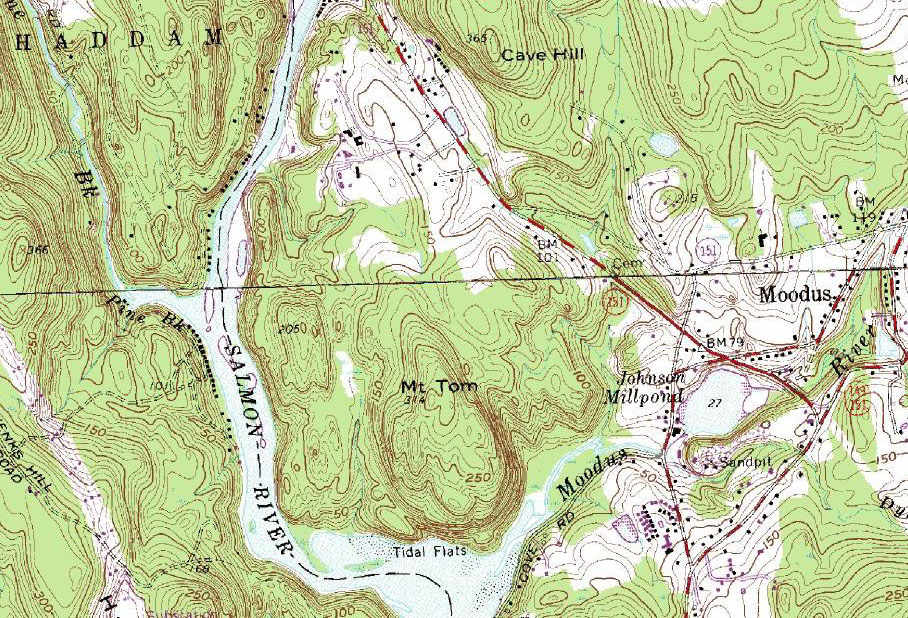

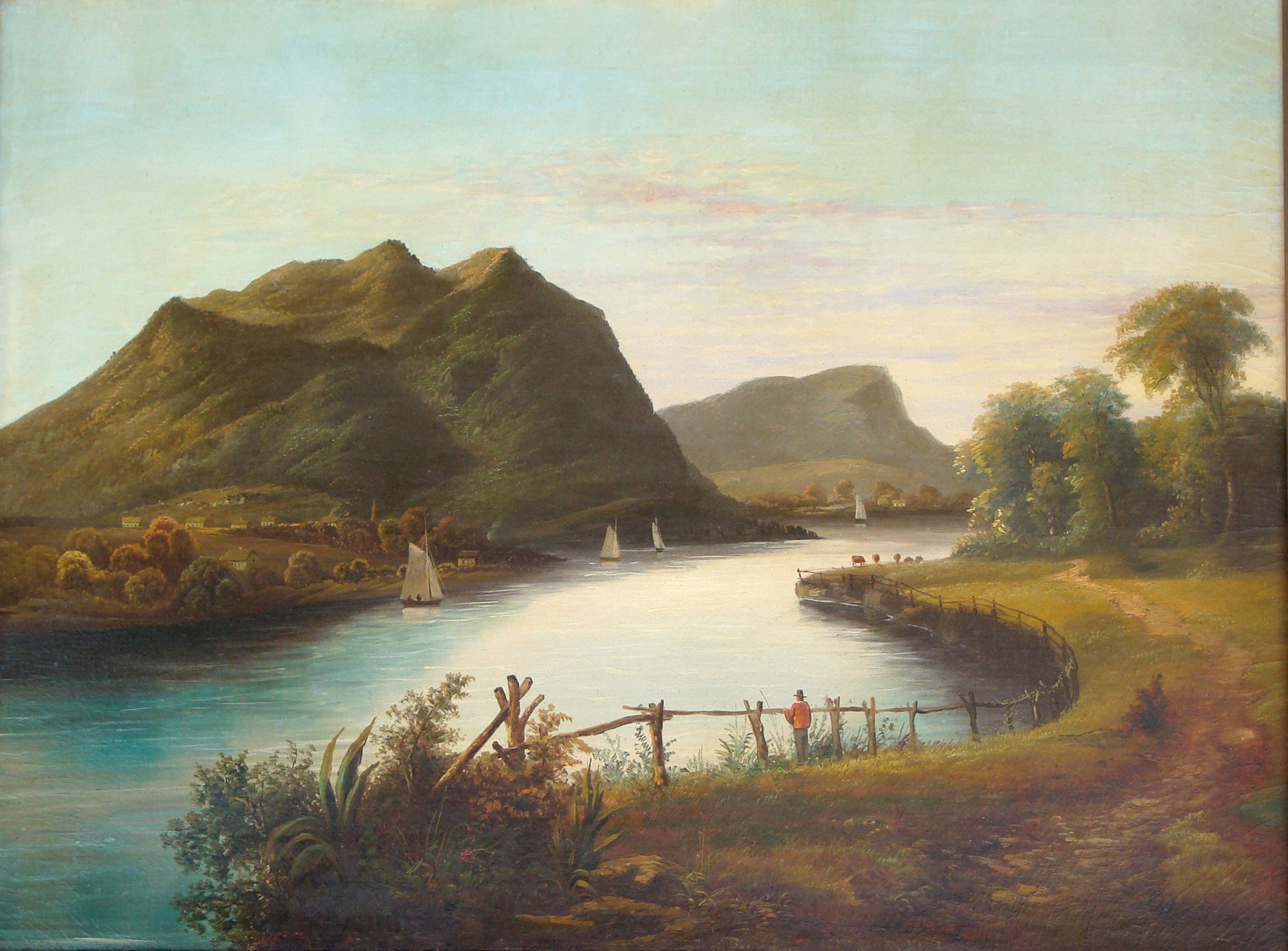

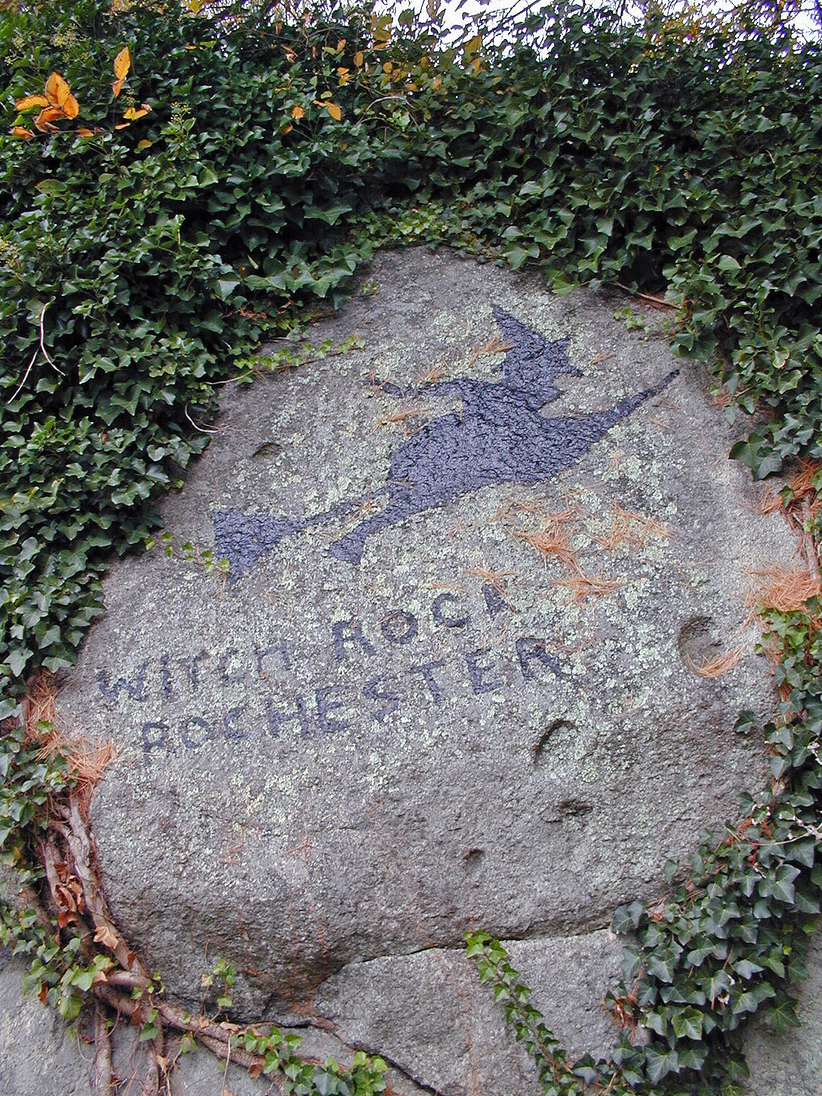
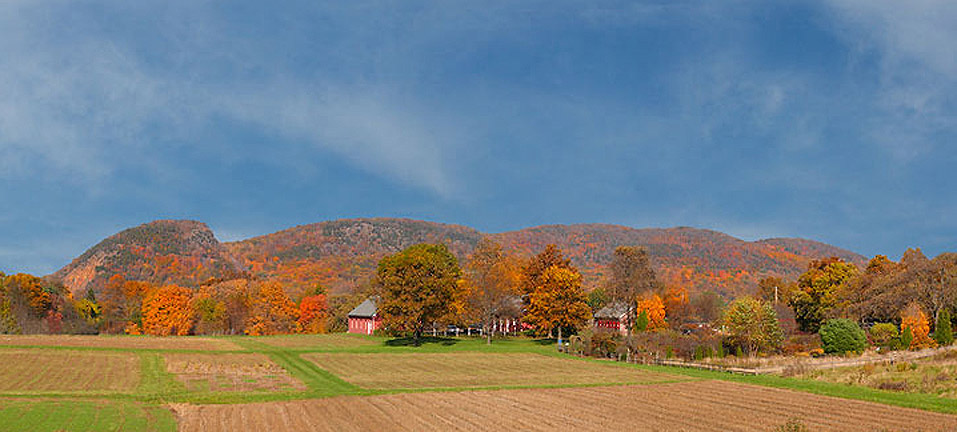
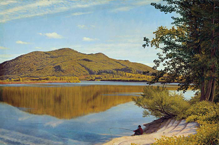

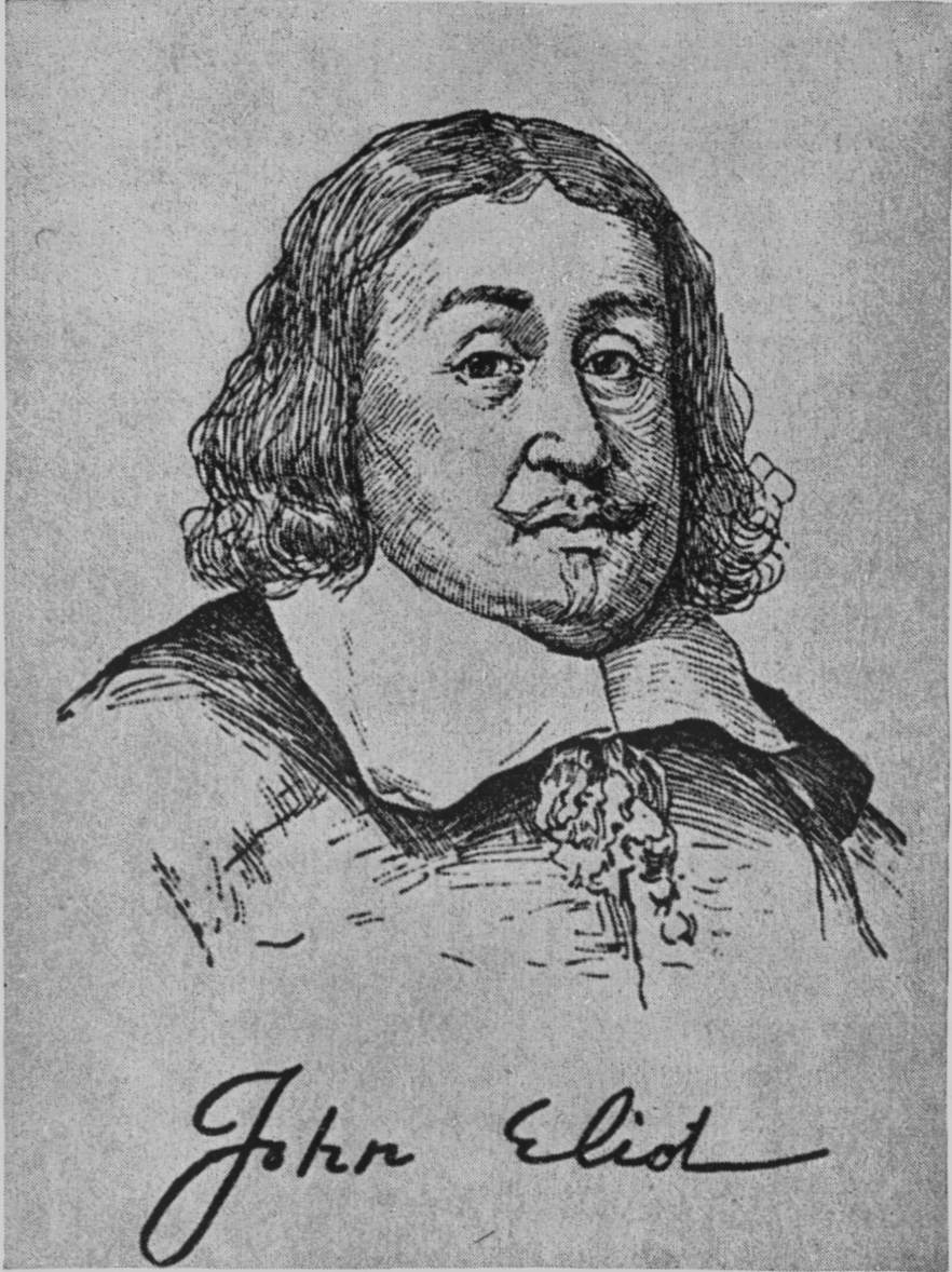

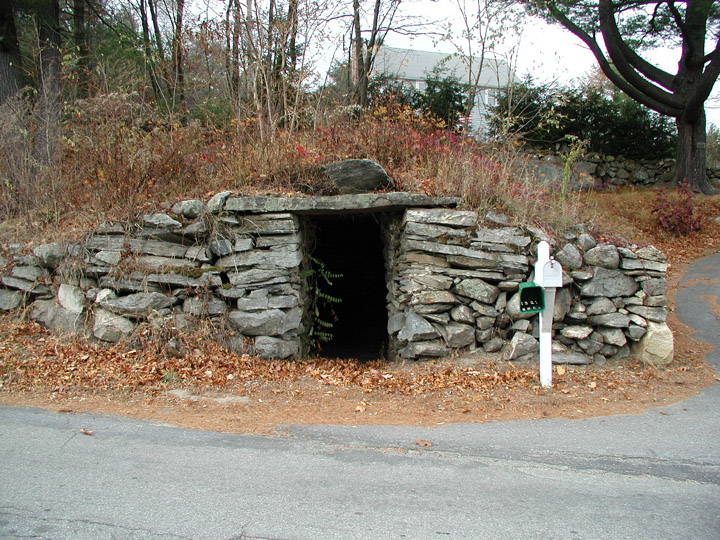
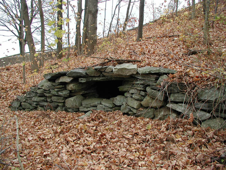

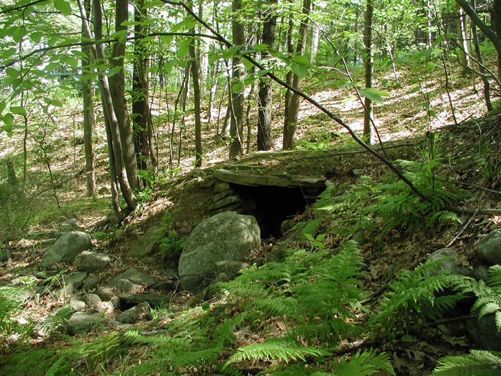
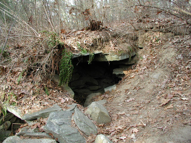
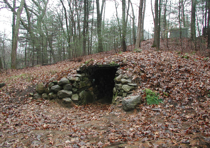


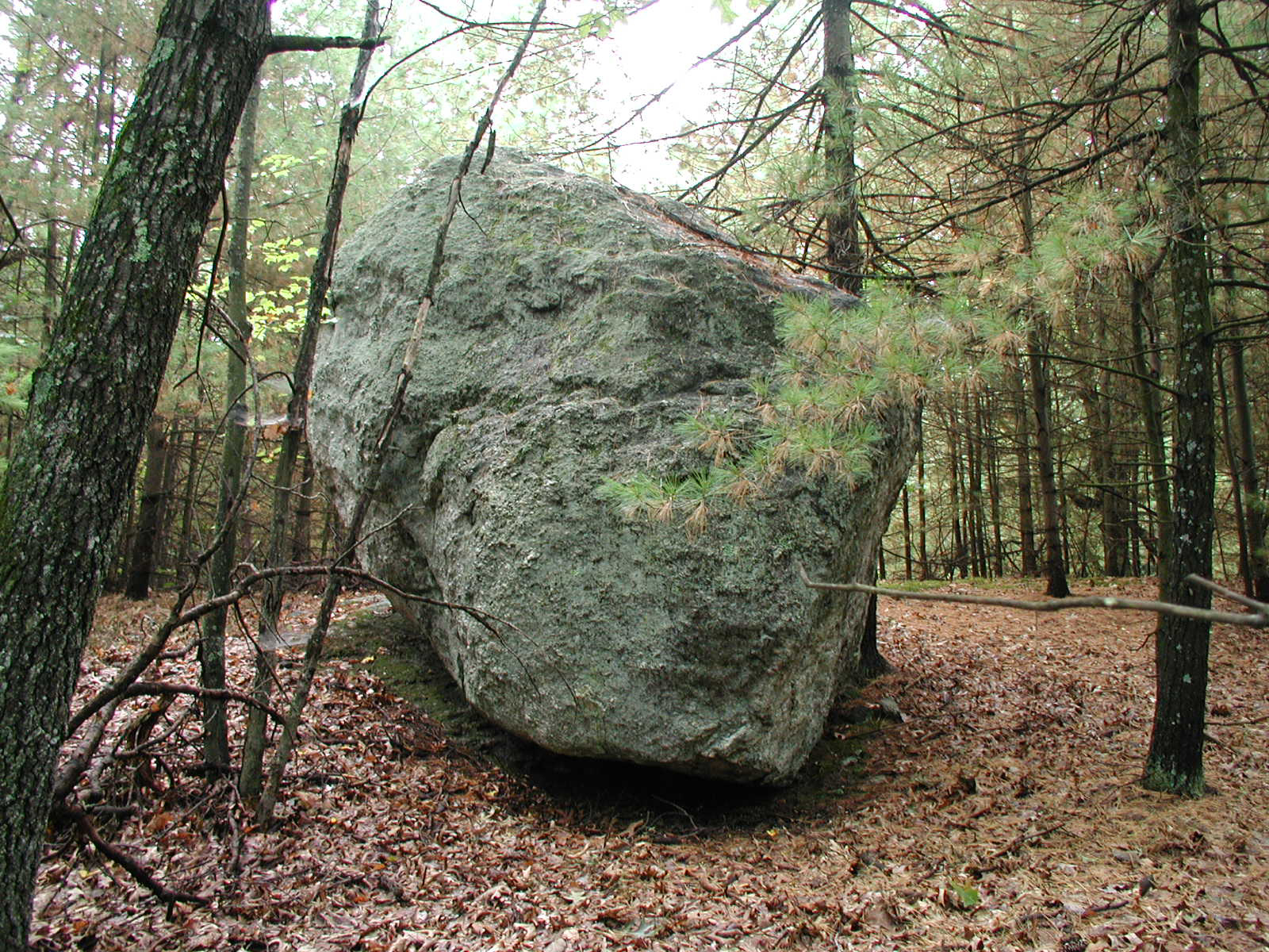

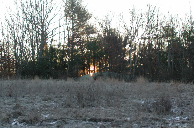


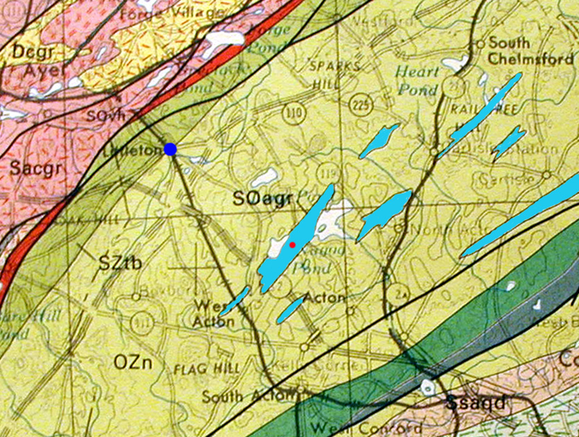


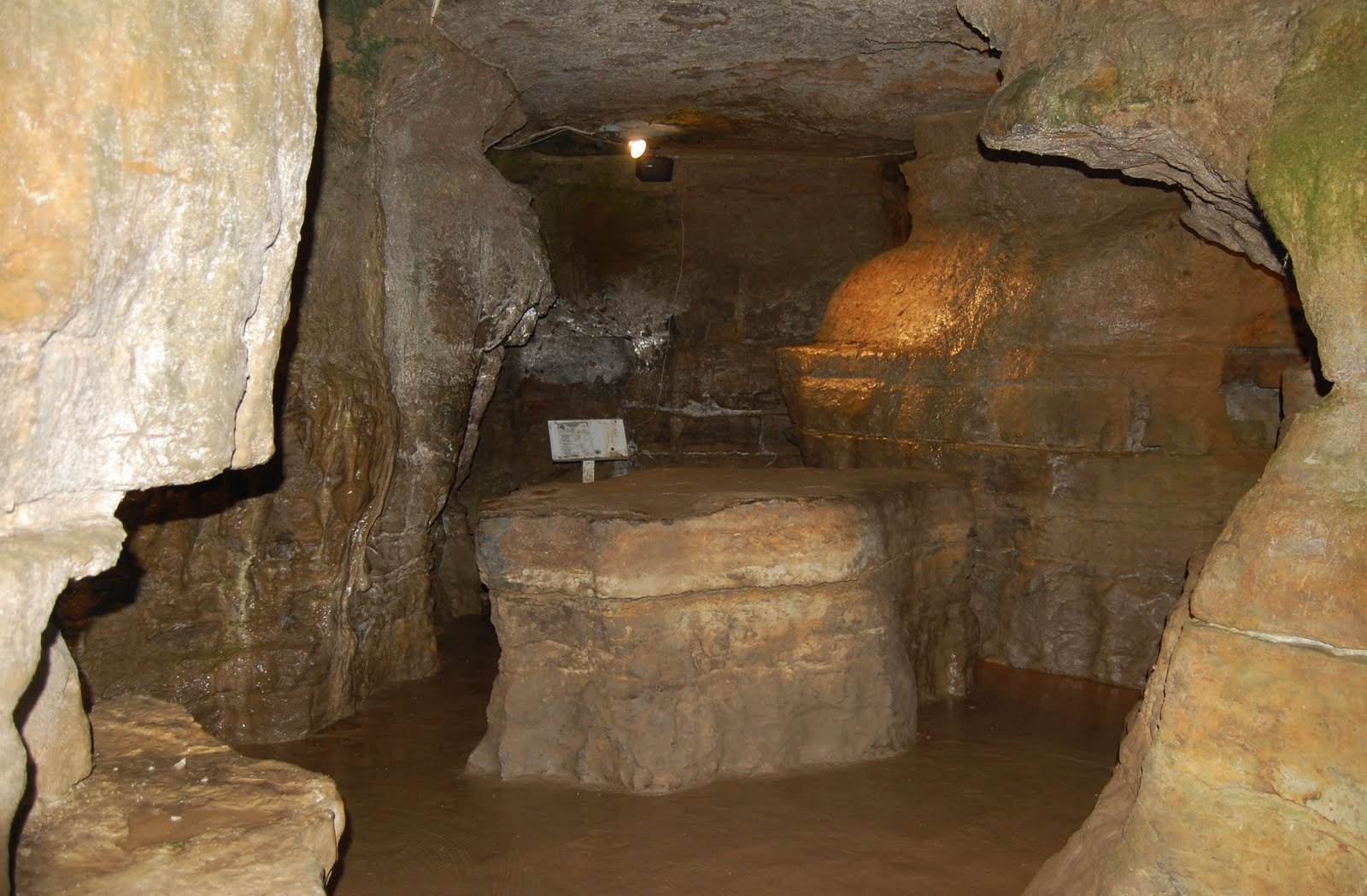


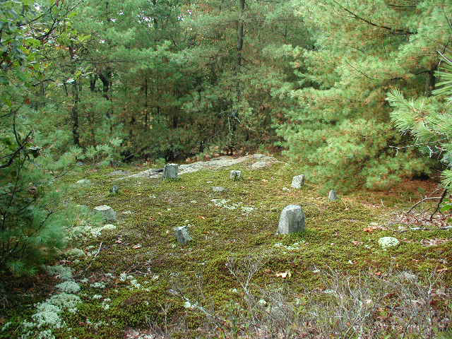


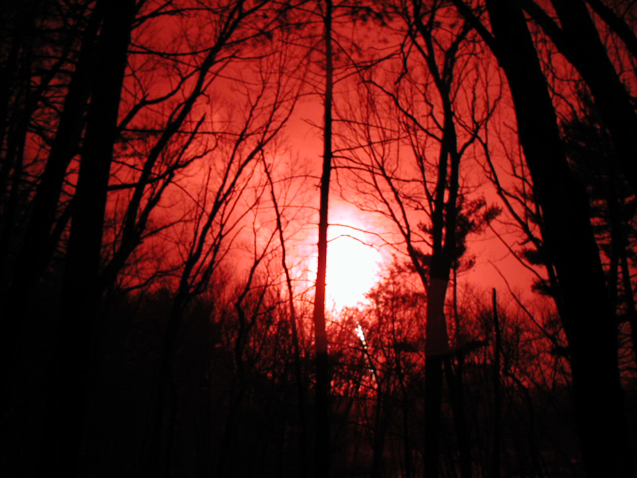
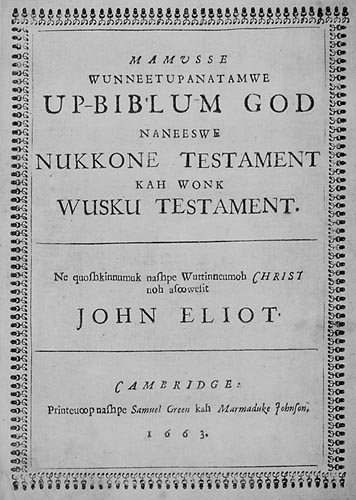
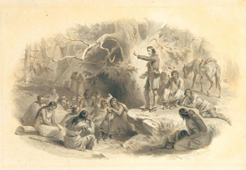
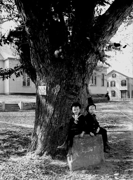
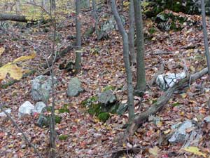
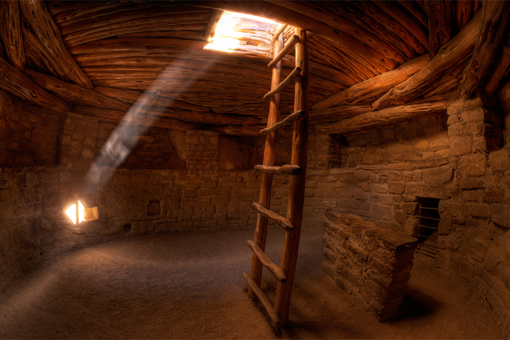
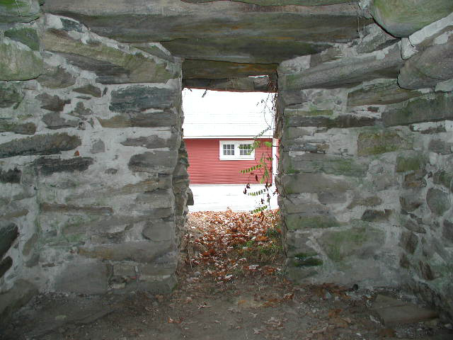
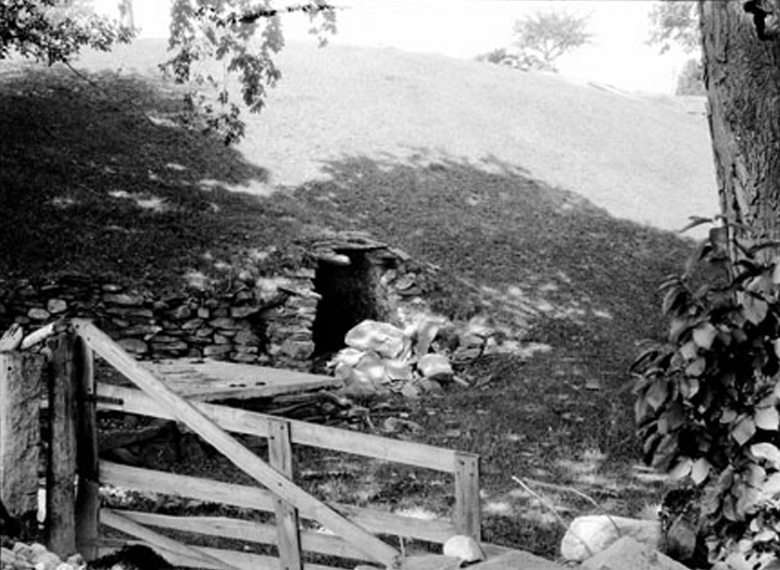
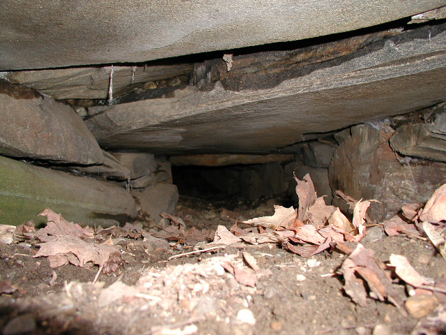
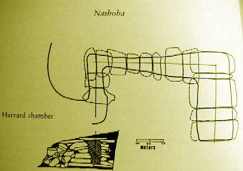
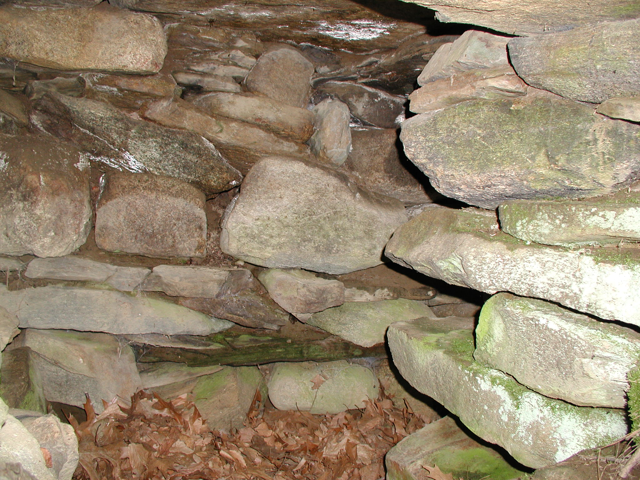
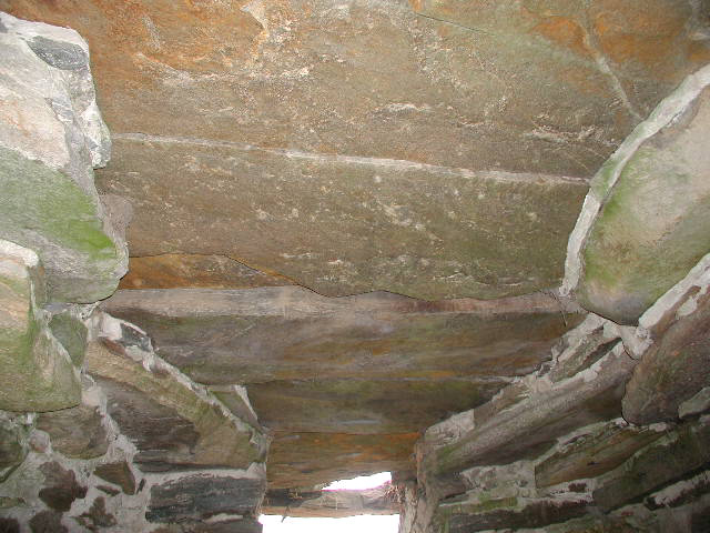
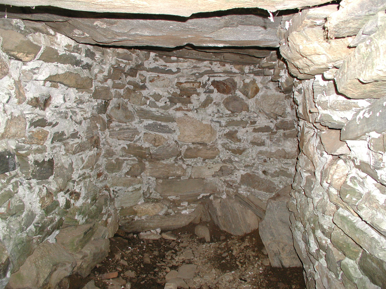
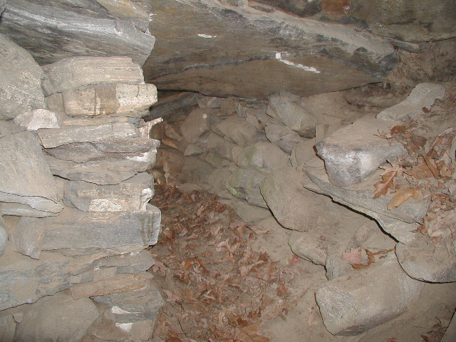
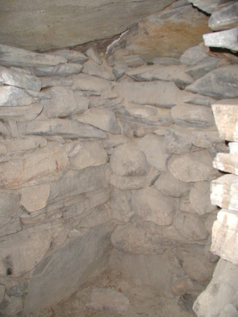
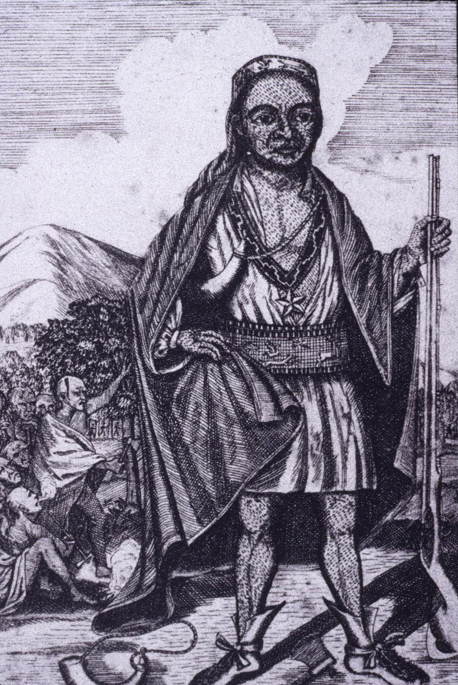
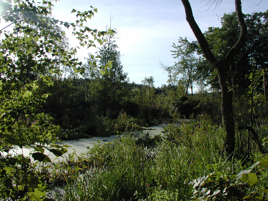