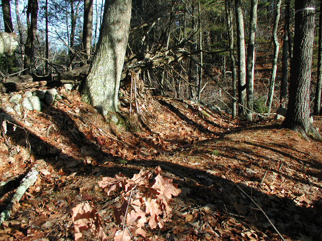
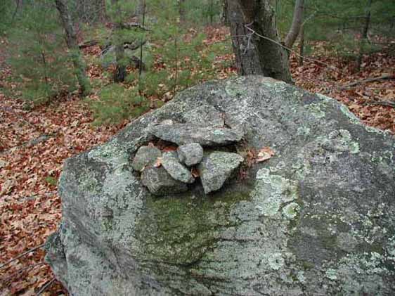
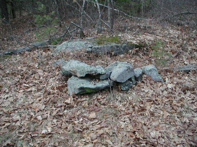
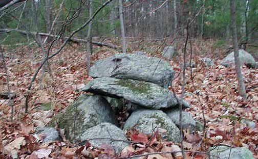
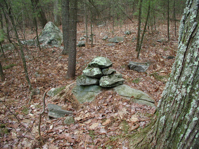
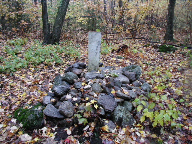
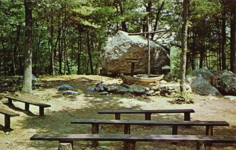
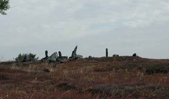
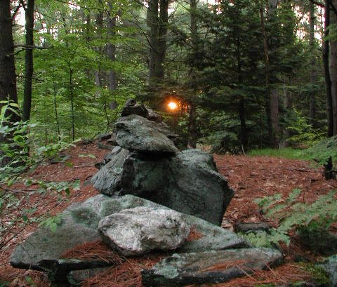
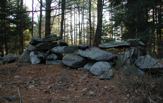
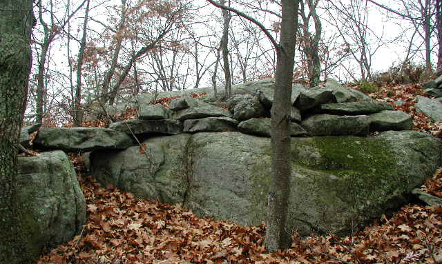
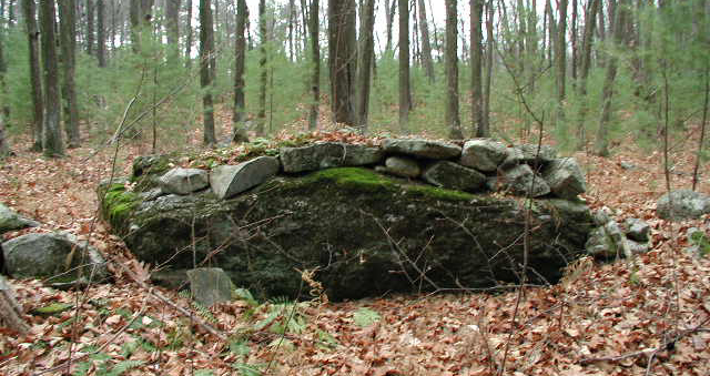
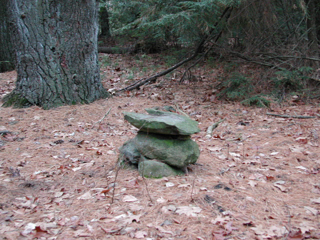
Cairns:
A cairn is a carefully built structure of stones
rather then a heaped pile of stones. They are known to have been
built for such diverse reasons as land parcel boundary markers, celestial
alignment markers, as part of Colonial field clearing, and as markers of
locations significant to Native Americans.
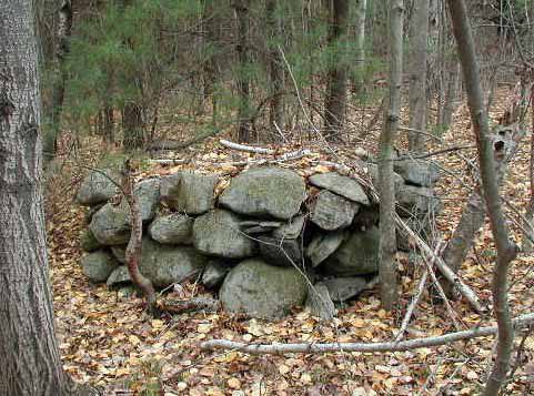
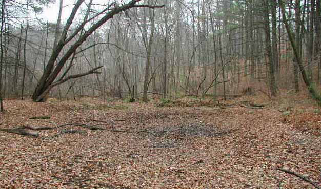
Cairns in Littleton
Note:
Both cairns were built within historical times.
The one on the left has Native associations and was the NW boundary cairn of
the 1714 Indian Reservation in Littleton. The one on the right was made
(among others) by Flint Furbush around 1920 while clearing fields for his
brother-in-law. A local historian found charcoal on some of the cairns
and deduced that these were Indian altars and every family in the tribe had
one.
Unbeknownst
to him, the
charcoal came from fires my friends and I made on them as wayward youths.
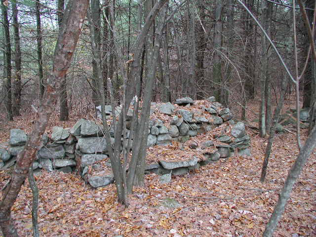
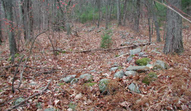
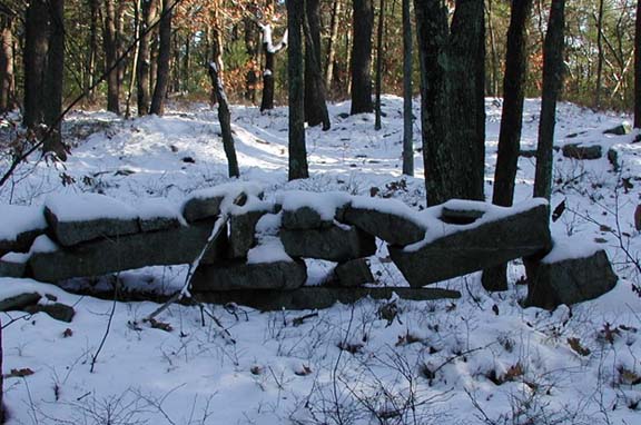
Cairns in Littleton & Indian Point (now
destroyed)
Note:
Cairn to the left is not only built into the
stone wall, but has a "bench" built into it as well. It was described to
me by a previous land owner that this is where on the Summer Solstice sunrise the
Medicine Man would plunge a dagger into the heart of an Indian maiden.
In all actuality, this rock cairn was built by Flint Furbush. These
particular cairns have since become known as "Furbush Formations." Whether he
scarified Indian maidens or not is unknown.
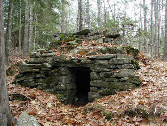
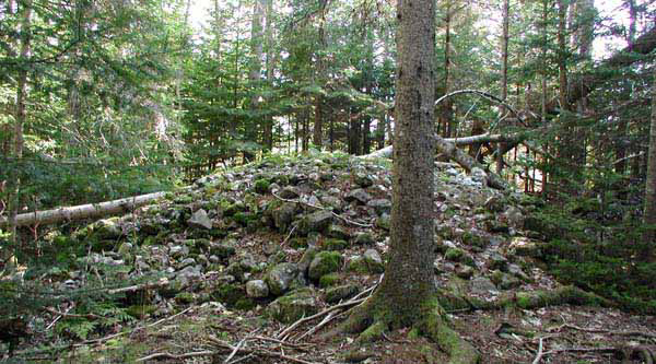
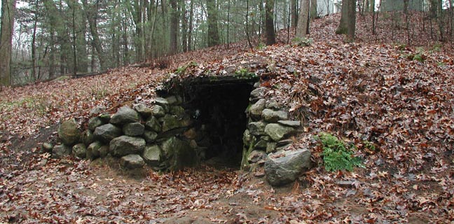
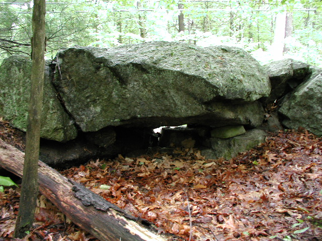
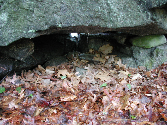
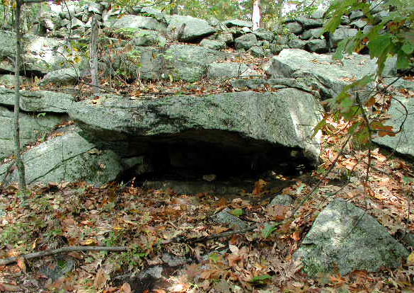
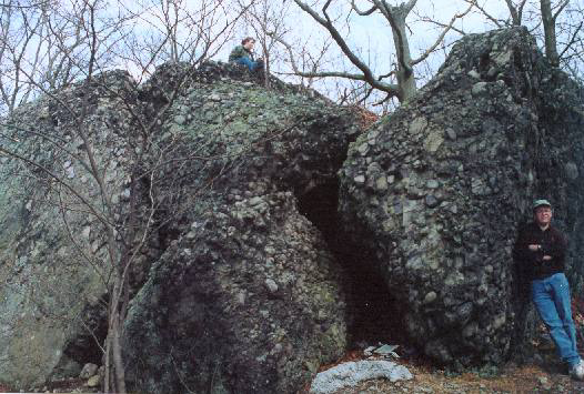
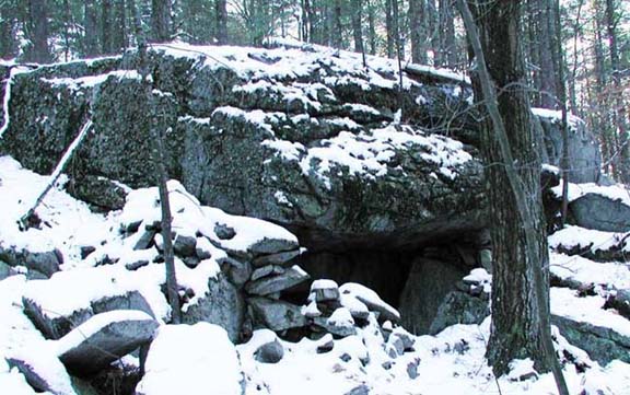
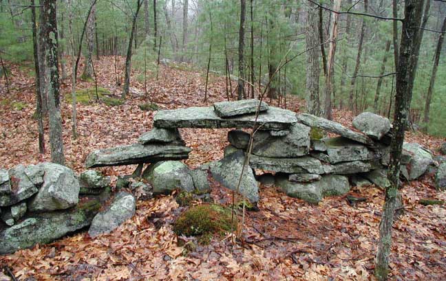
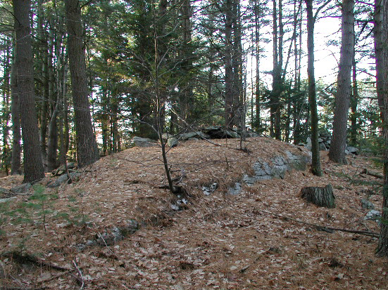
Chambers: There are hundreds of
underground manmade stone chambers in New England of unknown origin and conjectured purpose.
There is much debate and controversy over this. Everything from Irish Culdee
Monks to Colonial root cellars to Native American construction
has been proposed. From inside, some of these chambers view significant
celestial events, and most are tall enough to stand up in.
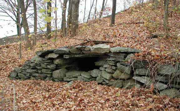
Two Littleton Chambers
Note: The
chamber on the right (which originally had a walk-in entrance like the one on
the left) was briefly used as a tomb by the Whitcomb family until around
1925 when some collage boys broke in and stole a bone. It was also used by a
Mr. Whitcomb of years gone by to play the trumpet in.
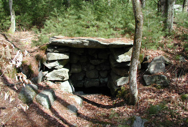
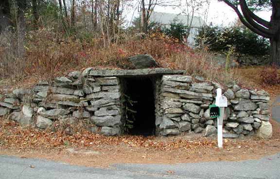
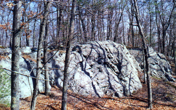
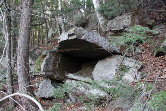
Acton: Spring House on Flag Hill & Nashoba Brook
Chamber
Note: The structure
in the left picture is said to be a Colonial Spring House, and indeed, it does
house a spring. The Nashoba Brook chamber
(on right) was recently
reconstructed by the Acton Historical Chamber with assistance from
NEARA. It is just up the river from
the old Thoreau Pencil Factory.
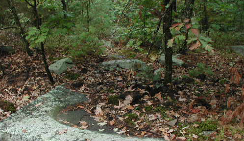
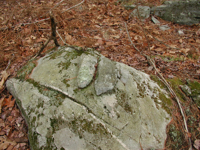
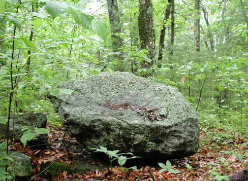
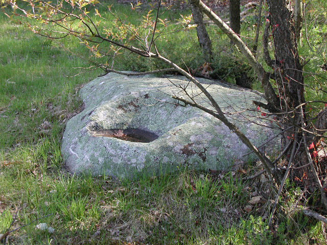
Corn Grinding Stone: Native Americans ground corn in stone and
wood mortars. The stone ones were often a boulder that had a shallow
hollow worked into its top. These worked hollows are to be occasionally
seen on boulders in the woods.
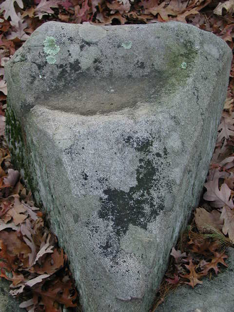
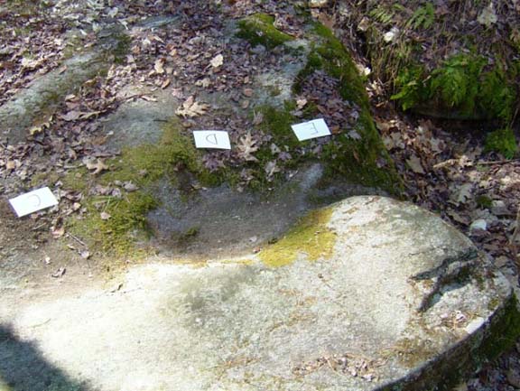
Corn Grinding Stones in Nagog Woods & Petersham
Petersham picture courtesy of Bradley P. Dean
.
Note: The Nagog
Woods corn grinding stone may also be a "Stone Seat." (See below section
on stone seats.) Interestingly, the Manitou Effigy Stone at Lake Nagog
(see Manitou Stone section, below) was found close to it, and the two items may
go together, as it is known that the mortars were left near the pestle stones.
(But it seems unlikely a stone mortar would be used with a stone pestle.)
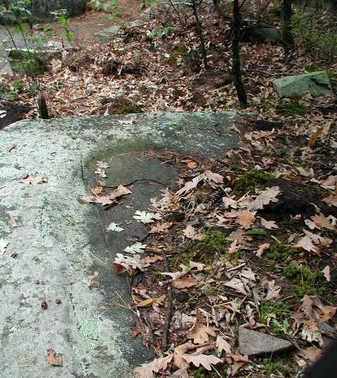
Large oval bowl in stone slab in Littleton's
Sarah Doublet Forest
Note: The Sarah
Doublet Forest was an Indian Reservation from approximately 1714 to 1735, and
previously was part of the Praying Indian Village of Nashoba from approximately
1651 to 1714.
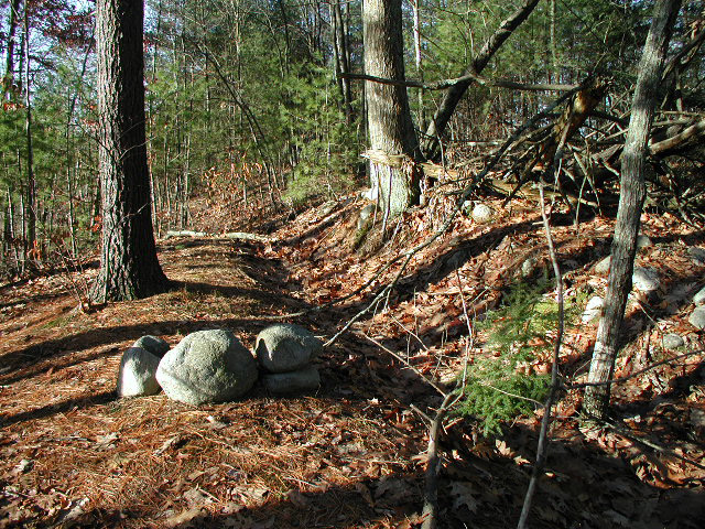
Devil's Den: These are typically small talus caves (jumbled boulders)
and boulder piles.
There are dozens in New England that have been specifically known since
Colonial times by the name Devil's Den.
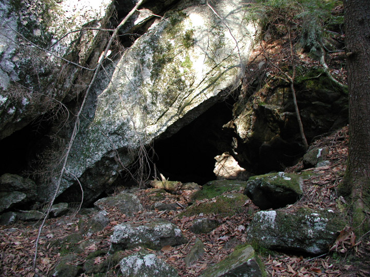
Devil's Dens in Littleton & Williamsburg,
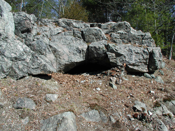
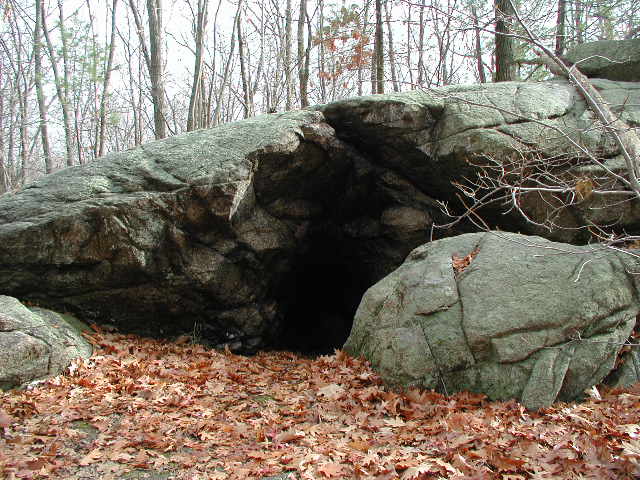
Devil's Dens in Westwood & Ashland
Note: The
Devil's Den in Westwood is in an area known as Satan's Kingdom and is
remembered as being an "Indian Cave." The Ashland Devil's Den is on the
Old Connecticut Path Indian trail, and is also said to have been used by
Indians. The Indian/cave association may be a clue to why the Puritan
settlers named these places "Devil's Dens." (See my forthcoming
article The Tophet Swamp Mystery for more information.)
Devil's Footprints: These are natural
formations in boulders and bedrock that resemble the shape of a foot.
In New England they are almost universally known has Devil's Footprints,
and most of them has some sort of legend and story of how they came to be.
Several such legends are recounted here:
Devil's Footprints.


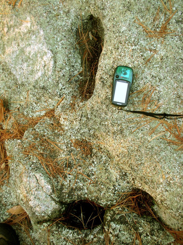
Devil's Footprints in Ipswich, Norton, and
Medfield
Norton & Medfield photos courtesy of
Jim Moore
.
Note: Natural
formations or smoldering relics of the Devil? I personally prefer a
world that at least at some point allowed the Devil to caper madly about the
countryside leaving his infernal tracks behind him.
Ditches: According to Mavor & Dix in
Manitou, the Native people often used ditches to regulate water
flow in aquatic areas as flood control works. Ditches of this sort
usually have a corresponding berm or row running its length.
Ditch with berm and rows at the Boxborough
Esker
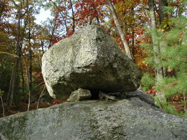
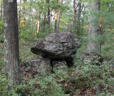
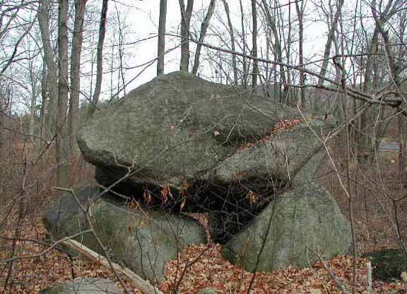
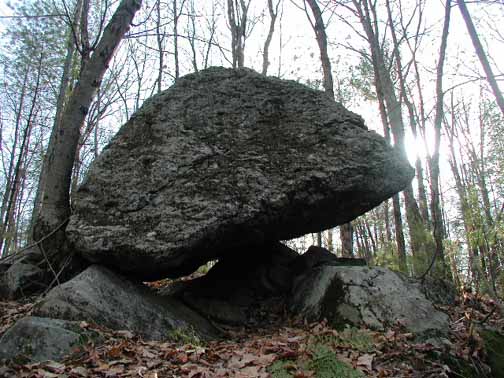
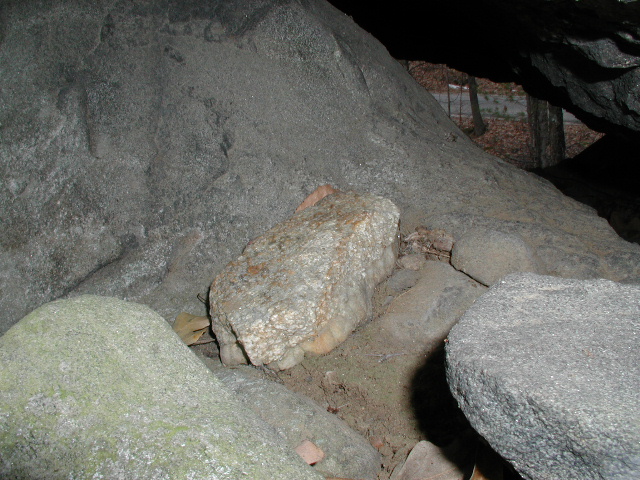
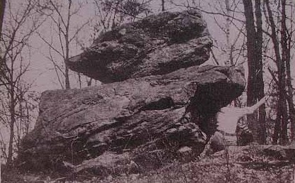
Dolmen: A large boulder resting, typically, on three smaller
stones. These boulders can range from one ton to many ton monstrosities.
These constructions are manmade, but who or when is unclear. A second
style of dolman is glacier created, and is more correctly called a perched
rock to differentiate it from a human construction. Both, however,
often have colored stones placed underneath them like an offering or donation.
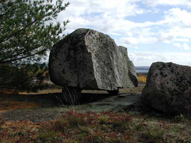
Dolmen in Littleton, Dogtown, and Acadia
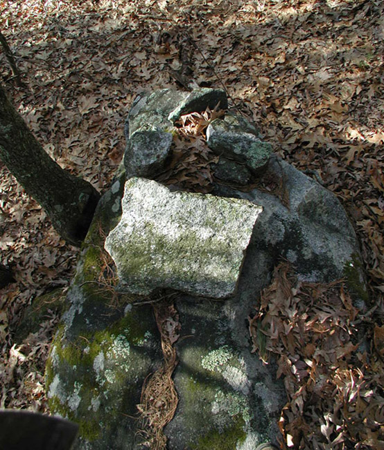
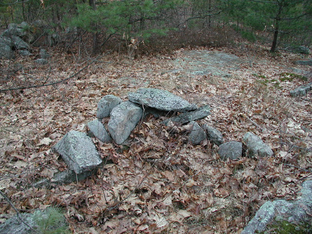
Donation Stone: These are a stone construction most often seen
in stone rows, but occasionally on their own. A large slab will be
placed with smaller stones such that there is a cove beneath it.
In this cove will be found an old bottle or two. Interestingly, it
was post-contact Native tradition in New England to place bottles in such
places as an offering or donation to the spirits. For an analysis of a
possible donation site, please see:
Father
John & the Rock Pile.
Donation Stone: Harvard Shaker Village
Note old bottle in close-up view.
Mavor & Dix believe there was a subtle overlap between Native ritual sites and
Shaker villages. For more on the Harvard Shaker Village and their
spiritual practices, see: The
Ecstatic Spirits of Holy Hill.
Earthen Circles: A very rare but fascinating structure in New
England is the Earthen Circle. These are a raised circle of earth,
about 14 feet across, and several inches high. There is usually a
shallow ditch around the circle. These are conjectured to be of ritual
significance to the pre-contact Native peoples. Where these are found,
there are typically a large assortment of other lithic features.
One of Four Earthen Circles at the Boxboro Esker
Note: Mavor &
Dix in Manitou had this to say about the Boxborough Esker:
"We
believe that the shaman-preachers of Nashoba used the Praying [Indian]
Villages to maintain the Indian communication links, the sacred landscape and
the stone and earthen structures in the midst of encroaching white colonists.
We believe that central to their world was the Boxborough esker."
For more information in the
Boxborough Esker, see:
Boxborough Esker
Earthworks: New England has quite a few old earthworks of unknown
origin. Berms, ditches, trenches etc.
Earthworks in Littleton: Praying Indian
Village Dam &
Newtown Hill Crescent Stone Berm
Effigy: A large boulder with several smaller rocks arranged on
it. Often these rock arrangements seem to form a symbol
or animal
shape. These are interpretative as to what they might be representing,
but there is no doubt that they exist, and by the hundreds. They
appear to be rock-arrangement petroglyphs. For more information on Effigies (and
rock piles in general) see Peter Waksman's
Indian Rock Piles website.
Effigys in Boxborough, Littleton, and Lake
Nagog
Embrasure: A u-shaped indentation into a stone row. These
may well be a variation on the Prayer Seat, or possibly used as hunting
blinds. (See Prayer Seat, below, for more details.)
Embrasures at Half Moon Meadow Brook in
Boxborough
Ledge Shrine: There are natural stone ledges on rocky hillsides.
Some of the smaller ones will typically have a small white stone placed
in the cove under the ledge. This is conjectured to be a Native American
offering of some sort. I have seen some that appear to be quite old,
while others are only a few years old.
Ledge Shrines in the Sarah Doublet Forest in
Littleton
Note the small white quartz rock placed in center
under ledge. At this location these white stones have disappeared and
reappeared from time to time suggesting contemporary activity of some sort at
the site.
Manitou Stone: Manitou is a word used by the Algonquin speaking
peoples of New England to mean
"spirit", as in having spiritual power.
These stones are shaped similarly to an old fashioned Colonial headstone,
and placed in places that were felt to have great spiritual power, and
often in conjunction with other lithic features. For example, in
one of the Praying Indian Villages I found a stone row that ran up out
of a river and up a hill to terminate in a beautiful Manitou stone.
Manitou Stone in Boxboro and Manitou Effigy
Stone at Lake Nagog
Note: The
Manitou Effigy stone on the right is located near the Nagog Woods corn
grinding stone (or alternatively, stone seat). Note how in the first
picture the Manitou stone is part of a stone row. Significantly, this
stone row marks a section of the Southeast boundary of the old Praying Indian
Village of Nashoba. (See Nashoba
Hill: The Hill that Roars for maps.)
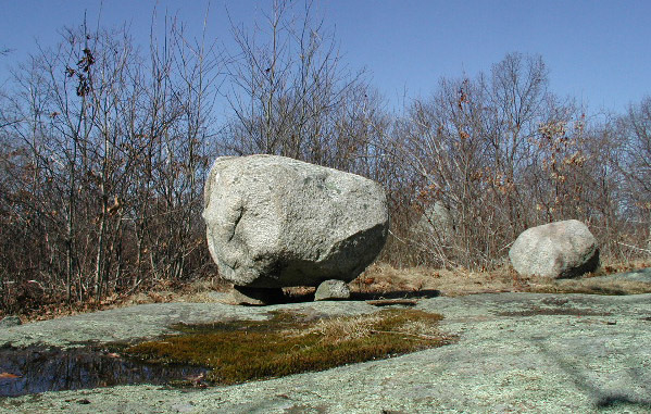
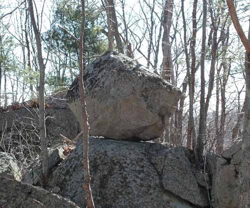
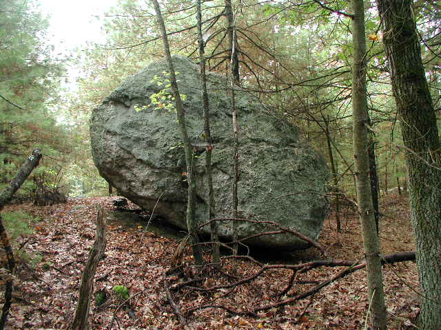
Perched Rock: These are boulders that are perched on smaller
boulders, similar to a dolman, or perched on top of another large boulder.
Many of these appear to be glacier-placed, while others are such that it
is a wonder how they occurred. In any event, it is known that the
Natives were attracted to the spiritual power of large stones, especially
oddly placed ones, and held their meeting in such places.
Perched Rocks in Littleton & Hopkinton
Perched Rock in Athol with White Quartz
Donation Stone Underneath
Note for
Forteans: Site overlooks Fay Cemetery
Perched Rock-on-Rock in Dogtown & Boxborough
Note: The Boxborough perched rock (since destroyed)
was known as Eliot's Pulpit because he is said to have preached to the
"Praying Indians" of Nashoba there between 1651 and 1675.
Prayer Seat: This is a u-shaped enclosure of rocks large enough
to sit in. These often face the rising or setting of the sun on an
equinox or solstice, or the arc of the big dipper. These are considered
to be of Native American origin, and are still being constructed today.
It is thought they are were originally for observing significant celestial
turning points, and that the newer ones may possibly have been intended
rather for contemplation and possibly vision quest. For more on Prayer
Seats and alignments see Edwin Ballard's
For Want of a Nail:
An Analysis of the Function of Some Horseshoe or "U"-Shaped Stone
Structures.
Prayer Seats at Westford Esker and at Lake
Nagog
Prayer Seat in Sergeant Road area of Boxboro, front and back views
Praying Indian Villages: In the 1650s John Eliot preached to
the Massachusetts Indians, encouraging them to live in European-style villages
and wear European-style clothes. As part of this arrangement, the
sites of these Indian-owned villages were chosen by the Indian Shamans,
and they typically chose their last remaining sacred places as the sites
for these villages. More about the Nashoba Praying Indian Village may be
found here: Nashoba
Hill: The Hill that Roars.
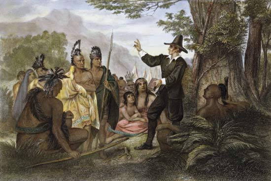
"John Eliot
preaches to the Indians of the Massachusetts Bay Colony"
by John Chester
Buttre, 1856
.
Note: Eliot, like most early itinerant preachers,
actually preached from large boulders that have since become known as Eliot's
Pulpits. For example:
Eliot's Pulpit Roxbury, Pulpit Rock Rowley,
Eliot's Pulpit Boxborough
Roxbury & Rowley photos courtesy of
Jim Moore
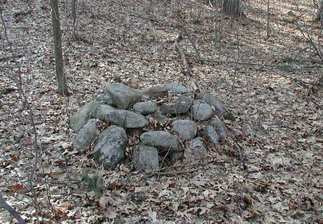
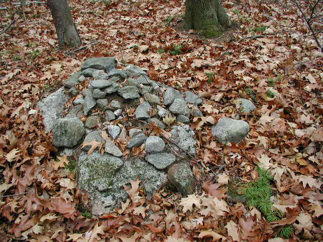
Rock Piles & Stacks: There are thousands and thousands of small rock piles
in the Massachusetts woodlands. Many of these are in rocky and swampy
areas that would not have been worth the time and effort of a Colonial
farmer to clear the stones into piles. Often, these piles are on
the east side of hills overlooking water. It is considered by some
that these piles have Native American significance. Indeed, I have
seen a good few that appear to be made to represent a turtle, a creature
whose spirit was sacred to the Native Americas of New England. The
best resource on the native significance to rock piles is Peter Waksman's
Indian Rock Piles website.
Rock Stacks & Piles at Newtown Hill and Fort
Pond
Turtle shaped rock pile at Lake Nagog
Modern rock stacking in Williamsburg
Harvard Shaker Rock Pile
Note: On 2 June
1783 Father James Whittaker was whipped by an anti-Shaker mob at this
location. It
became the custom for any Shaker who passed to place a stone on the pile in
remembrance of him and what he endured for his beliefs.
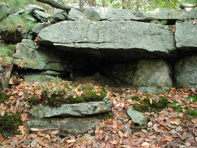
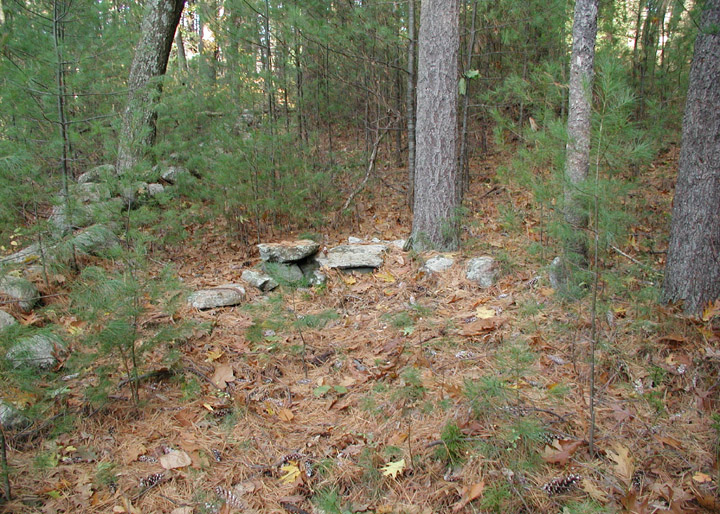
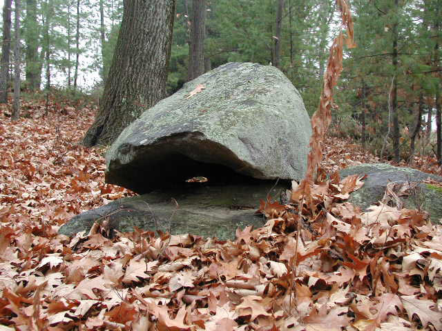
Rock Shelter:
These are simply an area under an overhang of ledge
or boulders that allows shelter for several people. The locations of
such natural shelters were well known to the Indians and were often
improved by them with stone-work. It is likely such natural shelters
were used as camping locations on well-traveled trails.
Rock Shelters in Snake Hill in Ayer and Black
Pond in Littleton
Note: The rock
shelter on the left has been partially enclosed with stonework to provide a
better shelter from the elements.
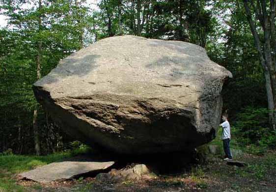
Rocking Stones & Balance Rocks: This is a large stone, usually of at least a
ton, that rocks when pushed with the hand. Often these stones are
larger than a car, and some are enormous. Both glaciers and human
activity are responsible for their placements. These stones rock
easily, and even a slight earth tremor sets them wobbling. This seismic
movement was considered by the Indians to be a sign of their god Hobomock,
and much revered as such. Not all rocking stones rock anymore, but an echo
of that quality is found in them being now known as "balance rocks."
One Ton Rocking Stone in Harvard Shaker
Village
Note: This stone still rocks with the touch of a
finger
Balance Rocks in Groton, Savoy, and Littleton
Note: These no longer rock
Scallops: Scallops are shallow scoops taken from hillsides.
They are approximately five feet wide and somewhat deeper. These
are often places where specific celestial events may be observed.
In this interpretation, they would function similar to Prayer Seats and
Embrasures. Often in significant Native sites, it is not unusual
to see Scallops, Embrasures, and Prayer Seats all in one area.
Scallop in Boxborough Esker
I've never been impressed by any scallop not
covered in drawn butter.
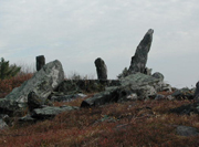
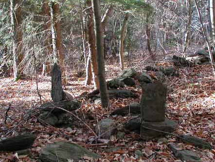
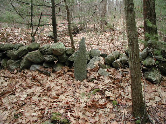
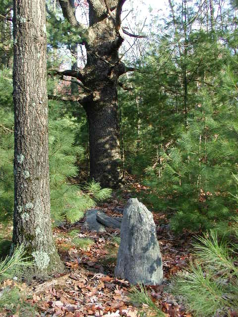
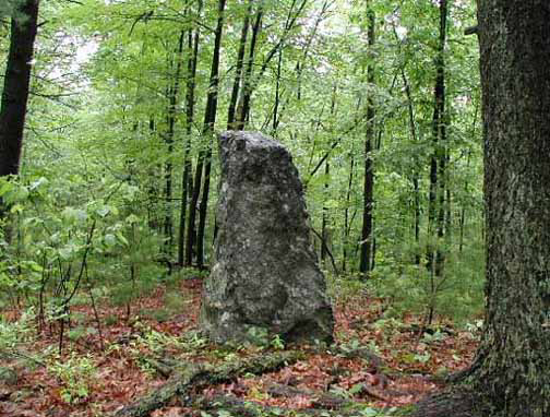
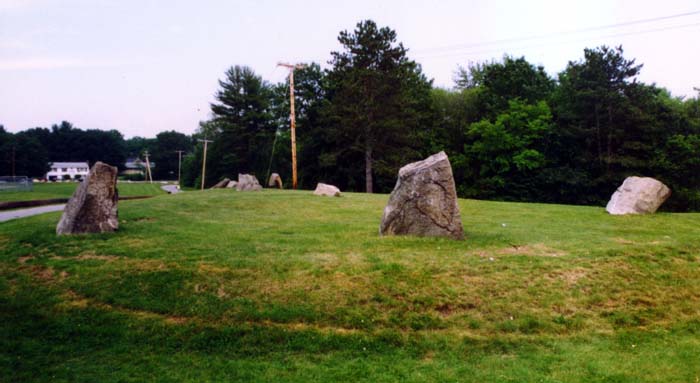
Standing Stones: These are tall stones set upright in the earth
by human activity. It is not completely understood why this was done,
but the stones are definitely here and are occasionally to encountered
in the woods.
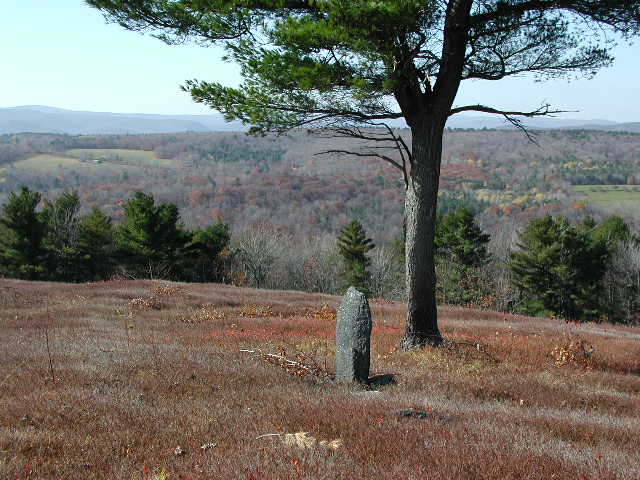
Standing Stones on burnt Hill in Heath and
Half Moon Meadow Brook in Boxboro
Standing Stones on Newtown Hill in Littleton
& Shaker Village in Harvard
Note: The
Newtown Hill stone is of Neo-Pagan origin, and the Shaker Village stone, due
to drill holes, is very unlikely to predate historical times.
Stone Circles: This conjures up a European megalithic image like
Stonehenge. However, nothing so grand is to be found in New England.
Rather, there are occasionally small rings of stone to be found in the
woods. It is unclear as to the origin of these structures, but it
may be noted that the more impressive ones I have seen have all been of
recent neo-Pagan construction.
Stone Circles on
Burnt Hill
and on Druid Hill
in Leblanc Park
Druid Hill photo courtesy of Edward Bochnak
Note: Druid Hill stone circle is thought to be a
folly
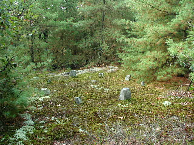
Neo-pagan Circle in Littleton's Sarah Doublet
Forest
Note:
John Mitchell says
this in Trespassing about the Sarah Doublet Forest, "Once I even
found a small stone circle in the the area, a sort of miniature Stonehenge ...
neo-pagans have set up a celestial tracking stage here, in the form of a
circle of stones, wherein they worship the rising or setting of the sun, moon,
and stars."
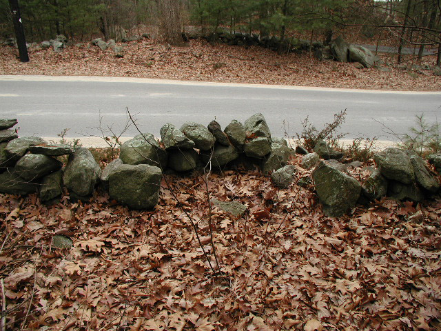
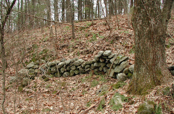
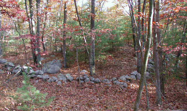
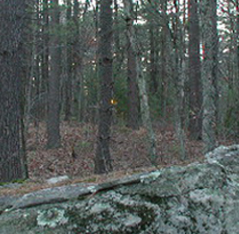
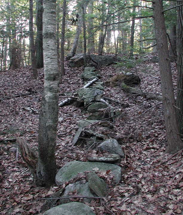
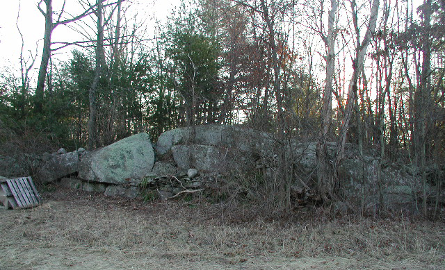
Stone Rows: New England has thousands of miles of stone rows.
Most of these were constructed by Colonials as part of field clearing and
boundary making. However, there is a significant number of rows that
do not conform to known Colonial practices both in construction and purpose.
These rows meander through the woods, wandering right and left to connect
large boulders with bedrock outcrops etc. Others seem concerned with
connecting hill tops with rivers, swamps, and ponds. Some do a little
of both. Some of these rows mark the suns setting or rising on solstice
and equinox days. (See Solstice Alignments, below) It is conjectured that this style of row may be
of pre-Colonial Native construction and reflect a concern with connecting
the landscape in a sacred way.

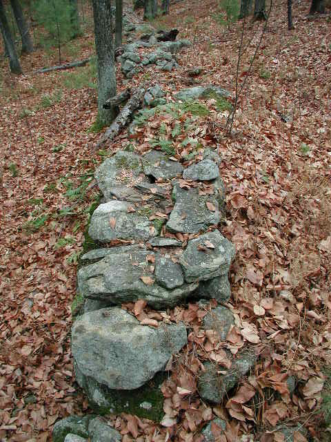
Stone Rows: Fort Pond, Fort Pond, and Snake Hill
Note the odd
style of row construction. The rows on the right and left are built
Native-style with "holes to the let the wind through", and the middle row is
simply a long string of stones laid in a line through the woods. Neither
styles conform to typical Colonial wall construction.
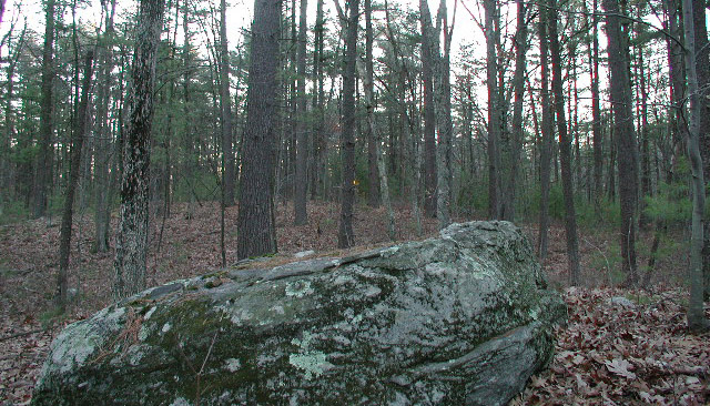
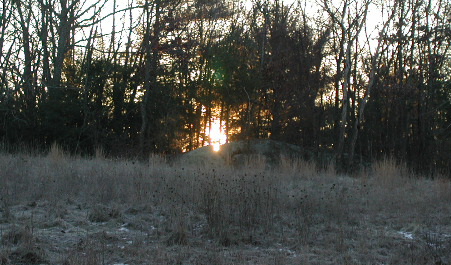
Summer Solstice sunrise over stone row at
Black Pond in Littleton
Note: The stone
row runs the length of the granite whaleback in the left picture. The
sunrise is viewed along the length of the row from the far right in the
whaleback picture. The section of row the sunrise is pictured over is
seen in profile in the far right picture. Note its Native-style "holes
to let the wind through" construction. Also note in sunrise picture the
white stone marking the viewing position.
Stone Rows at the Sarah Doublet Forest in
Littleton
Note in the left
picture how the stone row curves along the outer edge of the large granite
ledge, and then bridges the gap to the far left to the next section of ledge.
Note in the picture to the right how the stone row makes a rounded curve
rather then a good 90 degree Colonial
corner. Both pictures are of different sections of the same stone row.
This stone row also passes over the top of a small chamber.
Stone row over top of boulder at Nagog Woods
Note: This stone
row passes over the top of a flat faced boulder, incorporating it into the
row. Picture to the left shows the top of the boulder in the foreground
with the row extending into the distance. Note how the flat face of the
boulder is exactly in line with the direction of the stone row - or - did the
boulder face define the direction of the stone rows construction? This
formation is only a stones throw from a neo-Pagan stone altar.
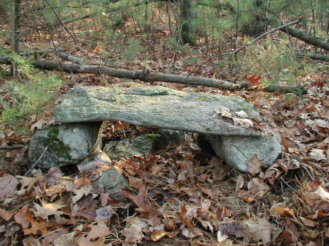
Stone Tables & Neo-Pagan Altars: These
table-like structures are encountered in the woods with surprising
regularity. Some seem to have Native significance and others appear
to be part of campsites. Further, there is a whole class of these
structures that are apparently neo-Pagan altars, and are directionally
aligned in keeping with modern neo-Pagan ritual practices. For an
examination of some of these structures in the Nashoba area, see:
The Six Altars Of
Nashoba.
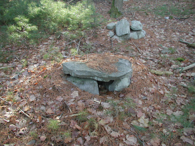
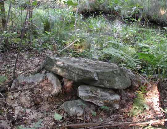
Stone Tables at Flag Hill in Acton & Fort
Pond in Littleton
Note: Fort Pond
was so-named after the Indian Fort of the 1651-1714 Praying Indian Village
era. The Fort Pond "table" is located on one of the islands where the
Nashoba were said to have made burials, and as late as 1921 were said to still visit
their ancestors there.
Neo-Pagan Altars at Lake Nagog and on Oak
Hill in Littleton
Note: The altar
on the left does not seem to have had any recent activity, but the Oak Hill
altar was apparently used in neo-Pagan rites until at least the mid 1990's.
Stone Seats: These are naturally occurring
depressions in boulders and bedrock that make a convenient seat, and have
usually been improved upon to some degree. Most notable of the named
stone seats are the dozens of King Philip's Thrones/Seats/Chairs scattered
across Massachusetts and Rhode Island.
Stone Seats at Nagog Woods in Acton
Note: Stone seat
to the right and below may actually be a corn grinding stone.
Stone Seat at Nagog Woods in Acton
.
Note: The stone
has been carefully propped and positioned. Because it can be used as a
seat and faces East, and is arrowhead shaped, consideration was given to any
possible celestial alignments, as follows:
Note how stone
is v-shaped and carefully propped in place and is on top of a small knoll.
When you sit in it you face Easterly over the large boulder. Here is
what you see at the Winter Solstice Sunrise:
Winter Solstice sunrise as seen from seat
looking over boulder
click pictures to better see pinprick of
light from rising sun
.
Note: Although
the Winter Solstice sun does rise over it, the boulder is to close to be a
significant marker of the event in my opinion. A more convincing marker
would be a boulder on the horizon of the small hill in the distance.
Such a marker has not as of this writing been found. For Solstices
alignments that are more convincing, see the following section:
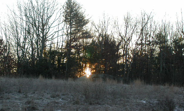
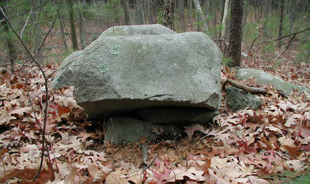
Solstice Alignments:
Perhaps surprisingly, there are a number of lithic
Solstice sunrise and sunset alignments in New England. And again
surprisingly, many of these seem to involve stone rows. Most of the
ones I've seen involve the Winter Solstice sunrise, and conversely, I've
never personally encountered an Equinox alignment - although that's not to
say they don't exist.
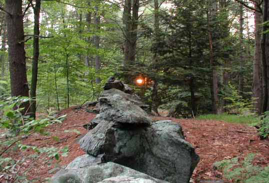

A. Summer Solstice sunrise over stone row at
Black Pond in Littleton
B. Winter Solstice sunrise over stone row at
Tophet Swamp in Littleton
C. Winter Solstice sunset over Esker in
Littleton as seen from Prayer Seat
Winter Solstice sunrise in notch in rock at
Half Moon Meadow Brook in Boxborough
Note: Half Moon
Meadow Brook was part of the Nashoba Praying Indian Village.
Turtle Rocks & Effigies: Simply put,
these are rock formations of many sort that resemble a turtle in some way.
It is known that the Native Americans found the turtle significant, and
there are several well-known (but hard to find) Turtle Rocks in the
Nashoba Valley area where Native Americans still gather for reasons of
their own. Where you find Turtle imagery is where you can assume a
particularly strong Native American significance to the area. For
more Turtle Effigy information I would suggest visiting Tim MacSweeney's
Waking Up On Turtle
Island blog.
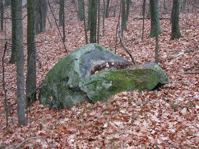
Turtle Shell, Turtle Rock Pile, Turtle Rock
Lake Nagog & Sarah Doublet Forest
.
Note: All three
of these Turtle images are found in vicinity to Lake Nagog and the Sarah
Doublet Forest. This would indicate the area had a strong and special
Native American significance. This would be borne out by the area having
been a place of vision-quest, as argued here:
Nashoba
Hill: The Hill that Roars